Severe weather an increasing threat for eastern Australia
There are growing signs that severe weather could affect parts of eastern Australia at the beginning of next week.
A large pool of cold upper-level air will pass over southern and eastern Australia towards the end of this week, causing a mix of rain, thunderstorms and snow in multiple states and territories between Friday and Sunday.
On Monday, this upper-level pool of cold air should reach Australia's east coast. The interaction of the cold air with relatively warm sea surface temperatures in the Tasman Sea could fuel the development of intense and dangerous weather along parts of Australia's eastern seaboard early next week. However, this is a dynamic weather event and the uncertainty around its development is high.
-- Murky models --
As is often the case with these east coast severe weather events, there's quite a bit of model uncertainty around how this system will evolve and where it's most significant impacts will occur.
When interpreting computer models, forecasters take into account how much certainty there is around upcoming weather events. Forecast uncertainty can arise from disagreements between different weather models and within individual weather models themselves.
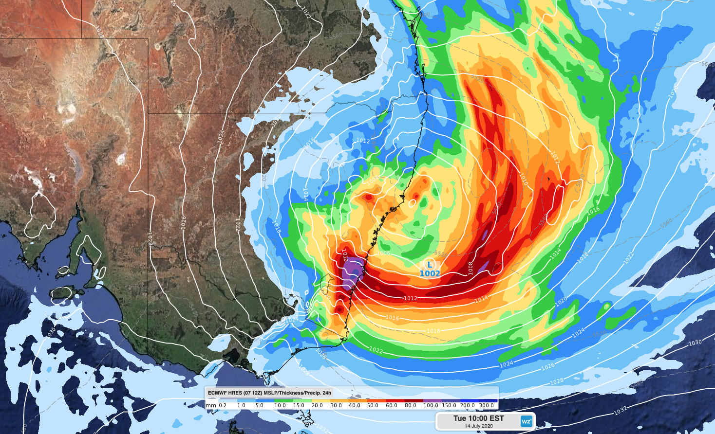
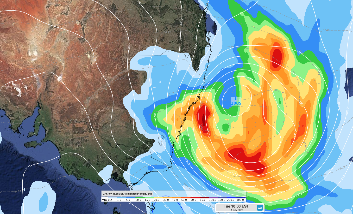
As of this morning, two of the main global forecast models - GFS and ECMWF - both indicate that a surface low pressure system could deepen near the central coast of NSW on Monday and Tuesday. If this scenario eventuates, it would cause heavy rain, strong and potentially damaging winds and dangerous surf along parts of the NSW coast and ranges early next week.
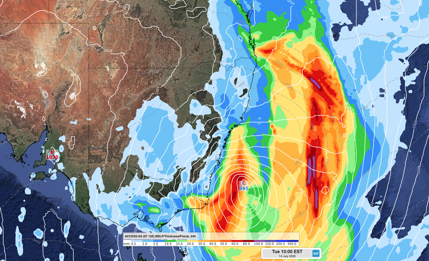
However, some other forecast models, such as the Bureau of Meteorology's ACCESS-G model, predict that the system will develop further off the coast and further south. This would significantly change which areas are likely to be impacted by the most intense weather from this system.

Image: Forcast accumulated 24-hour rainfall and mean sea level pressure on Tuesday morning next week, according to the ECMWF-HRES model.

Image: Forcast accumulated 24-hour rainfall and mean sea level pressure on Tuesday morning next week, according to the GFS model.

Image: Forcast accumulated 24-hour rainfall and mean sea level pressure on Tuesday morning next week, according to the ACCESS-G model.
This disagreement between different forecast models is being compounded by a high degree of uncertainty within the individual models.
Each global forecast model can be run multiple times to produce what's called an ensemble forecast. Each 'member' of an ensemble forecast starts at the same point in time, but with slightly different starting conditions and small tweaks to the model's forecast algorithm. This process produces a range of forecast 'scenarios' that usually become increasingly different as we look further into the future.
Ensemble forecasts allow us to see how confident an individual model is about an upcoming weather event. For example, if there's a lot of disagreement between the ensemble members five days ahead, there is low confidence in this model's forecast.
For this upcoming weather event, this intra-model uncertainty is quite high. For example, the 51-member ensemble forecast from the ECMWF model shows a high amount of uncertainty from Monday onwards for mean sea level pressure over the Tasman Sea.
With so much uncertainty, both within and between forecast models, it's almost impossible to anticipate how this weather event will unfold near eastern Australia early next week.
However, past events of this nature have shown us that despite the model uncertainty, this has the potential to turn into a high impact severe weather event. At this stage, the most likely areas for dangerous weather would be on and east of the ranges somewhere between northern NSW and eastern Victoria.
More accurate information will become available during the coming days as new model information comes to hand.