
Severe tropical cyclone threat looms for WA
Tropical Cyclone Zelia hasn’t even formed yet, but the system could make landfall in northern WA as a severe tropical cyclone later this week.
At 8am AWST on Tuesday, a tropical low was spinning off the northern coast of WA, roughly 295 km to the northwest of Broome. This developing low pressure system is causing large pulses of convective cloud over the warm seas off the state’s northern coastline.
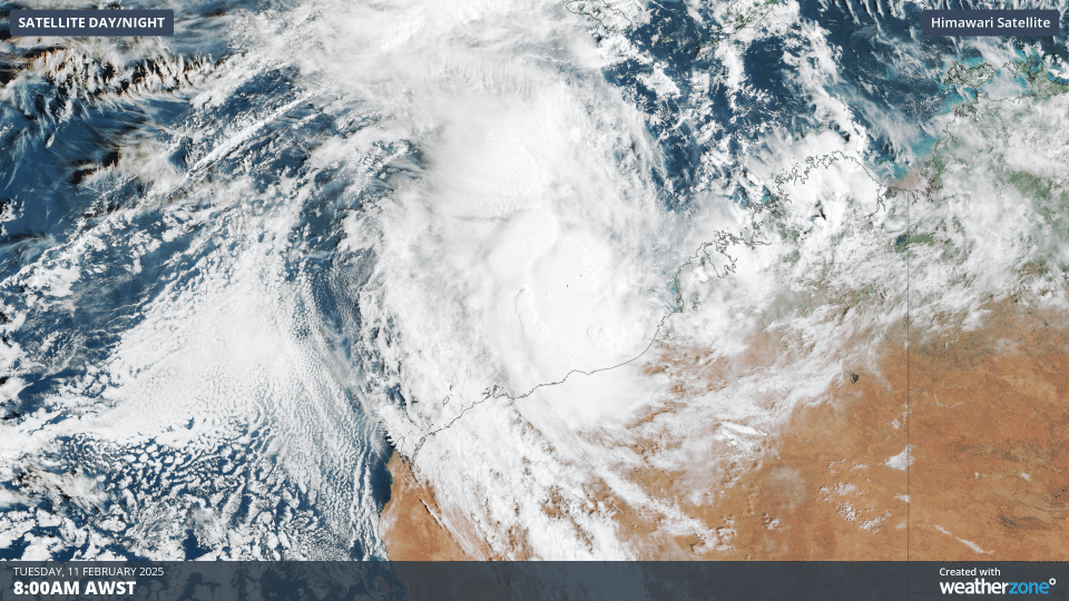
Image: Clouds swirling around a developing tropical low to the north of WA on Tuesday.
These warm waters will help the tropical low gain strength as it moves towards the south or southwest in the coming days, with the Bureau of Meteorology predicting that it will become a tropical cyclone on Wednesday. The latest track map issued by the Bureau anticipates that the tropical cyclone, which will be named Zelia, will then strengthen further on Thursday. Zelia is then expected to become a category three severe tropical cyclone by Friday as it gets closer to the WA coast.
As the tropical cyclone hasn’t even formed yet, there is still a lot of uncertainty regarding its future movement and strength. However, current computer model guidance suggests that Zelia may approach the East Pilbara or West Kimberley coasts as a significant tropical cyclone later this week.
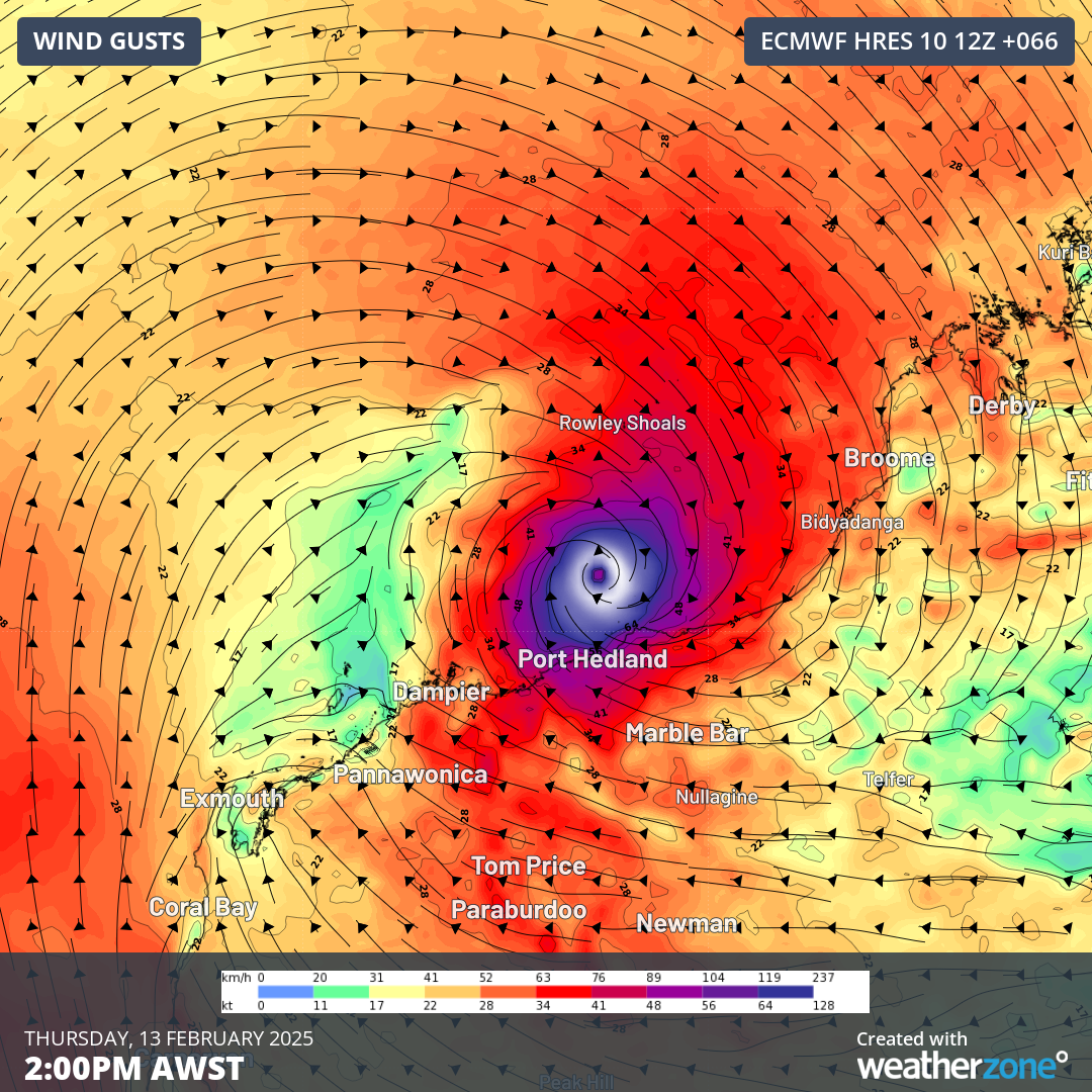
Image: ECMWF model forecast showing wind gusts near the north coast of WA on Thursday, February 13.
More reliable information will become available to meteorologists over the next few days, which will mean the tropical cyclone track maps and forecasts issued for this system should become more confident in the next 24 to 48 hours.
For now, anyone in the north of WA, particularly between Karratha and Cape Leveque, should keep a close eye on this system and the latest tropical cyclone advisories.