Severe Tropical Cyclone Sean spinning out to sea
Severe Tropical Cyclone Sean reached Category 4 strength on Monday, but the system is now losing strength as it continues to track southwest, entering cooler waters off the coastline of Western Australia.
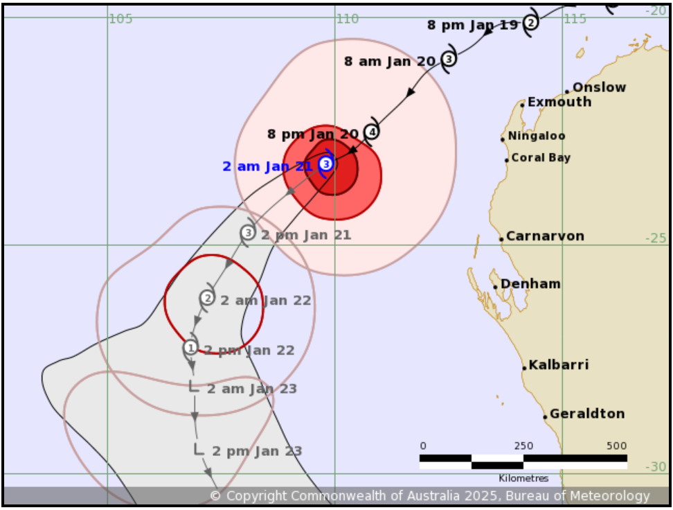
The cyclone was still a Category 3 system in the BoM's latest update at 2:41am Tuesday (AWST) but the BoM advises that it is no longer expected to cause any direct impacts to the WA mainland.
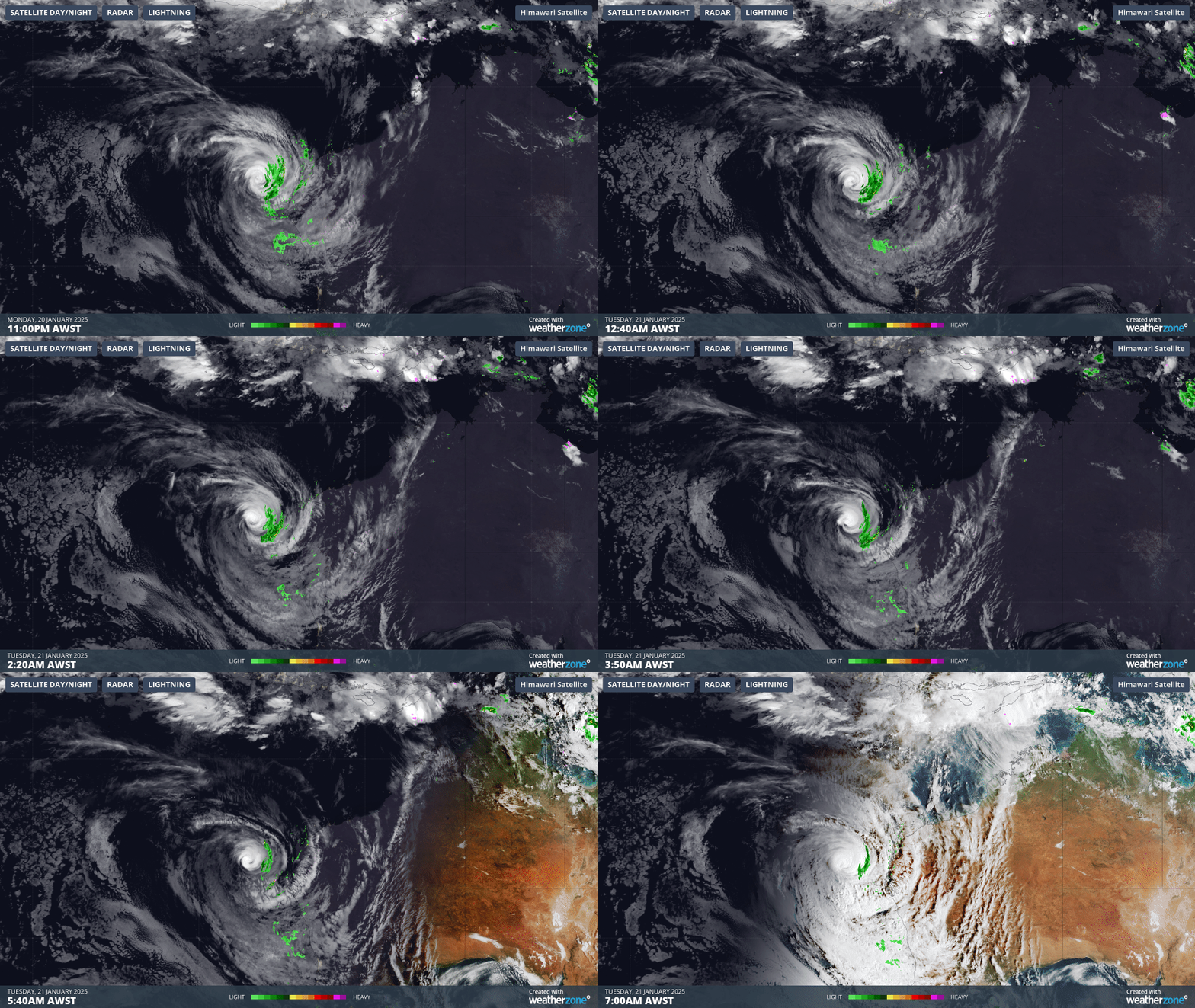
You can see the cyclone spinning gradually towards the southwest in the 8-hour loop below from 11pm AWST Monday night to 7am Tuesday morning.

Image: The cyclone was approximately 400 km offshore early on Tuesday morning.
Sean is expected to further downgrade throughout Tuesday as it stays well out to sea and is likely to be below tropical cyclone strength by Thursday.
Sean was the second cyclone in the Australian region in the 2024/25 cyclone season after Robyn in November which mostly impacted southern parts of Indonesia.
Its most notable effects were along on the Pilbara coastline, where the town of Karratha copped its heaviest recorded daily rainfall (in any month) of 274mm. Some highways and homes were affected by floodwaters however damage was minimal overall as the cyclone never crossed the coastline.

Image: The BoM’s latest track map for Severe Tropical Cyclone Sean shows it weakening to below tropical cyclone strength by Thursday when it is roughly on the same latitude as Geraldton (which equalled its hottest day on record on Monday). Source: BoM.
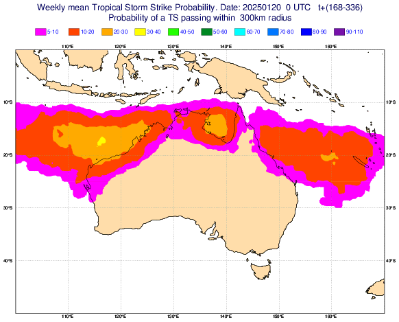
Australia typically sees 9 to 11 tropical cyclones inside its area of responsibility during an average tropical cyclone season. No further cyclones are forecast in the immediate future but they are an increased risk over the next few weeks as the monsoon continues to hover near Australia.

Image: The chart above shows the probability of a tropical cyclone forming in the Australian region between January 27 and February 3, 2025. Source: ECMWF.