
Severe Tropical Cyclone Alfred edging closer to Queensland, landfall unlikely
Severe Tropical Cyclone Alfred is a Category 3 system this Friday morning, after becoming as strong as Category 4 on Thursday night.
The good news – for now – is that it remains well offshore. At 4 am Friday (AEST), it was located over the Coral Sea about 750 km east northeast of Mackay and 770 km northeast of Rockhampton.
The BoM said early on Friday morning that “there is increasing confidence that Alfred will stay offshore. However, Alfred is likely to be slow moving next week with some ongoing uncertainty as to how close to the southern Queensland coast it may come.”
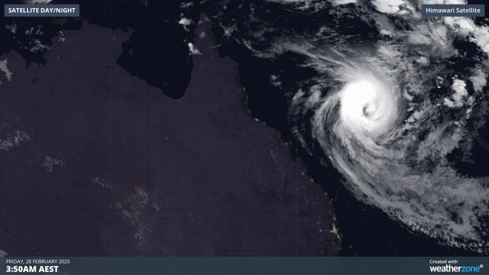 Image: A four-hour satellite loop in the early hours of Friday morning, February 28, showing Severe Tropical Cyclone Alfred to the east of Qld.
Earlier this week, Weatherzone meteorologist Ben Domensino wrote that it was not possible at that stage to know if Alfred will eventually cross the Queensland coast, and if it does, whether it will be a tropical cyclone or a weaker low pressure system.
It has since become clearer that Alfred will track close enough to the coast for its impacts to be felt, with gales and huge swells expected along parts of Australia’s east coast, as Weatherzone meteorologist Felix Levesque explained on Thursday.
In its Friday statement, the BoM added that “regardless of the track Alfred takes, severe coastal hazards are likely for southern Queensland and northeast New South Wales.
“A large and powerful to potentially damaging easterly swell as well as abnormally high tides are forecast to develop about southern Queensland beaches from Friday and especially during Saturday, extending to northern New South Wales from Sunday or Monday.”
At this stage, Tropical Cyclone Alfred is expected to remain off Australia’s east coast as it slowly moves towards the south over the coming days. While a coastal crossing appears unlikely, the anticipated slow movement of Alfred in the coming days makes its future track more difficult to predict.
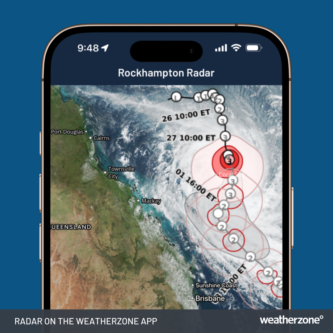
Image: Satellite and tropical cyclone forecast track on the Weatherzone app, showing Tropical Cyclone Alfred's predicted future track. Valid at 9:35 am AEST on February 28, 2025.
Please check the latest cyclone advisories and weather warnings for the most up-to-date information and be sure to stay on the Weatherzone news feed into the weekend and the new week for more TC Alfred updates.