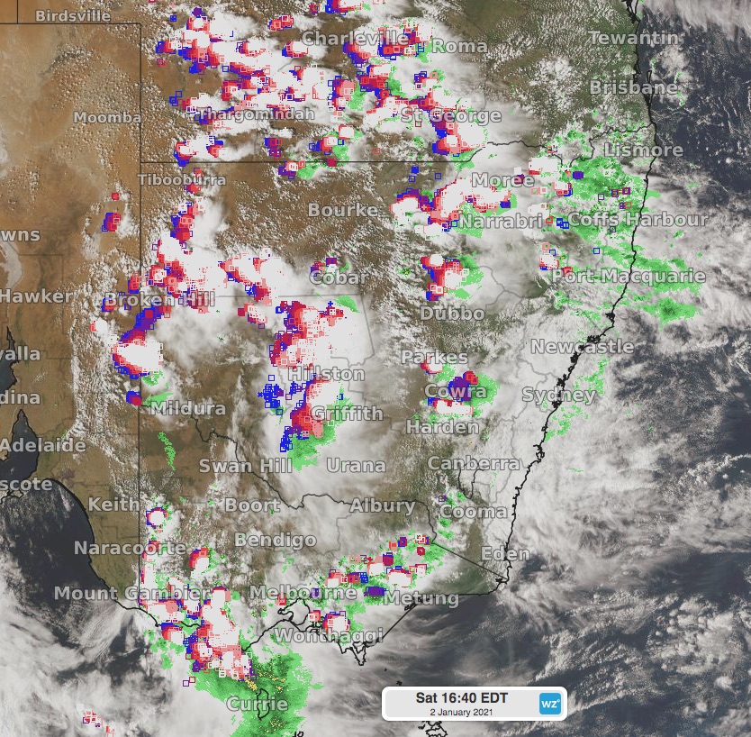
Severe thunderstorms lashing western NSW and Victoria
A deep trough has triggered widespread thunderstorms over much of eastern Australia on Saturday, with some very dangerous storms affecting western parts of NSW and Victoria.
A deep, broad trough stretching from the NT to southwest Victoria, fueled by plentiful moisture, has and still is generating widespread showers and thunderstorms. Some of the most severe of these storms have formed over western parts of NSW and Victoria. Destructive wind gusts, large hail and heavy rain have been recorded within some of the storms.
 Image: widespread thunderstorms across NSW, Victoria, eastern SA and southern Queensland on Saturday afternoon using the Himawari-8 satellite.
A storm that crossed Parkes, NSW, produced a whopping 157.4km/h wind gust at 4:43pm. Other damaging gusts were recorded at Fowlers Gap and White Cliffs on Saturday afternoon, 92.6km.h and 90.7km/h respectively. Hail damage has also been recorded in the Broken Hill area.
In Victoria, a 92.6km/h wind gust swept through Warrnambool Airport at 2:26pm on Saturday. Hail damage has also been recorded in parts of the South West district.
Severe thunderstorm warnings are current for many districts in NSW and Victoria, as well as eastern SA and southern Queensland. Stay up to date with warnings at https://www.weatherzone.com.au/warnings.jsp?lt=wzcountry&lc=aus