Severe storms strike Sydney as low pressure system deepens

Sydneysiders were woken by heavy rain and loud thunder as severe storms struck parts of the city on Wednesday morning.
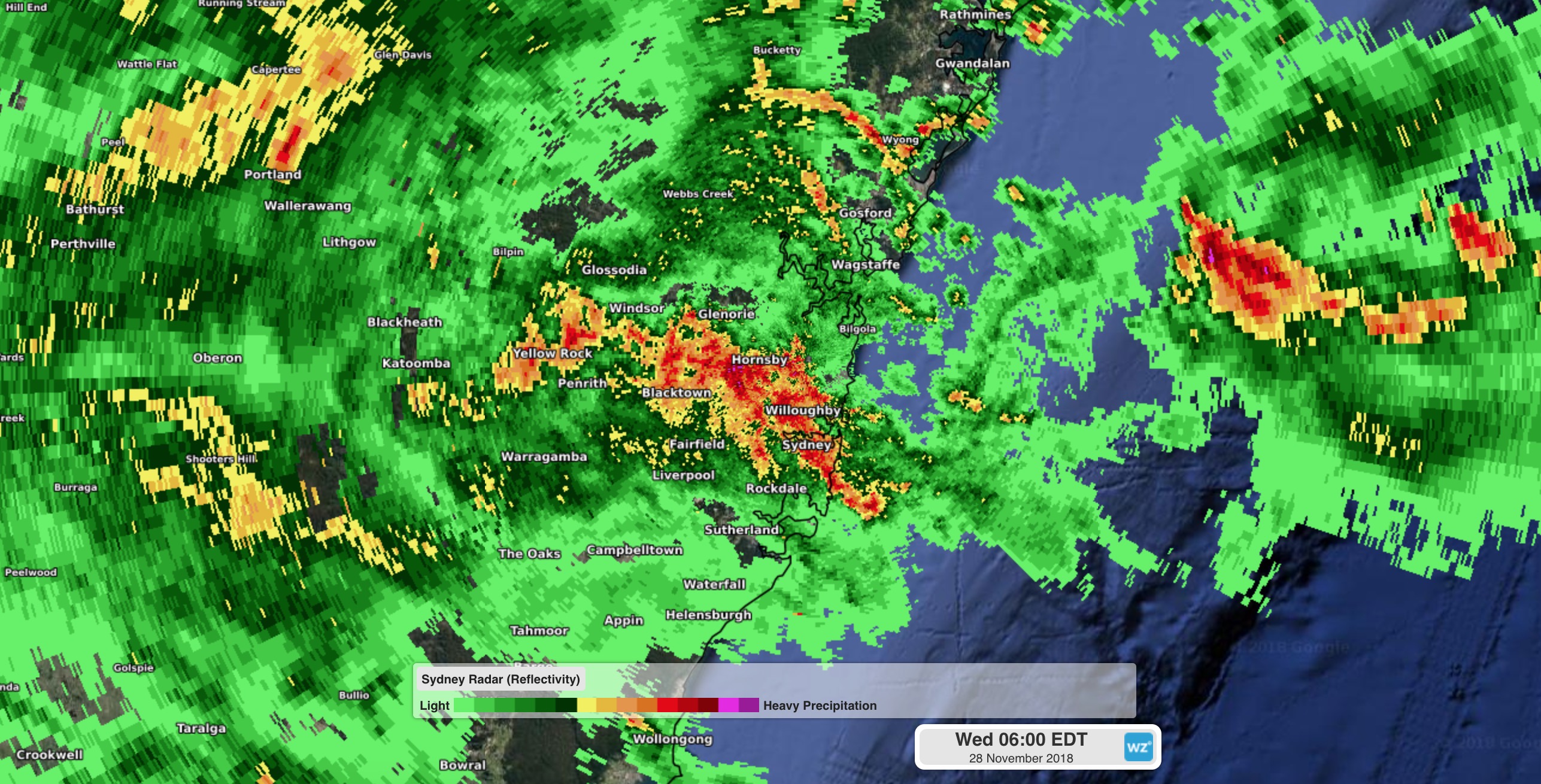
Early on Wednesday, a line of severe thunderstorms developed across the Sydney Basin and started moving towards the south. During the hour between 5am and 6am, Box Hill registered 55mm of rain and 45mm fell at West Pennant Hills. These rain rates are more than enough to produce flash flooding in urban areas, so commuting is likely to be affected this morning.

Image: A line of severe thunderstorms moves over Sydney early on Wednesday.
A deepening low pressure system is responsible for this morning’s storms and will cause more heavy rain and thunderstorms across a broad area of central NSW during Wednesday, with numerous weather warnings and alerts in place across the state.
A severe weather warning covers areas from the Illawarra up to the lower Mid North Coast and inland to the Blue Mountains, also including the Barrington Tops. A mix of heavy rainfall, flooding and damaging winds are likely in the area during the next 24 hours.
The low pressure system will mainly cause severe weather on Wednesday, before moving out to the Tasman Sea on Thursday, allowing conditions to ease in its wake. However, hazardous surf will linger for another day before easing from Friday.
Visit http://www.weatherzone.com.au/warnings.jsp for the latest warnings.