Severe storms slam Sydney
A cluster of severe thunderstorms has converged on the Sydney region on Monday afternoon, delivering heavy rain, hail, and hazardous driving conditions.
Fortunately, no reports of damaging hail have yet emerged, with the largest hailstones being not much bigger than pea-sized.
As the storms rolled in just after 3pm, the BoM issued a Severe Thunderstorm Warning for heavy rainfall for the Sydney area as well as parts of the Hunter, Illawarra, Central Tablelands, Southern Tablelands and South West Slopes forecast districts.
Storms are firing up across parts of NSW.
— NSW RFS (@NSWRFS) October 14, 2024
Just a reminder that if you require storm assistance call the NSW SES on 132 500 and Triple Zero for life threatening emergency.
???? storm moves across Picton in the Southern Highlands a short time ago. pic.twitter.com/V15ESYFVrU
The wild weather was caused by a trough moving over NSW which combined with an unstable airmass. The trough will deepen overnight enhancing showers and thunderstorms across the central ranges and coast of NSW, before impacting the northern ranges and coast on Tuesday.
The storms were relatively fast-moving, however moderate rainfall totals were recorded in a short time-frame, including:
- 18.4mm at Sydney Observatory Hill in just over half an hour up till 3:30pm.
- 23.6mm at Canterbury (about 12km southwest of the Sydney CBD), again in little more than half an hour.
- 10mm in few very brief stormy minutes at Mt Ginini in the Brindabella Range overlooking Canberra.

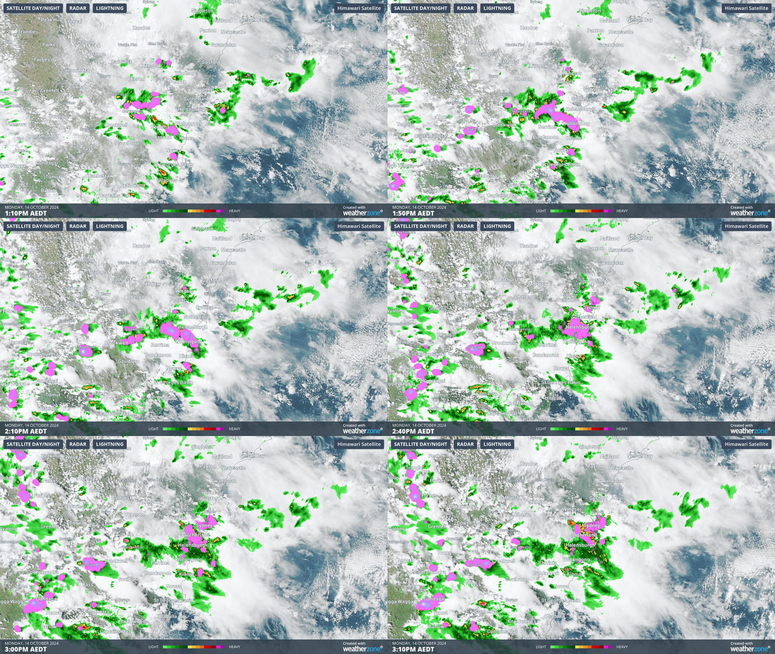
Image: Two-hour radar loop of storms to 3:10pm, Monday October 14, 2024. The storms were relatively fast-moving, with pink areas representing heat generated by lightning,
The radar loop above also shows that further storms lie to the west and southwest of the Sydney region, with storms also starting to build up around Canberra.
READ MORE: Destructive storms and record-challenging heat in Australia this week

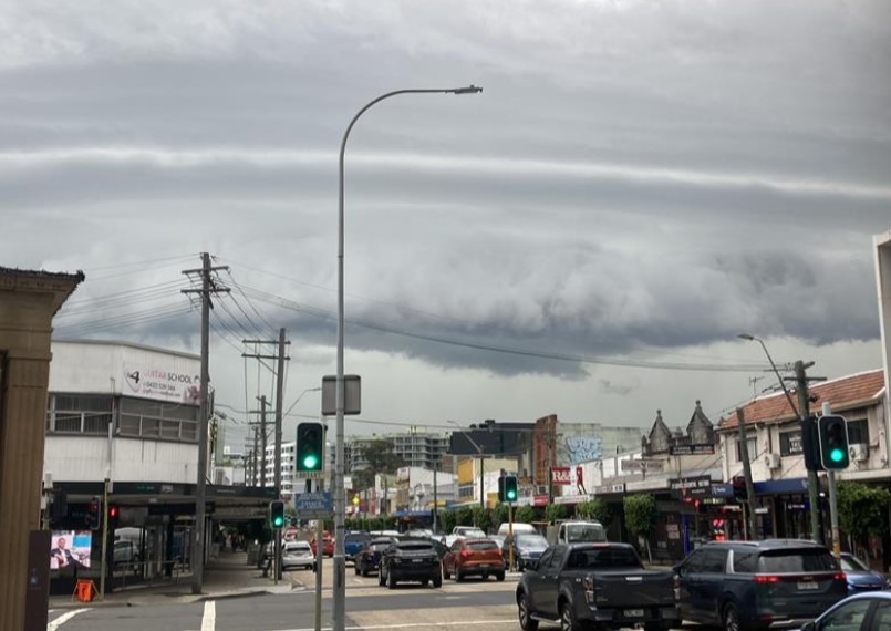
Image: Skies turned greenish-grey like the traffic lights over southern Sydney as the storms arrived, with loud rumbles of thunder.
This is a dangerous weather situation which is ongoing, with further storms possible in many of the areas mentioned into Monday evening, so please check the Weatherzone warnings page for the latest advice. You can also check the latest advice from the NSW SES here.
