
Severe storms loom for southeast Queensland
Dangerous thunderstorms will develop over parts of southeast Qld on Wednesday, with heavy rain, damaging winds and large hail all on the cards and supercells possible.
The interaction between an unstable atmosphere, abundant low-level moisture and a low pressure trough will trigger thunderstorms over a broad area of central and southeast Qld on Wednesday.
There have already been a few storms during the morning, however the most intense and dangerous thunderstorms are likely to develop in the afternoon and evening as temperatures climb near the surface and a southerly wind change pushes into the state's southeast.
Anywhere near and south of about Mackay could see severe storms on Wednesday, with the greatest chance over the state’s South East Coast and Wide Bay and Burnett Districts.
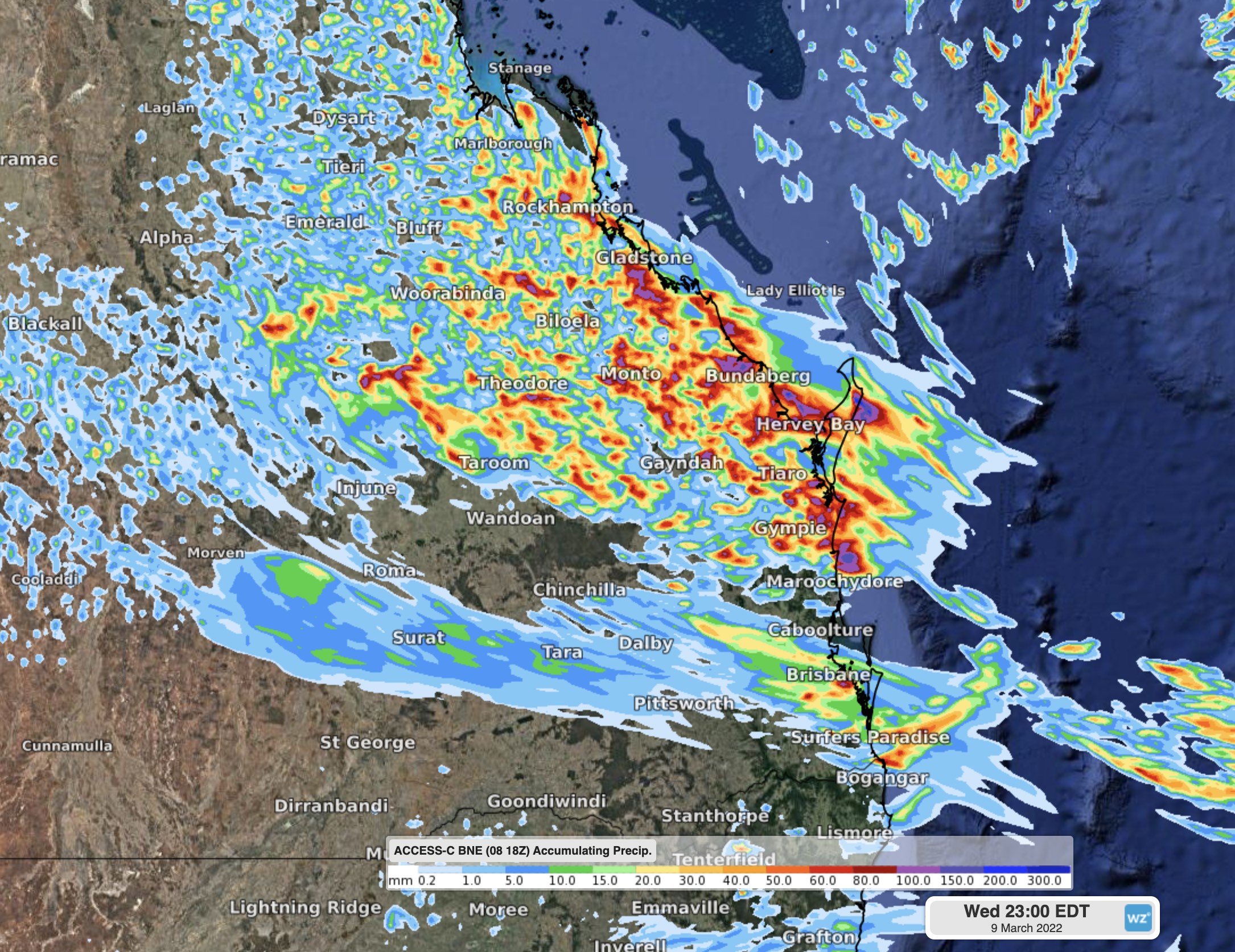
Image: Forecast accumulated rain on Wednesday, March 9, according to the ACCESS-C model.
The location, timing and intensity of Wednesday's storms in the state's southeast will depend on the arrival of a southerly change.
Anyone living in central and southeast Qld should closely monitor the radar today and tonight and stay up to date with the latest severe thunderstorm warnings.
Looking ahead, more severe thunderstorms could develop over central and southern inland Qld on Thursday, however they are unlikely to redevelop over the state’s southeast.