Severe storms in NSW
Dangerous thunderstorms are developing over NSW, prompting warnings in some areas.
A low pressure trough crossing eastern Australia today is triggering storms over central and eastern districts of NSW.
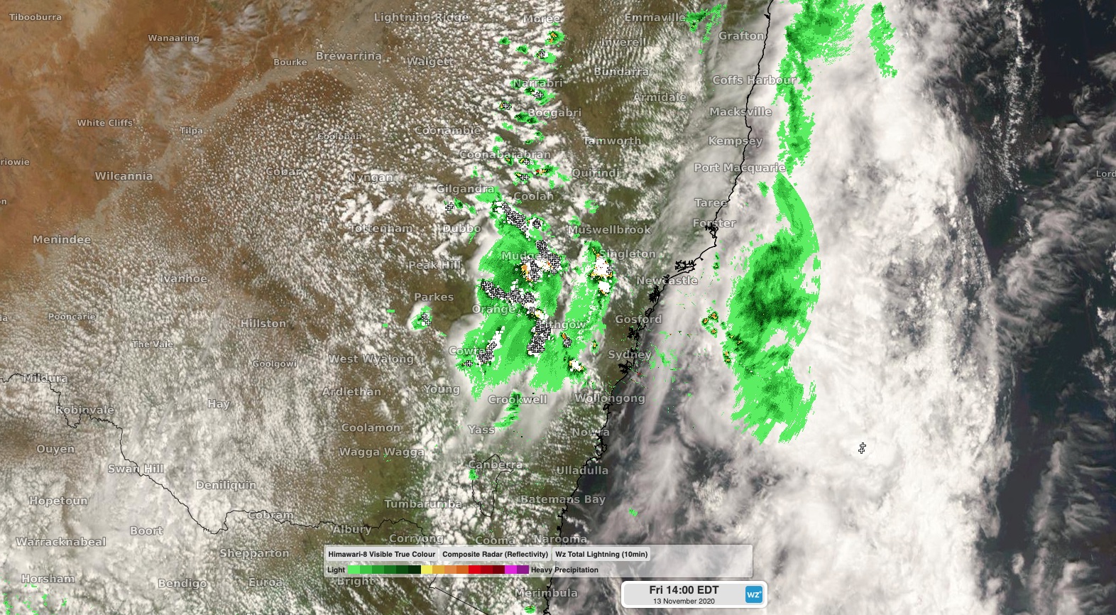
As of 2pm, storms were occurring over the state's central inland, with a warning in place for damaging winds and large hail in the Hunter, Sydney Metro, Central Tablelands and parts of Mid North Coast, Illawarra, Southern Tablelands, North West Slopes and Plains, Central West Slopes and Plains and South West Slopes Forecast Districts.

Image: Composite radar, satellite and lightning strikes showing where thunderstorms were located at 2pm AEDT on Friday. These stroms are moving towards the east.
Westerly steering winds will cause storms to move towards the east during the afternoon, which means some coastal areas could see a storm later in the day. This should include Newcastle, the Central Coast, Sydney and Wollongong.
Keep up to date with the latest warnings throughout Friday for the latest details on these dangerous storms.
Today's storms will ease overnight before drier and calmer weather returns to NSW on the weekend.