Severe storm trifecta in eastern Australia today
Heavy rain, large hail and damaging winds - the severe storm trifecta - are all likely to occur in parts of eastern Australia today as severe thunderstorms erupt over Queensland and New South Wales.
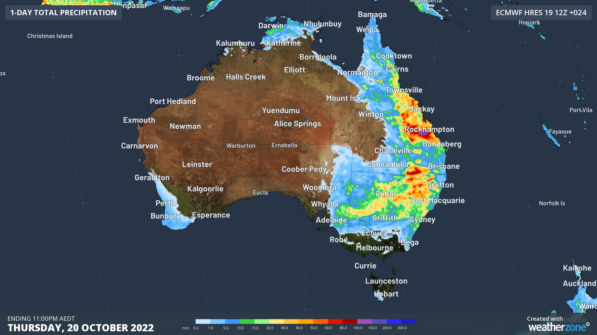
A low pressure trough combined with ample moisture and an unstable atmosphere will cause widespread showers and thunderstorms over eastern Australia today. The map below gives an indication of where these showers and storms will occur.

Image: Forecast accumulated rain during the 24 hours ending at 11pm AEDT on Thursday, October 20, 2022, according to the ECMWF-HRES model.
In Qld, thunderstorms are possible over most northern, central and eastern parts of the state on Thursday. The most intense storms are expected to occur over the central and southern inland and parts of the central coast, where damaging winds, heavy rain and large hail are likely. Supercell thunderstorms are also a risk in this region, which are the most dangerous type of storm, capable of causing destructive winds and giant hail.
In NSW, showers should affect part of every district at some stage on Thursday with thunderstorms possible over most of the state, excluding the far northwest and far southeast. Severe storm activity is possible in a broad corridor extending from the state’s southwest up to the northeast, most likely over the central and northern inland. Supercell thunderstorms are a risk over the Central West Slopes and Plains, North West Slopes and Plains districts, and eastern parts of the Upper Western district.
Severe thunderstorm warnings will be issued and updated throughout Thursday in both states. Be sure to keep an eye on the radar and check the latest warnings in your area.