
Seventh tropical cyclone of season possible this weekend
There are increasing signs that two tropical lows could develop over northern Australia in the next week, with one a high risk of developing into a tropical cyclone.
The enhanced tropical risk comes as the Madden Julian Oscillation (MJO) makes its way towards the Australian region in the coming week. While the MJO currently weak, some models suggest it could strengthen as it enters the Australian region, which would increase the risk of cyclone development in the next week.
The MJO is a pulse of rain and cloud that moves around the equator every 30-60 days and when it is near Australia it can increase the risk of tropical cyclone development and enhance rain and thunderstorms.
The first tropical low, designated 11U, should form over waters to the north of WA in the next 24 hours. This system is expected to move parallel to the Kimberley and Pilbara coasts from the weekend into early next week. The low-pressure system has a high chance of developing into a tropical cyclone from Sunday as it moves into more favourable environmental conditions.
The Bureau of Meteorology’s tropical cyclone forecast map shows that there is a high risk of a cyclone on Sunday, April 7 with the centre of the system expected to be located off the northwest shelf of WA.
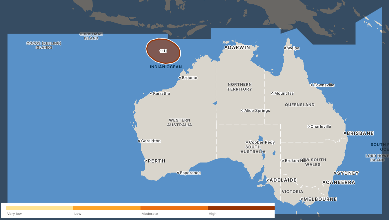
Image: The Bureau of Meteorology’s tropical cyclone outlook for Sunday, April 7. Forecast valid at 7:31am AWST on Thursday, April 4. The dark shading highlights areas that lie outside Australia’s area of responsibility for tropical cyclone monitoring. Source: Bureau of Meteorology
If Tropical Low 11U forms into a tropical cyclone, this would be seventh tropical cyclone inside Australia’s area of responsibility so far this season.
The map below shows that the low’s centre (black solid line) should track southwest away from the WA coastline. The map below shows that no ensemble members for this computer model forecast the system crossing the WA coast at this stage.
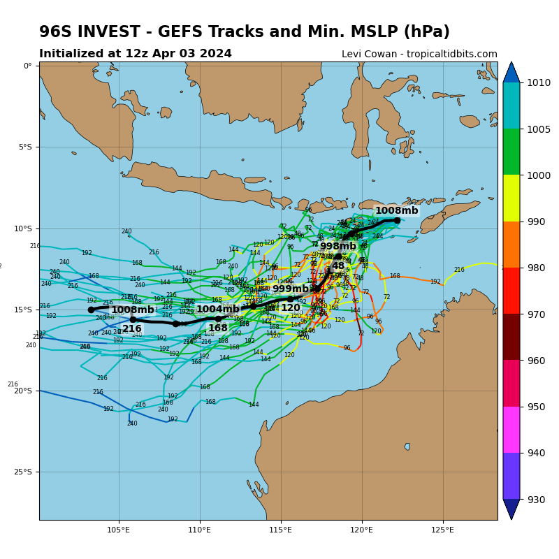
Image: GEFS ensemble member tracks for Tropical Low 11U. Source: TropicalTidbits.com
By Tuesday, April 9, the system should be moving further west and weakening as it moves over cooler waters and into a less favourable environment.
While the low should remain offshore, the tropical moisture from this system could feed south in the coming week, bringing cloud and rainfall to parts of WA.
The map below shows one computer model’s forecast keeping the heaviest rain offshore in the path of the low, but with the Kimberley and Pilbara coasts still coping some rainfall in the next week.
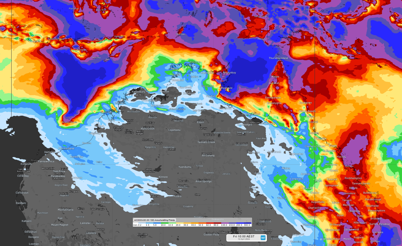
Image: Accumulated rainfall forecast for the eight days leading up to 10am AEST on Friday, April 12, according to ACCESS-G
You will notice in the map above that large rainfall totals are also forecast across Top End in the NT and Far North Qld in the next week.
This rain is due to another tropical low that could form in the Arafura Sea to the north of the NT early next week. At this stage there is a low risk of this system developing into a tropical cyclone. However, the strength and location of the low at the end of next week is still very uncertain, with some computer models suggesting it could cross the Top End later next week, most likely as a tropical low, and other model keeping it offshore
If the low does move over the Top End, heavy rainfall and strong winds could extend across the northern NT.
Please keep an eye out for the latest warnings and tropical cyclone advisories as the coming week unfolds.