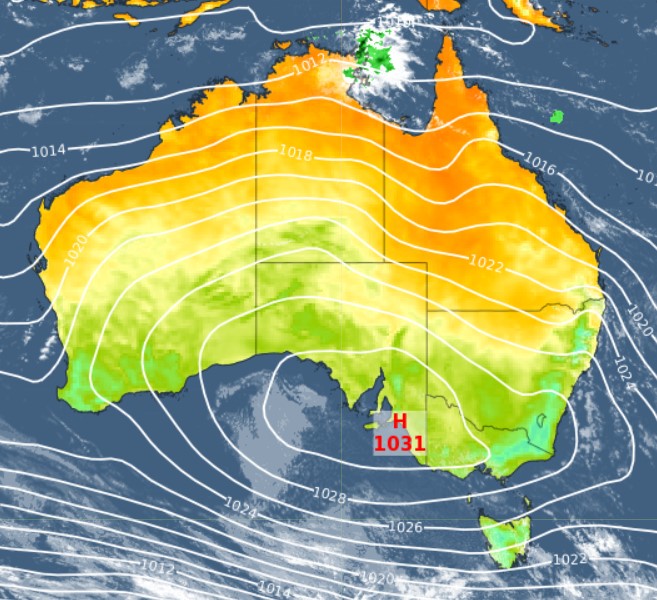
Say hi to a great big high
It's not often you can say that a single feature on the synoptic chart is responsible for the weather across pretty much the whole of Australia, but that's the case this Friday.
Take a look at that whopping great high pressure system centred almost exactly over Adelaide. Gaze upwards from the SA capital and you could just about see the big red H in the sky!

As you probably know, high pressure systems generally usher in fine weather to most of the country, although there are exceptions.
- The east coast is under the influence of moist onshore winds circulating anti-clockwise around the high, meaning showers for the next few days from the NSW south coast to the northern Queensland coast
- The influence of those easterlies extends as far north as the NT, with the territory's Arnhem Coast currently experiencing showers, which you can see as the only green blob of rain on the radar in the chart above
- Down south, you can see how the anti-clockwise circulation means westerlies for Tasmania, and those should bring showers for the next couple of days for western parts of the state, as well as a very light shower or two for coastal Victoria from about Melbourne to the SA border, easing over the weekend
Otherwise, that great big high is delivering fine conditions that should stick around for a few days, which is good news for anyone taking a four-day break ahead of Anzac Day.
For those planning to attend a dawn service on Tuesday, we'll have an update on the expected conditions in the capital cities and beyond by Monday.