
Satellite captures massive sandstorm in China
The sky above Beijing turned orange on Monday as the city was engulfed by a huge sandstorm sweeping across China.
A powerful cold front and associated low pressure system caused a large cloud of sand and dust to become airborne over China on Monday. Much of the sandstorm originated in Mongolia before spreading south across the border into China.
On Monday, visibility and air quality plummeted in Beijing as some residents covered their faces with goggles and masks.
Dangerous conditons in Beijing, China 🇨🇳 as major sandstorm (largest in at least 10 years) causes huge disruption today.
— Scott Duncan (@ScottDuncanWX) March 15, 2021
Via @shen_shiwei pic.twitter.com/YZ14PtKDlU
According to reports, the concentration of airborne particles less than 10 micrometres in diameter, also known as PM10, reached more than 8,100 micrograms per cubic metre in some parts of the city on Monday. This is more than 13 times the threshold used in New South Wales for 'Extremely Poor' air quality, which is the top category in a five-tiered scale.
The sandstorm was even large enough to be seen clearly from space.
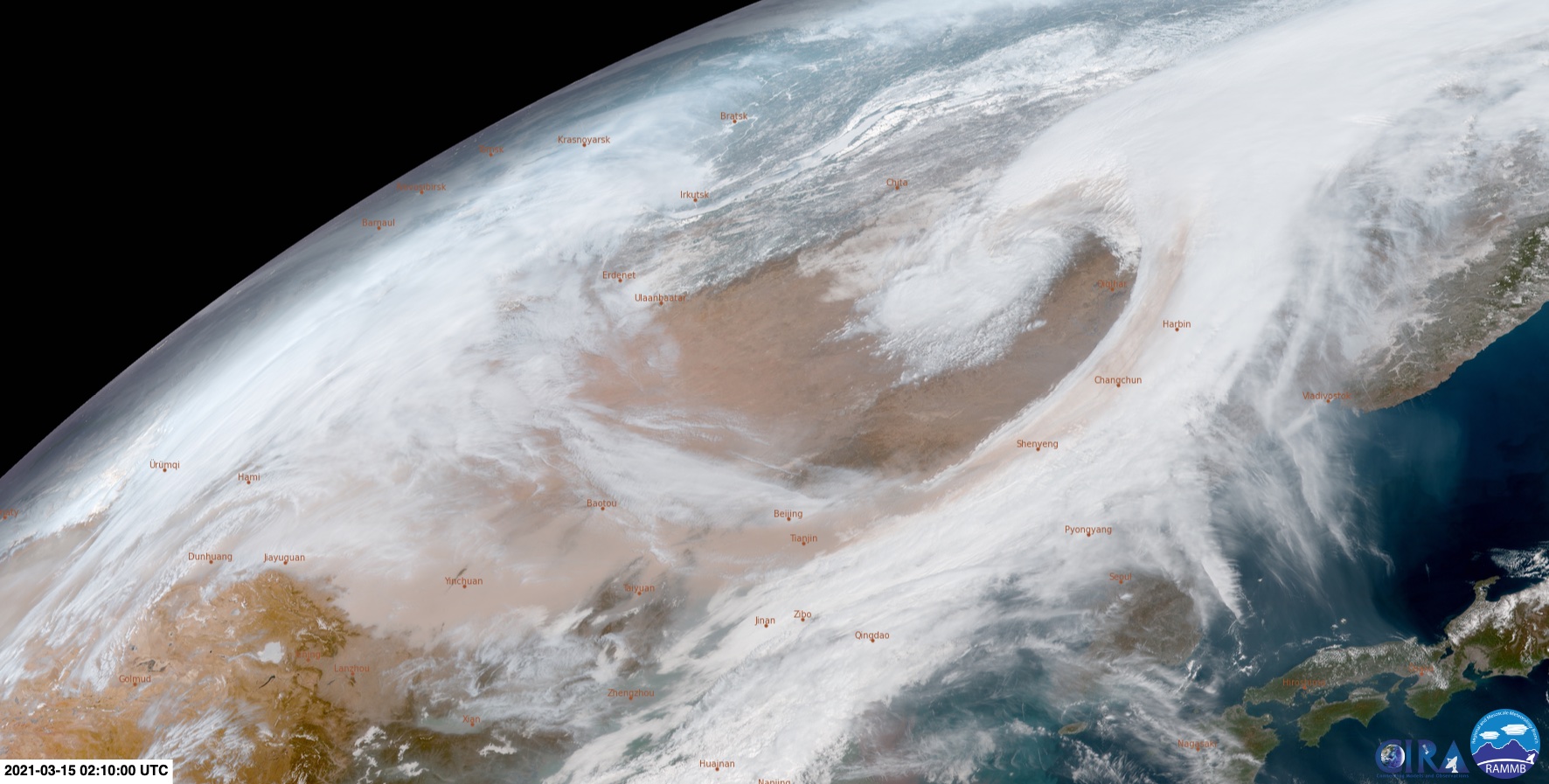
Image: Himawari-8 satellite image captures an elongated sandstorm stretching across China on Monday. Source: RAMMB/CIRA
Japan's Himawari-8 satellite captured phenomenal images (above) of the sandstorm spreading across China and feeding into a well-defined low pressure system on Monday.
Large dust storms like this are also common in Australia, particularly during years of drought. One of the most well-known dust storms occurred in September 2009 as a cloud of inland dirt drifted across Canberra, Sydney and Brisbane.