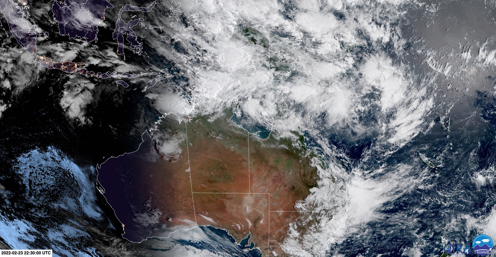
Sat pic shows northern Australia ripe with cyclone potential
Take a look at this satellite image from Thursday morning. See all those blobs of cloud over northern Australia?
Those are low pressure systems, and one or more of them could potentially turn into Tropical Cyclones over the next few days.

3 pm UPDATE Thurs Feb 24. Darwin has just been put on Cyclone Watch. For more, here's our story.
The wet season peaks in much of northern Australia in February and March. For example, they are the two wettest months of the year for Cairns, closely followed by January (all three months see more than 400 mm of rainfall on average).
Tropical cyclone potential is also at its highest at this time of year, and as we told you earlier this week, conditions right now are optimal for their formation.
The Bureau of Meteorology issues three-day Tropical Cyclone Outlooks at this time of year for three regions:
- The Coral Sea (off the Qld coast)
- The Western Region (off the WA coast)
- The Northern Region (Top End waters including the Gulf of Carpentaria)
The likelihood of tropical cyclones developing is considered low chance ( 5-20%) over the next two days, though that rises to a moderate likelihood (20-50%) by Saturday in the Northern Region.
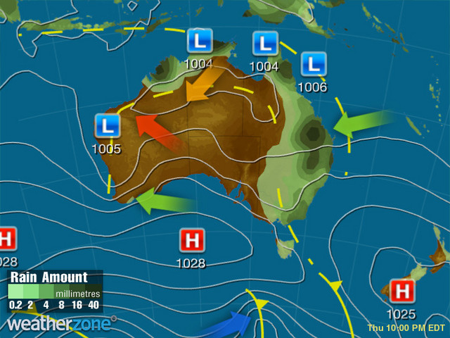
A glance at this evening's synoptic chart tells you more about the situation. See all those lows hovering just above northern Australia?

They're sitting along the monsoon trough, which marks the boundary between warm, wet monsoonal northwesterlies, and drier winds with a southerly component.
Low pressure systems typically develop along the monsoon trough, and that's what you can see clearly now – with one in the Timor Sea west of Darwin, one in the northern Gulf of Carpentaria near Cape York, and one east of the Queensland coast in the Coral Sea.
(The fourth low on the chart is a dry heat low in inland WA, and is unrelated to cyclone potential.)
Whether one of the lows up north develops into a tropical cyclone remains uncertain for now, but it's the sort of set-up that is ripe with potential, and we'll keep you posted if and when a tropical cyclone forms.