River of cloud just west of Sydney
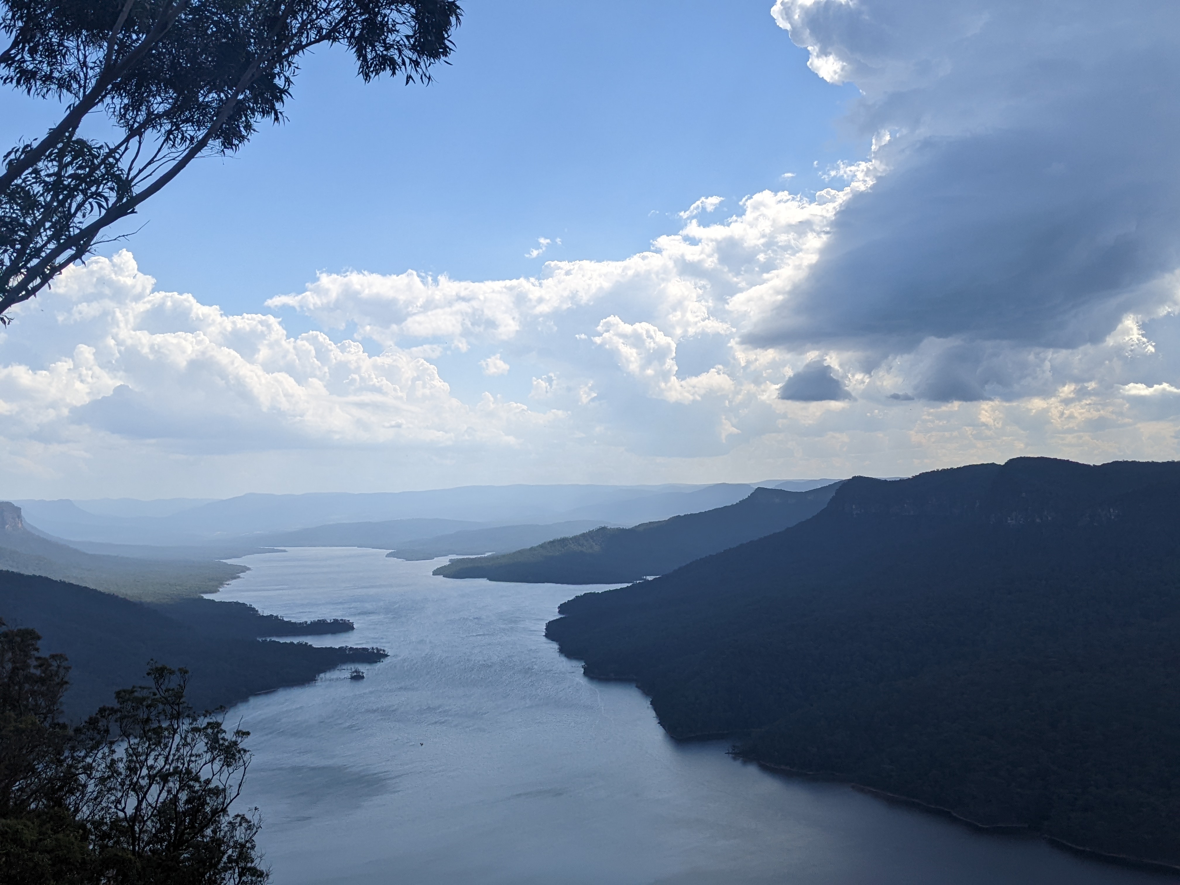
The Burragorang Valley lies to the west of Sydney and forms part of the Warragamba dam, Sydney’s main water supply. The valley once had a river flowing through it and a small town until the Warragamba dam was built and it was flooded to become a lake.

Image: The Burragorang Valley with cumulus clouds and a thunderstorm. Source: Billy Rout
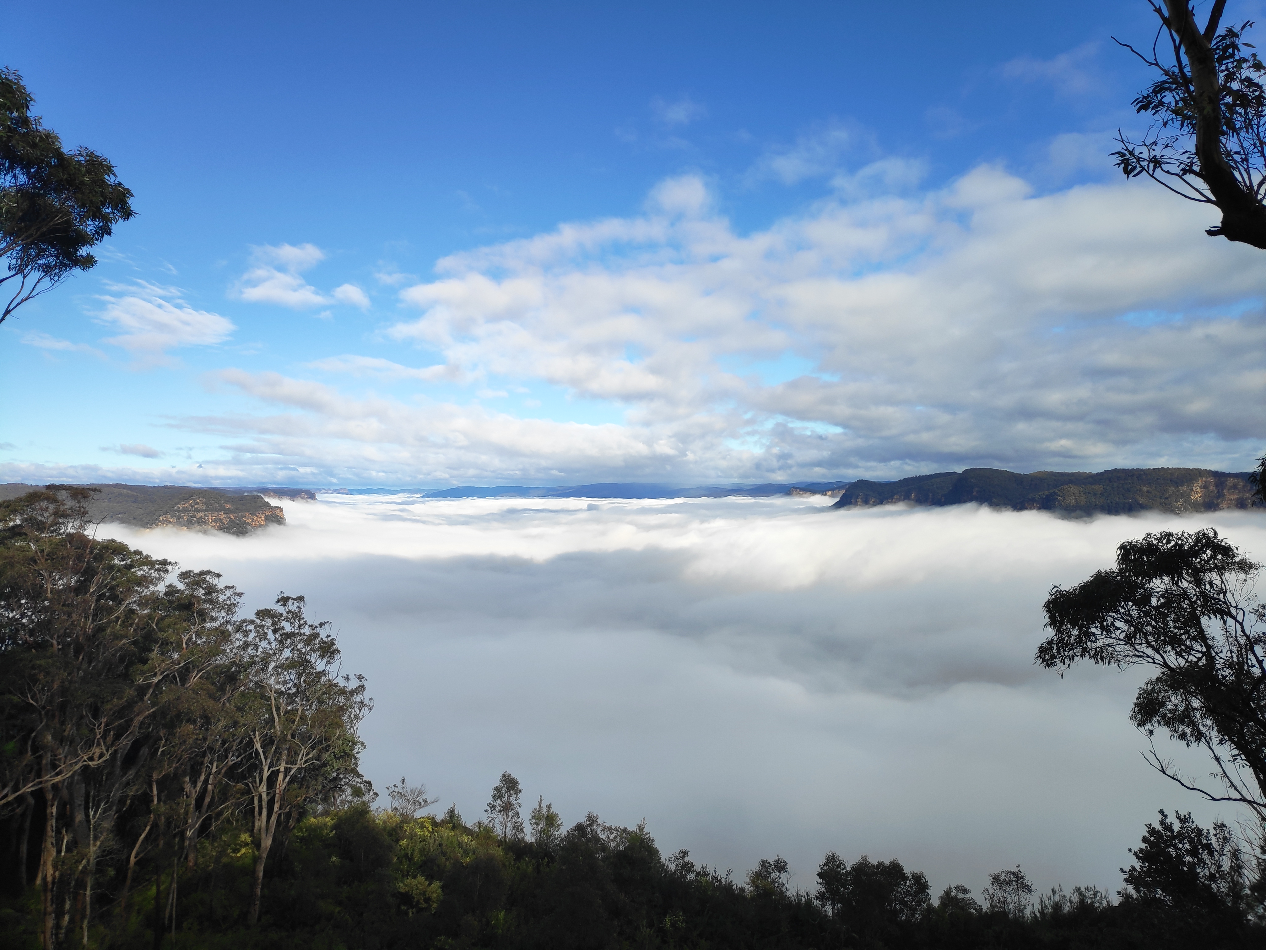
This past Wednesday morning, the Burragorang Valley was filled with a river of thick cloud.

Image: Valley fog in the Burragorang Valley on Wednesday 5 July. Source: Author’s photo.
This cloud is called Valley fog and it’s a special type of radiation fog. There was rainfall over the region on Tuesday evening which increased the surface moisture. Then skies cleared overnight with high pressure, allowing the air near the surface to cool quickly. As the air cooled it became denser and sank down to the bottom of the valley. The pooling of cold air over a valley floor allows fog to form easier and remain longer through the day than over flat land.
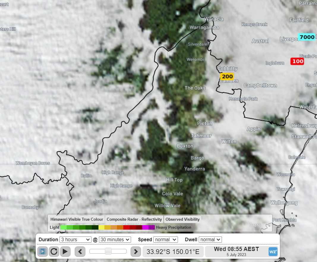
This valley fog was visible from space as seen in the following satellite image. You can see the cloud winding along the valley in the middle of the image.

Image: Himawari-9 visible satellite imagery with numbers indicating visibility in metres at 8:55am AEST Wednesday 5 July.