Respite in sight after days of severe weather in WA
Perth is having its wettest start to July in 21 years after a series of cold fronts caused several days of severe weather in southwestern Australia.
Multiple strong cold fronts have caused bursts of strong wind, heavy rain and large surf over parts of Western Australia's South West Land Division since Friday last week.
This prolonged spell of wild wintry weather saw powerful winds damage buildings in Perth, while heavy rain caused flash flooding and inundated some of the city's streets.
As of 9am on Wednesday, Perth had received about 70mm of rain since Friday, about half a month's worth of rain at this time of year. It also takes the city's running total for the month to 154.8mm, which is the highest to this point in July since 2000.
In addition to the flash flooding caused by this rain, the combination of runoff and abnormally high tides also caused some minor riverine flooding in the Swan River.
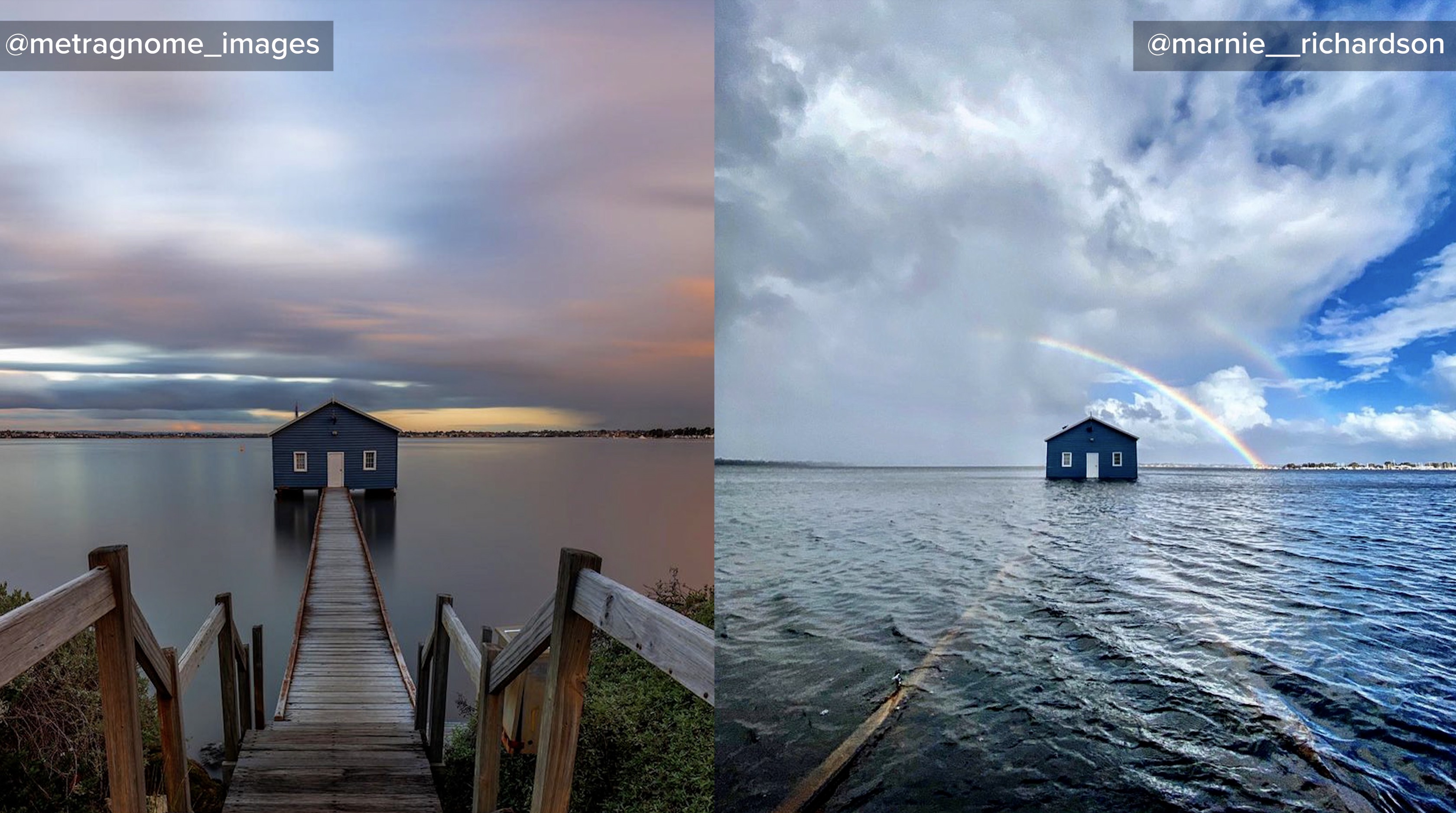
The image below shows the jetty leading out to Perth's famous 'Blue Boathouse' completely submerged around high tide on Tuesday (right image), compared to a photo of the boathouse on Saturday (left image).

Image: Before and after the Swan River swallowed the walkway to Perth's famous Blue Boathouse. Source: @metragnome_images (left) and @marnie__richardson (right) on Instagram.
Now, the last in this series of frontal systems is approaching WA and will clip the state's south and southwest on Wednesday night and Thursday morning. While Perth will see more blustery winds and showers as this front sweeps through, the most dangerous weather will occur along the state's south coast.
As of 3pm WST, a severe weather warning was in place for damaging winds, abnormally high tides and damaging surf in parts of the South Coastal and parts of South West and South East Coastal districts.