
Remarkably cold week in Australia
It's not every week we get to report on record-breaking cold weather in Australia.
Rising average global temperatures have loaded the dice when it comes to heat-related records in Australia. The last seven years have all been among our country's nine warmest on record based on mean temperature. The warmest of the lot was last year, which was more than 1.5ºC warmer than the long-term average.
Unsurprisingly, there have been a lot of heat records to talk about during the past decade.
So when cold weather records are broken in the modern climate, it's arguably more remarkable than records relating to heat.
This week, cold air mass and an extensive band of thick cloud - technically known as a northwest cloudband - swept across Australia from west to east. In addition to bringing useful rain to multiple states and territories, vast areas beneath this cold air and cloud experienced abnormally low daytime temperatures. In some places, it was the coldest October day(s) on record.
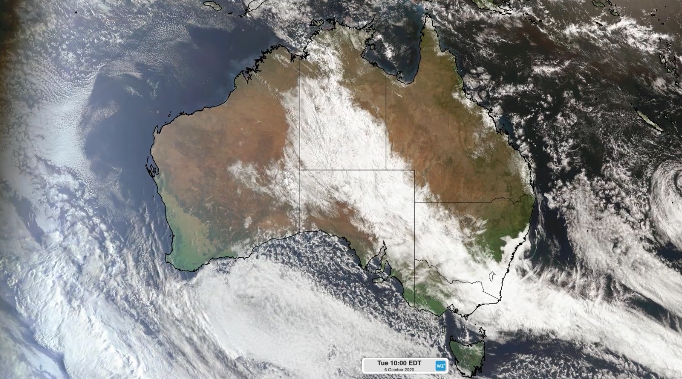
Image: Visible satellite image showing the northwest cloudband over Australia on Tuesday morning.
In Western Australia, the small Pilbara mining town of Telfer registered maximum temperatures of 25.5ºC, 24.9ºC and 24.8ºC last Sunday, Monday and Tuesday respectively. These were all new low maximum temperature records for October, with data available back to 1974. The previous record was 25.8ºC from 1974.
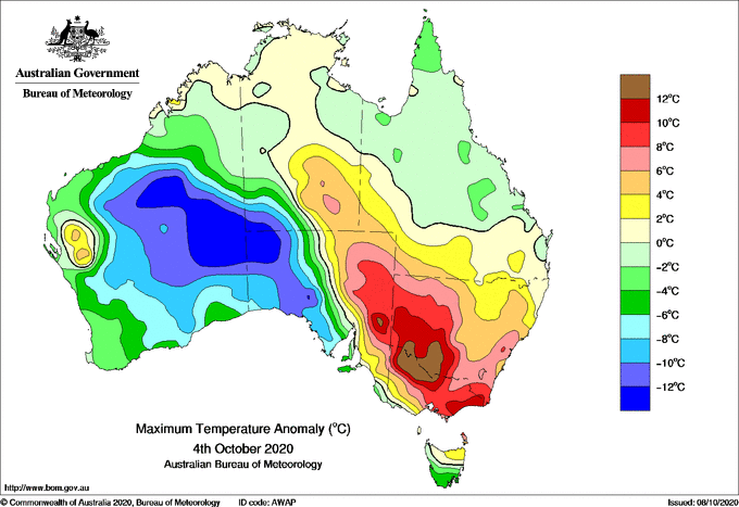
Image: Maximum temperature anomaly on Sunday, October 4. Source: Bureau of Meteorology
As the thick mass of cloud spread further east, temperatures also plummeted across parts of central and southern Australia.
A weather station at Curtin Springs in the far south of the Northern Territory registered maximum temperatures of 13.0ºC on Monday and Tuesday this week. This beat the site's previous low maximum temperature record for October (13.9ºC) by close to one degree. Data for this site is available back to 1965.
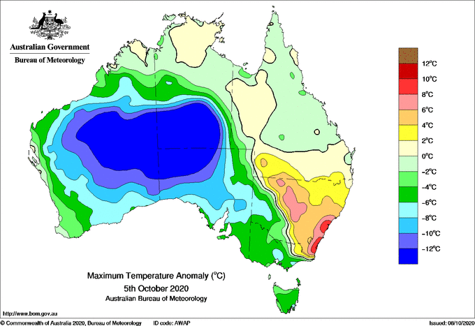
Image: Maximum temperature anomaly on Monday, October 5. Source: Bureau of Meteorology
Another Northern Territory weather station at Yulara Airport, near Uluru, also set new low October maximum temperature records on Monday (14.0ºC) and Tuesday (12.6ºC), beating 15.9ºC from 2011. Impressively, Tuesday's top temperature was about 20ºC below the long-term average for this time of year. Data for this site goes back to the 1980s.
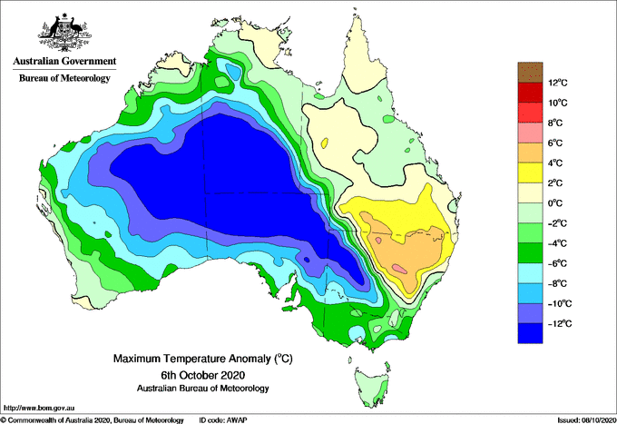
Image: Maximum temperature anomaly on Tuesday, October 6. Source: Bureau of Meteorology
Across the border in South Australia, Streaky Bay (13.7ºC) and Oodnadatta (13.9ºC) both had their coldest October days on record on Sunday and Tuesday respectively. Data for both locations goes back more than 60 years. It's worth pointing out that Oodnadatta also holds the record for Australia's highest reliably recorded temperature, which was 50.7ºC in January 1960.