Record-challenging heat hits Perth today
A burst of early-season heat will sweep across southwestern Australia at the start of this week, pushing the temperature to record-challenging levels in the Perth region.
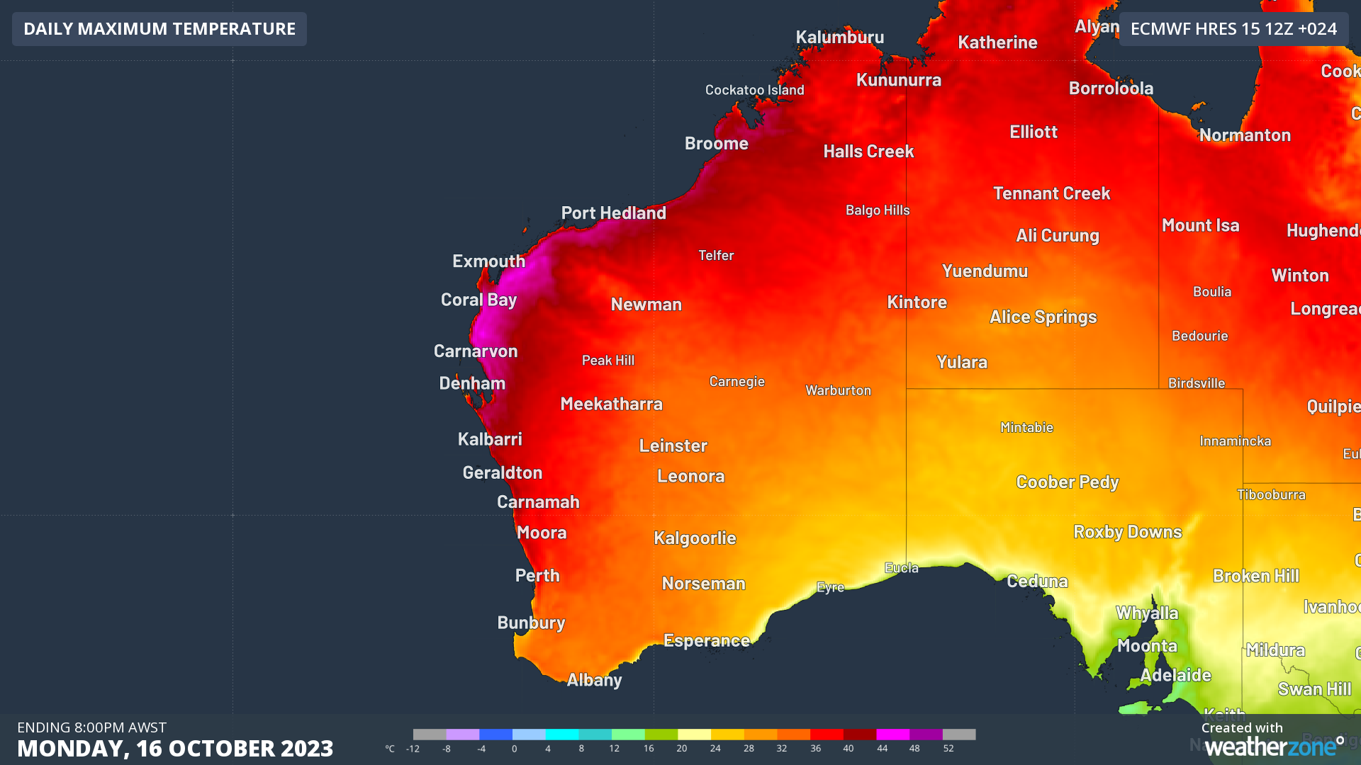
A large high pressure system centred to the south of WA will drive hot inland air towards the state’s west coast on Monday. This weather pattern will see temperatures reaching the mid-to-high 30s in the Perth region and even higher in the state’s north and northwest.

Image: Forecast maximum temperature on Monday, October 16, according to the ECMWF-HRES model.
Several places in and near Perth had their warmest October morning in more than a decade on Monday. This included minimum temperatures of 20.0ºC in Perth, 20.2ºC in Mandurah and 19.6ºC at Gingin Airport, which were all the highest October minimums since 2008.
This overnight warmth gave the day’s heat a head start, with Perth already up to 25ºC by 8am AWST and forecast to reach around 36ºC in the afternoon. This is 13ºC above average for this time of year and could challenge the city’s high temperature record for this early in spring.
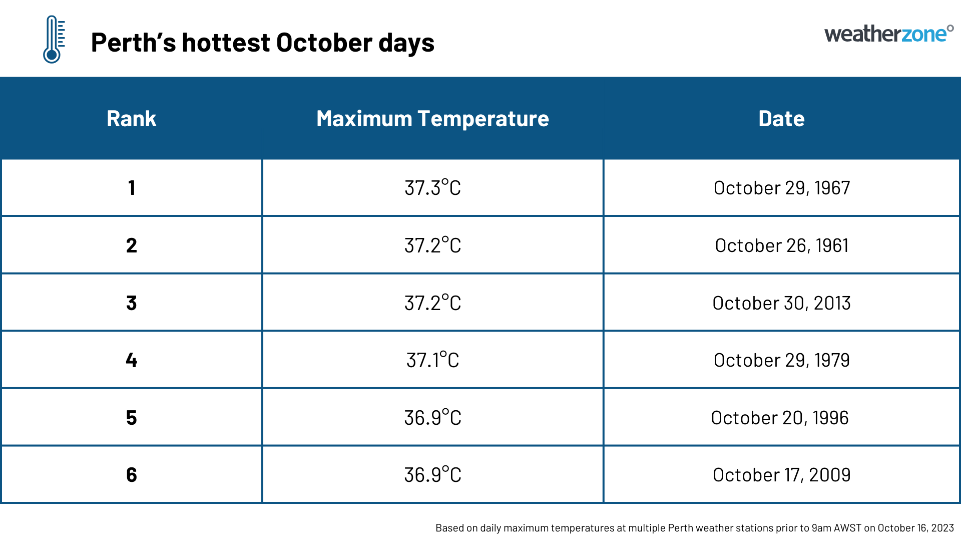
Perth’s highest October temperature on record was 37.3ºC from 1967. However, the highest temperature ever recorded on or before October 16 was 36.3ºC on October 16, 2011. Data in Perth dates back to 1897.

Monday’s heat will cause High to Extreme fire danger ratings in large areas of northern and western WA, with the most dangerous fire weather expected in the Central West district.
Looking ahead, Perth will be cooler from Tuesday as the heat gets carried further east by a low pressure trough.
