
Record-breaking heat gripping Western U.S.
Parts of California have just endured their hottest day on record amid an extreme heatwave that is straining power grids across the Western U.S.
A large and slow-moving upper-level ridge has allowed an extremely hot air mass to develop over the Western U.S. over the last few days. This ‘heat dome’ has already broken numerous records in several states, with more records tumbling in the last few hours.
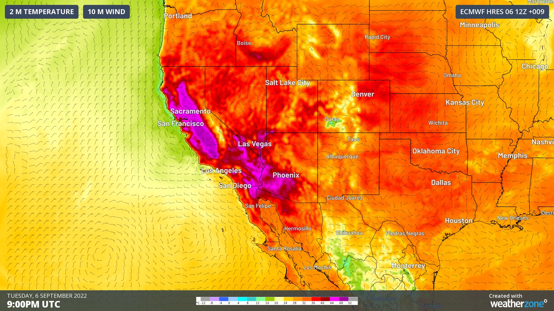
Image: Air temperature and wind speed/direction at the surface on the afternoon of Tuesday, September 6, according to the ECMWF-HRES model.
The official weather station at Downtown Sacramento reached 116ºF (46.7ºC) on Tuesday afternoon. According to the National Weather Service, this beat the site’s previous all-time record of 114ºF from July 17, 1925.
All-Time high temp records set or tied today. Downtown Sacramento reached 116 degrees today. This broke the previous all-time record high temperature of 114 set on July 17, 1925. Stockton reached 115 today which tied the previous all-time record set on July 23, 2006. #cawx
— NWS Sacramento (@NWSSacramento) September 7, 2022
Temperatures soared even higher in California’s Death Valley on Tuesday afternoon, where a unique combination of topography, altitude and the shape of the surrounding valley produce temperatures rarely seen anywhere else in the world.
Death Valley’s Furnace Creek weather station hit 125.2ºF (51.8ºC) shortly before 5pm local time on Tuesday. This was only 0.4ºC below the maximum temperature world record for September, which is 126ºF (52.2ºC) from Mecca (USA) in 1950.
Earlier in this heatwave, Furnace Creek also registered a minimum temperature of 101.8ºF (38.8ºC) on September 3. According to climate and weather historian Maximiliano Herrera, this is the equal highest minimum temperature ever recorded worldwide.
Ahead of Tuesday's dangerous heat, California’s Independent System Operator (ISO) warned consumers to be prepared for possible power outages as soaring temperatures cranked up demand and put the network under strain.
Then, as temperature records started to tumble, the ISO were forced to issue a level 3 Energy Emergency Alert (EEA), meaning controlled power outages are imminent or in process.
According to the ISO, Tuesday night’s “electricity demand is currently forecast at more than 52,000 megawatts (MW), a new historic all-time high for the grid.”
This heatwave has also caused numerous fires in western parts of the U.S. and Canada, with large smoke plumes visible from space on Tuesday afternoon.
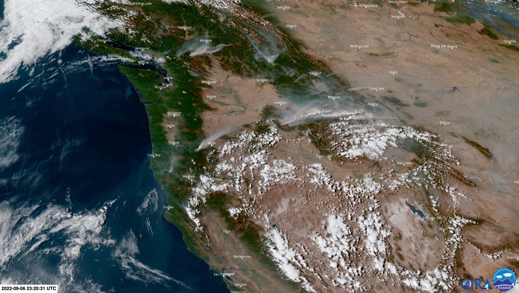
Image: Visible satellite image showing clouds and smoke over western Canada on Tuesday, September 6. Source: RAMMB/CIRA
Looking ahead, temperatures will start to drop later in the week as the heat dome breaks down over the region.