
Record warm June in parts of Qld
Large areas of Qld just had an unusually warm and dry June, with some places registering their warmest start to winter on record.
Despite prolific early-winter rain over large swathes of central and northwestern Australia this month, most of Qld saw little rain or cloud during June.
The map below shows that rainfall during June was in the lowest 20 percent of historical records for most of Qld, including Brisbane in the southeast and Burketown in the northwest.
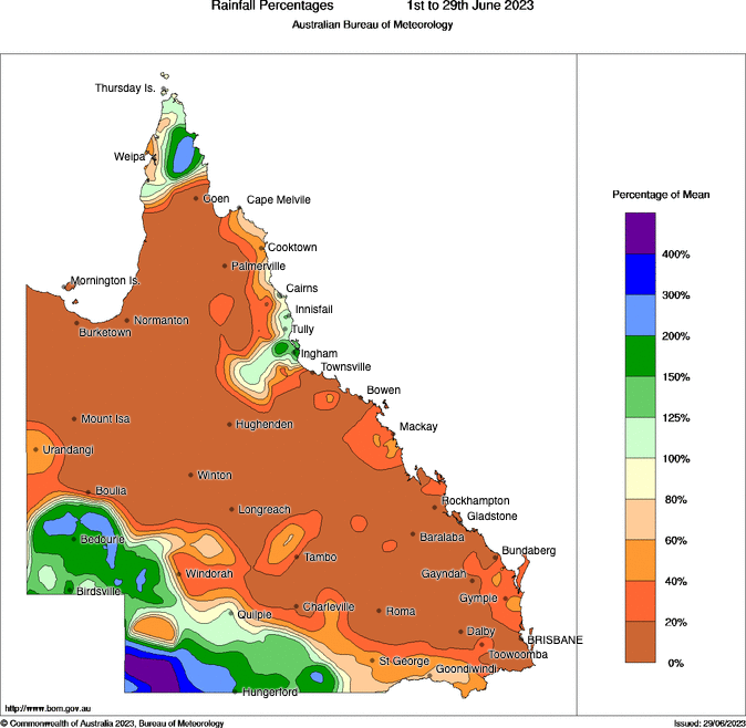
Image: Observed rainfall percentages in Qld during the first 29 days of June 2023. Source: Bureau of Meteorology.
While it’s not unusual to see little or no rain in central and western Qld during June, this month’s rainfall deficits have been more noticeable in the state’s southeast.
Brisbane’s 1.8 mm of rain this month was its driest June since 1986, and equal 10th driest June in records dating back to the mid-1800s.
Further south, the Gold Coast collected just 13.6 mm this month, making it their driest June since 2010 and the 2nd driest June since the site opened in 1994.
Rockhampton only received 3.2 mm of rain this June, which is a paltry 9 per cent of its long-term monthly average.
The lack of cloud cover over Qld during June also helped raise daytime temperatures, with many locations registering their warmest June on record based on maximums.
This month’s average maximum temperatures were around 3 to 5ºC warmer than usual in Barcaldine, Injune, Longreach, Emerald, Rockhampton, Charleville, Roma and Gladstone. These weather stations also set new June maximum temperature records for the current sites.
Brisbane’s average maximum will come in at around 23.2ºC (after taking Friday’s forecast top temperature into account), making this Brisbane’s 3rd warmest June in records dating back to 1887, based on maximum temperatures.
Rockhampton’s June maximum will be around 26.7ºC. This beats the previous June record by 0.7ºC, with data available back to 1888.
Looking ahead, a significant change in weather is in store for the opening week of July, with a northwest cloudband set to deliver widespread rain across the state.
The map below shows how much rain one computer model is predicting over Qld during the coming week.
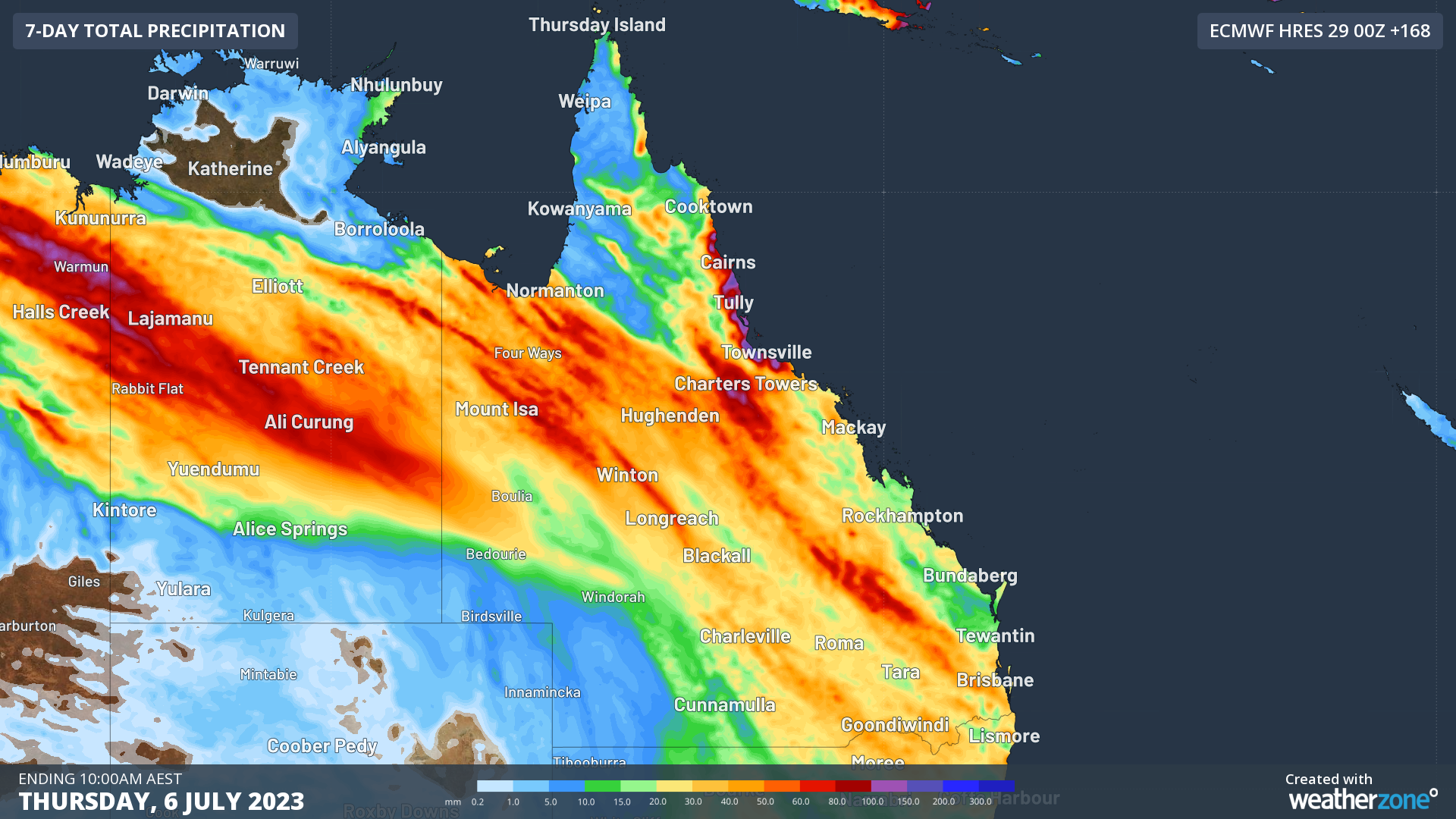
Image: Forecast accumulated rain during the coming week, according to the ECMWF-HRES model.
Some of this impending rainfall may be heavy enough to cause flooding and road closures, so be sure to check the latest warnings for the most up-to-date information.