
Rare Sydney Harbour surf on Good Friday
A powerful Tasman low will send damaging surf to NSW later this week, with waves expected to radiate into Sydney Harbour on Good Friday.
A tropical disturbance (TD11F) currently being monitored by the Fiji Meteorological Service is located between New Caledonia and Vanuatu. This tropical low could briefly become Tropical Cyclone Tam as it tracks south towards Norfolk Island and New Zealand’s North Island in the next 24-36 hours. Come the closure of Wednesday, April 16, a fully fledged extratropical Tasman Low will be sitting to the northwest of New Zealand.
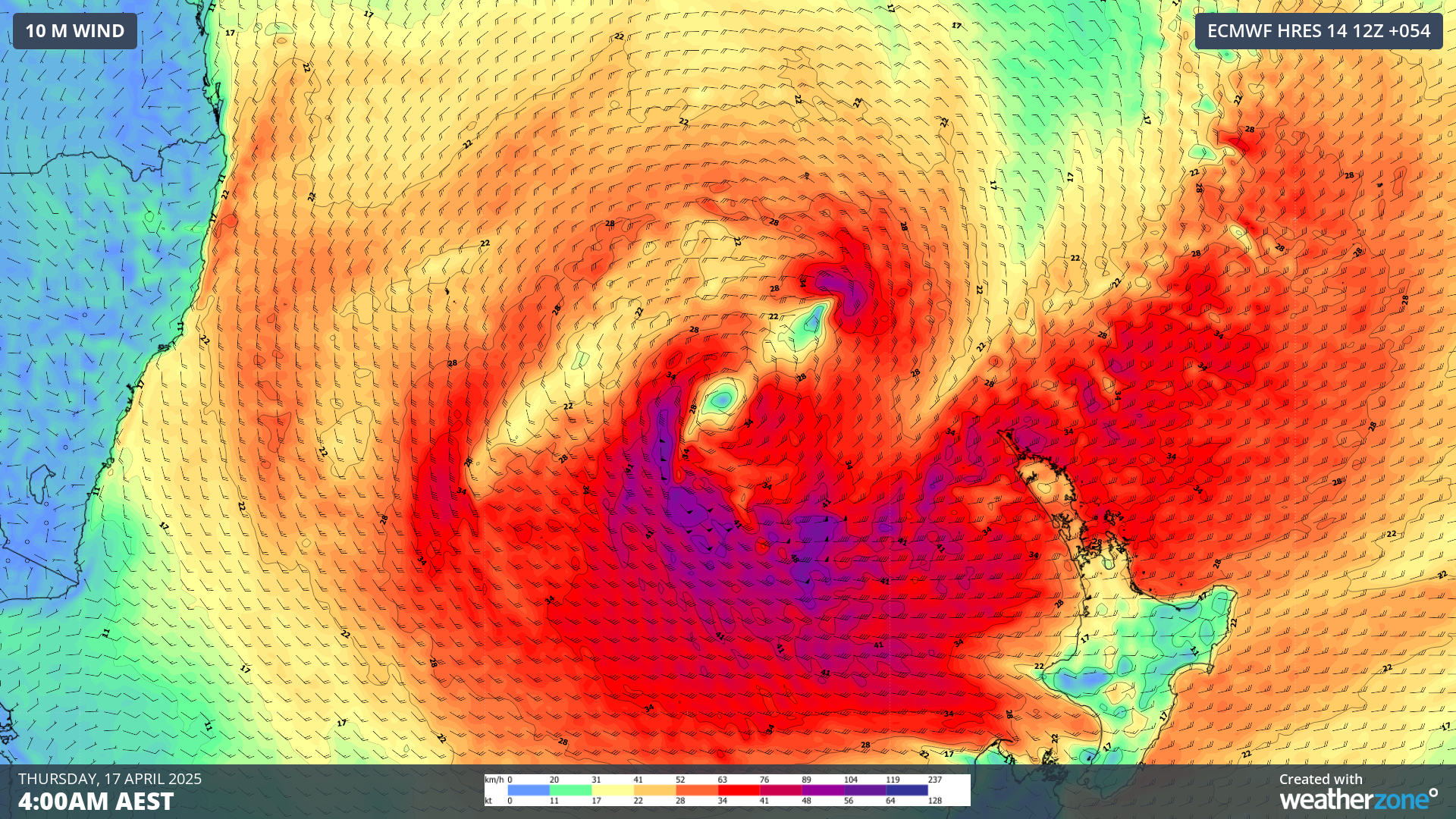
Image: Forecast winds over the Tasman Sea at 4am AEST on Thursday, April 17.
Powerful areas of gales wrapping around the south of the system on Wednesday and Thursday, as seen with the shades of purple in the image above, will whip up large and unruly seas across the Tasman. The image below shows wave heights reaching 10-12 metres to the west of New Zealand, approximately 1300 kilometres east-southeast of Sydney by Thursday afternoon.
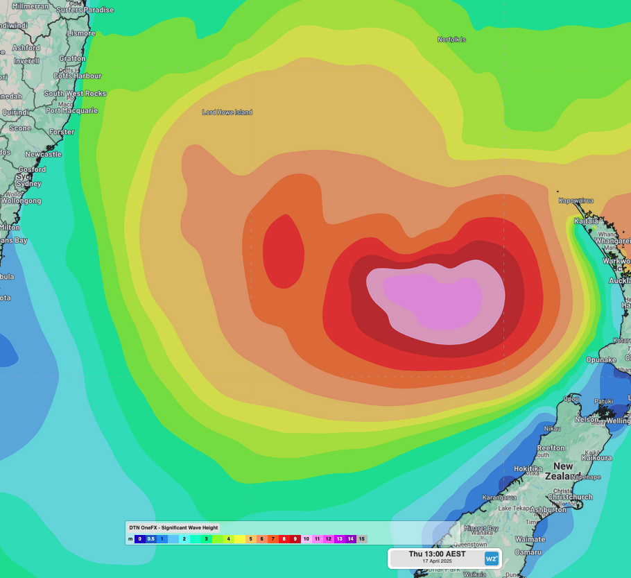
Image: OneFX significant wave heights at 1pm AEST on Thursday, April 17.
Wave heights will increase rapidly overnight into Friday, April 18, as the swell muscles into the NSW coastline. Much of Friday will feature hazardous surf conditions, with the swell expected to peak around 4 to 4.5 metres in the afternoon, with swell periods of around 14 to 15 seconds. Slightly smaller waves are expected for NSW’s South Coast, with the brunt of the swell focused on the Mid North Coast, where significant wave heights could reach 5 metres.
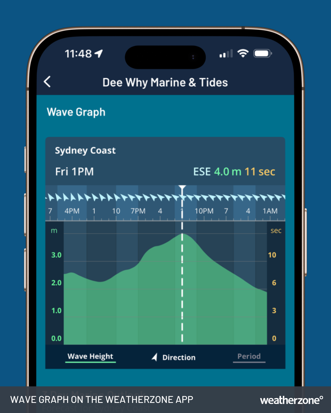
Image: Wave Graph on the Weatherzone App for Dee Why, NSW.
Waves in Sydney Harbour?
Wave heights should peak a touch below the powerful Tasman Low at the start of April, which saw wave heights of 5 to 6 metres off the coast. This swell had a swell direction from the southeast (between 130-150°), which sent some waves into northern sections of the Sydney Harbour, notably around Fairlight and Balmoral, and caused some port and ferry disruptions.
The primary direction of this coming swell is forecast to be from the east-southeast, with a direction of about 110-120°. As seen in the image below, the more easterly direction of the swell is primed to slip through the various heads into the harbours and bays of central-eastern NSW.
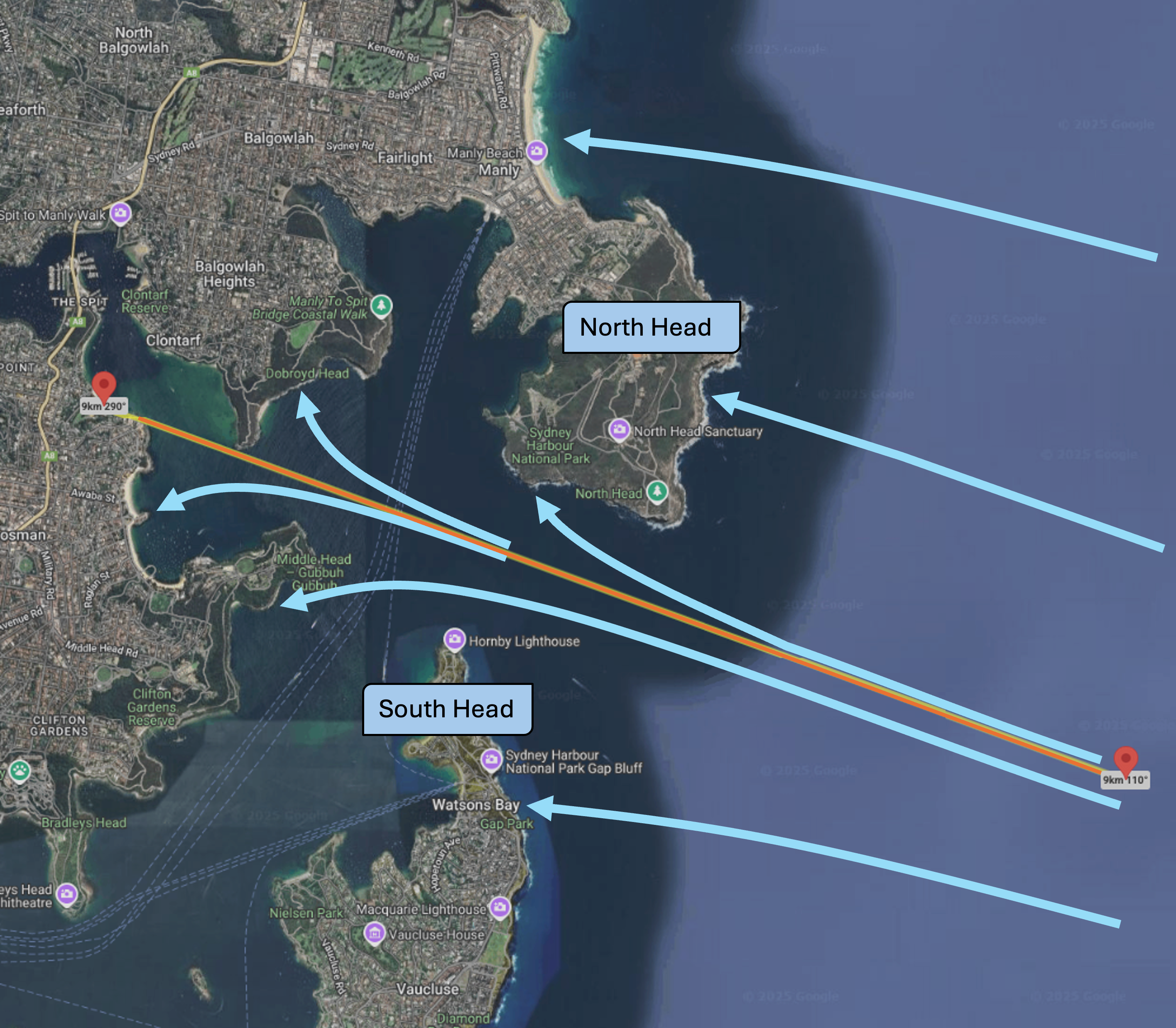
Image: An east-southeast (marked by the orange line) swell slipping between North Head and South Head into Sydney Harbour.
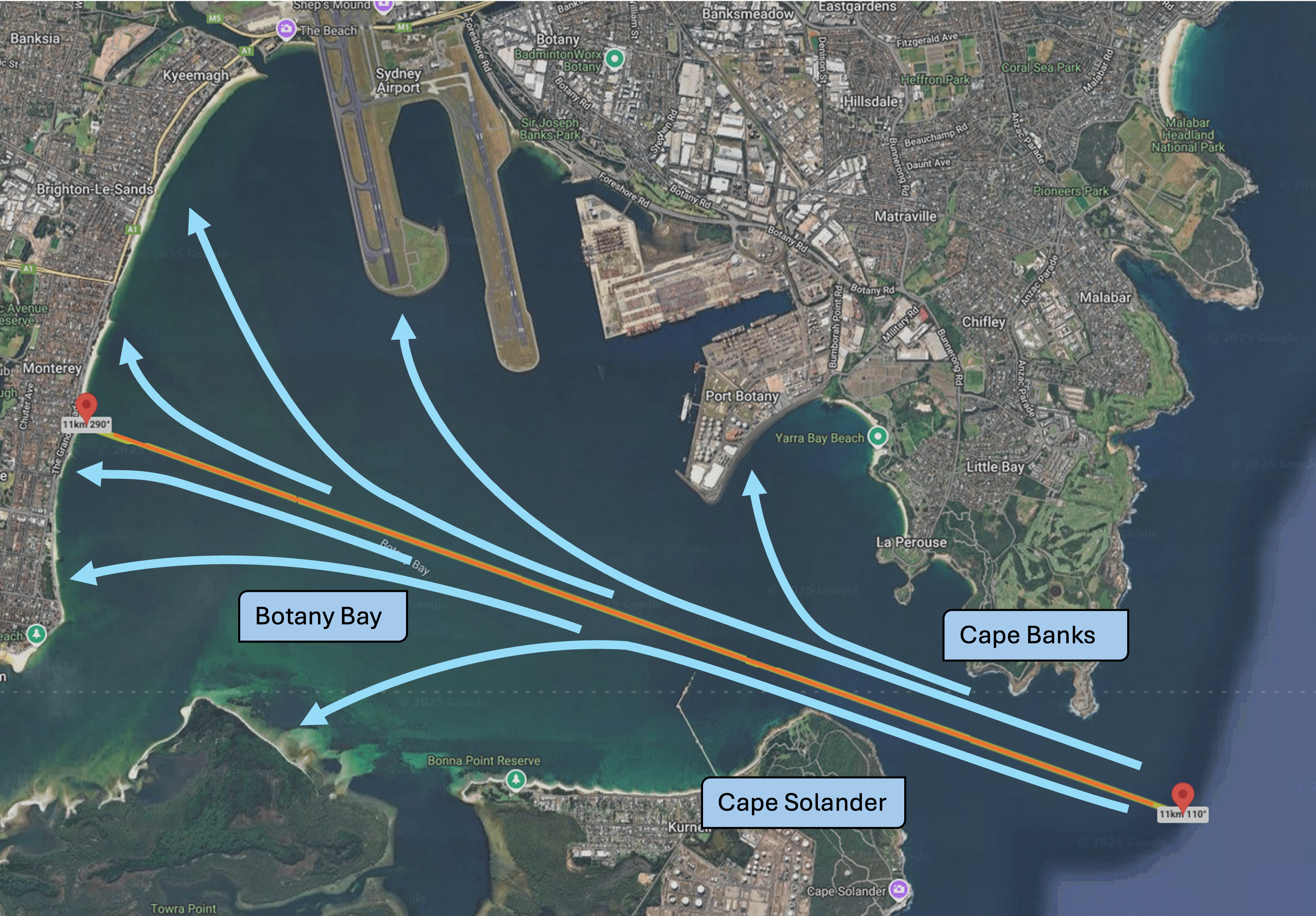
Image: An east-southeast (marked by the orange line) swell threading the needle between Cape Banks and Cape Solander into Botany Bay.
As a result, more wave energy should slip between the narrow heads protecting the harbours and bays, possibly enough to see keen wave riders catch some novelty harbour waves.
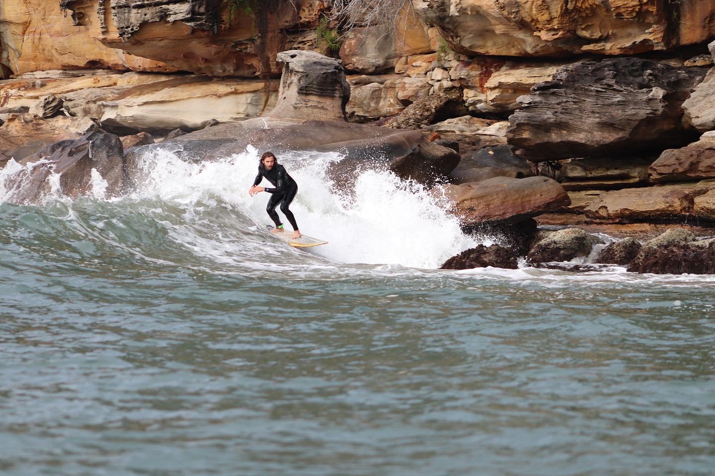
Image: Author catching a harbour wave during an East Coast Low.
With the weather expected to be clear and warm on Good Friday, it’s important to be aware of the latest weather warnings. Ocean beaches will be unruly with powerful surf and strong rips, but even usually sheltered harbour beaches could see surges of water and surprisingly large and powerful waves at times.
With a high tide forecast around 11:30am on Friday, conditions are ideal for funnelling some of this swell into sheltered bays, harbours and ports. The outgoing tide into the afternoon could lead to some increasingly large waves around the harbour mouths as the tidal current amplifies the incoming wave energy, possibly disrupting ferry and port operations.
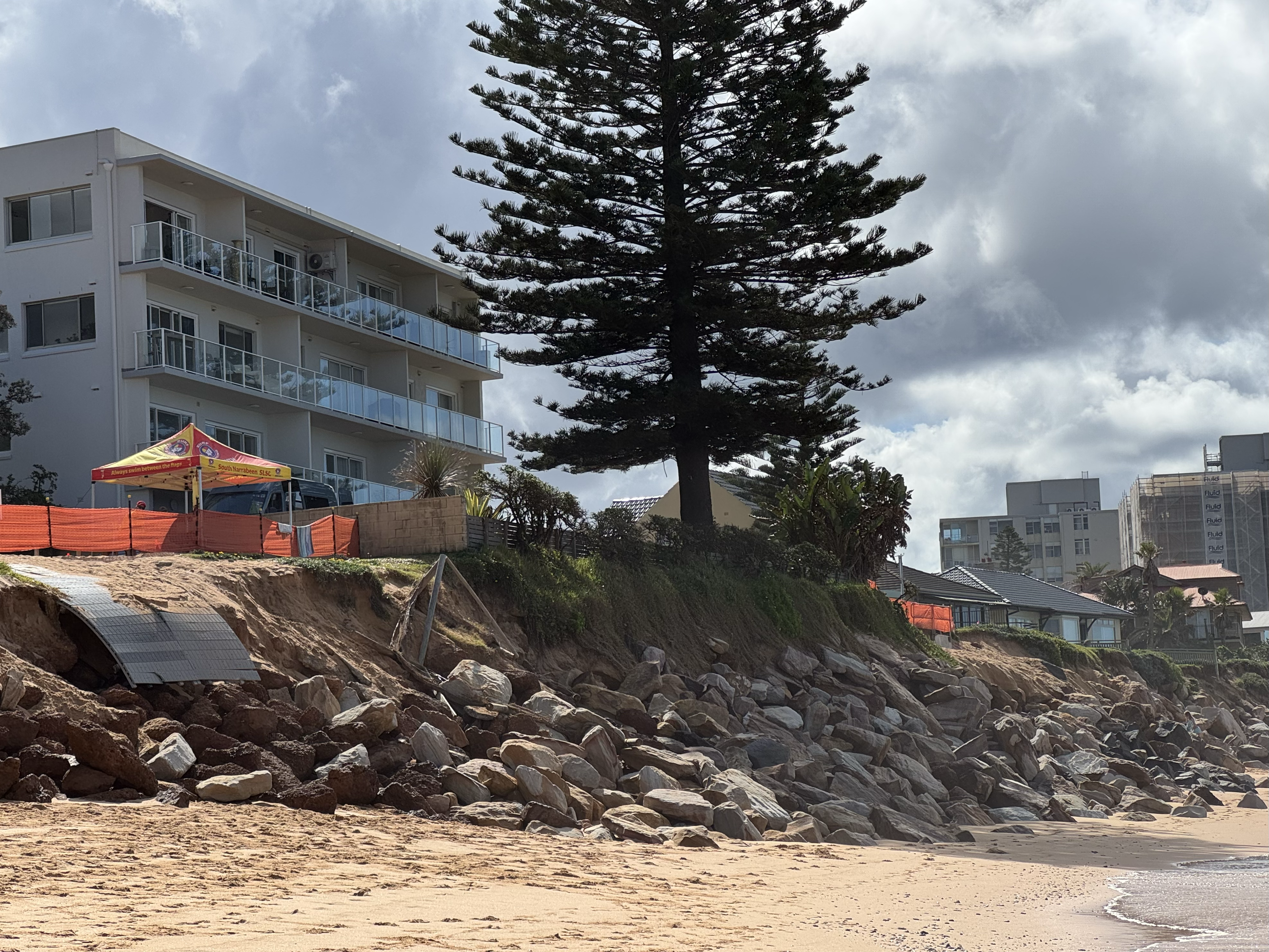
Image: Recent erosion at Narrabeen Beach, on Sydney’s Northern Beaches.
This powerful swell will also enhance coastal erosion, with beaches left in a vulnerable position by large swells generated by Tropical Cyclone Alfred and the early April Tasman Low, as seen in the image above.