
Rare sight as the whole of Queensland covered in cloud
It’s not often that virtually the entire state of Queensland is cloud-covered, but that's what the satellite image revealed on Monday afternoon as the ongoing statewide deluge continues.
As a slow-moving upper-level trough interacts with a stream of tropical moisture, cloud and rain combined to produce two main effects at ground level.
One was obviously heavy rain, with some of the heaviest 24-hour falls in years at numerous outback locations. The other effect was cool maximum temperatures, with cloud cover preventing the sun from warming the landscape.
Rainfall
Some of the rainfall totals in recent days have been massive, especially in the Channel Country of far southwest Queensland:
- Alderley Station received 201mm in the 24 hours to 9am Monday. Its annual average is around 300mm.
- The weather station at Cottonbush Creek received 142mm in the 24 hours to 9am Monday.
- Numerous locations again recorded falls in excess of 100mm to 9am this Tuesday, including Winton (Jundah Rd) with 155mm.
- There have also been consistent heavy falls in better-known spots like Birdsville, where three days of rainfall have brought the running total from this event to over 110mm.
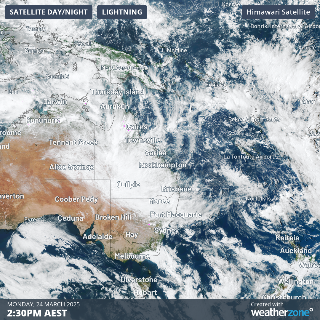
Image: Cloud cover over Queensland on the afternoon of Monday, March 24.
As Weatherzone meteorologist Ben Domensino noted on Monday, numerous towns could see their annual rainfall average exceeded during this event.
For example, Birdsville is well on its way to exceeding its annual average of just 157.3mm, while less arid towns like Charleville (in the Maranoa and Warrego forecast district: annual average rainfall 487.4mm) could also top the annual average in under a week.
This rain is also heavy enough to be felt for months to come, as floodwaters flow southwest towards the currently dry Lake Eyre in South Australia.
Temperatures
We mentioned Birdsville’s heavy rain, and to use that iconic outback outpost of 110 residents as an example again, the thick cloud cover has also hugely reduced temperatures.
- Birdsville topped 40°C on each of the first 13 days of March 2025, with a highest maximum of 45.7°C on March 2.
- This Sunday and Monday, it didn’t exceed 24°C, and the mercury is not expected to touch 30°C again until next week.
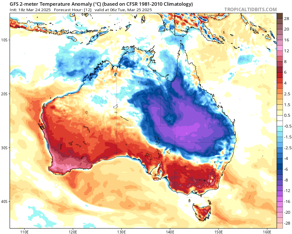
Image: Modelled Australian temperature anomalies for 4pm (AEST) Tuesday, March 25, 2025, with the lower-than-average temperatures in Qld indicated by blues and purples.
Meanwhile as this event continues, the so-called Sunshine State is anything but at the moment, with rain recorded in each of Queensland's 15 forecast districts in the 24 hours to 9am Tuesday.
We'll keep you updated with this event throughout the week, and please check the Weatherzone warnings page for the latest flood and severe weather alerts.