Rain teases South Australia again
Almost any rain is good rain in South Australia right now, even if it's not particularly heavy or long-lasting.
But recent SA rain events have also been frustrating, with a sense among locals in the state's south that every rain-bearing system of late has been a 'tease', dissipating before the landscape is properly soaked.
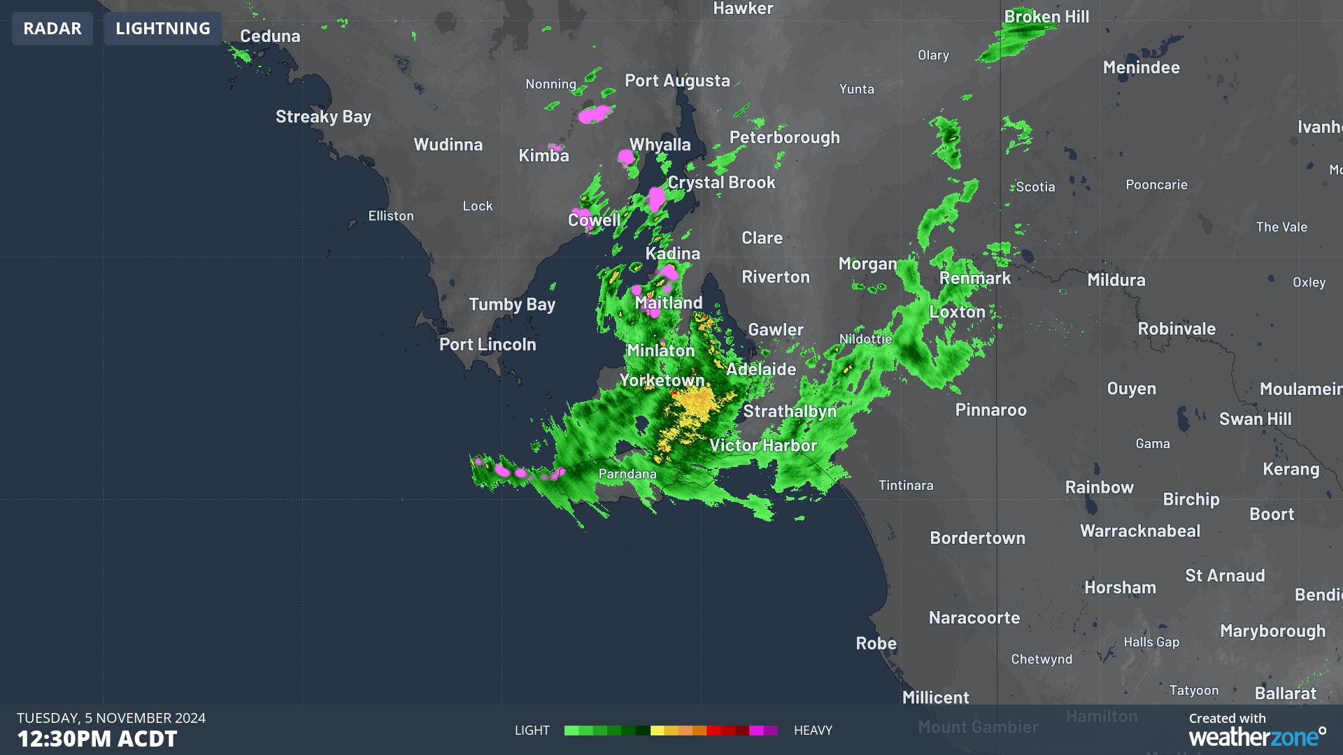
This Tuesday, a trough crossing the south of the state is once again delivering just enough moisture to generate hope but not enough to constitute what you might call a "good soaking".

Image: Rain radar near Adelaide at 12:30pm (ACDT) on Tuesday, November 5.
While the radar looks quite impressive and there has even been a brief storm or two, the system has been relatively fast-moving, with rainfall totals generally falling short of 5 mm.
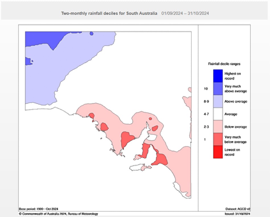
The chart below illustrates the recent rainfall deficiencies in parts of southern SA – usually the state’s wettest region.

Image: Rainfall deficiencies in SA for the first two months of spring (Sep and Oct) 2024. Source: BoM.
As the chart above shows, some of the most severe recent rainfall deficiencies have been in the Eyre Peninsula (the large triangular peninsula), the Yorke Peninsula (the narrower peninsula to its east which is shaped a little like a boot) and in the Adelaide area.
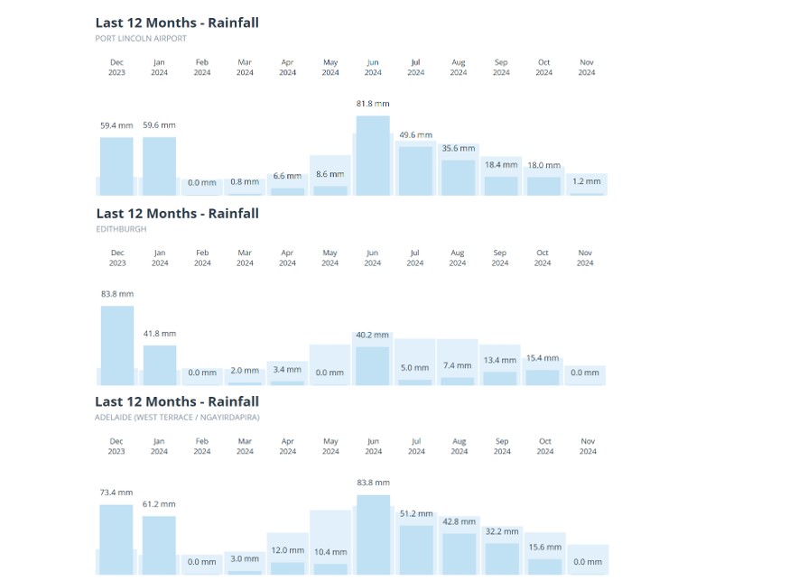
The rainfall graphs below show the most recent 12-month period for Port Lincoln on the Eyre Peninsula, Edithburg on the Yorke Peninsula, and for Adelaide (in that order).

Image: South Australians need to see more dark blue on these graphs.
- As you can see, all three locations have had below-average rainfall in virtually every month over the last year.
- And since June, all three locations have seen below-average rainfall in every month.
As Weatherzone’s Ben Domensino reported last week, the dry spell is already biting where it hurts most.
The latest crop and pasture report issued by SA's Department of Primary Industries and Regions predicts that the state's grain production in 2024/25 will be 35% below average and the lowest in six years.
Meanwhile Adelaide's rainfall total of 248 mm between April 1 and October 30 (typically the wettest time of year) was its 6th-lowest total on record for the period.
Some of the abnormally dry areas in SA and Victoria were also highlighted in Australia's latest seasonal bushfire outlook for their increased fire risk heading into summer.
The week ahead offers no signs of significant rainfall for any part of South Australia.