
Rain, storms and snow about to spread over Australia
Rain and thunderstorms will spread across Australia during the next five days, with a decent bout of late-season snow also on the cards for several states.
A low pressure system that’s currently sitting over northern WA will drift towards the south over the next few days, dragging a large mass of tropical moisture across Australia.
As this low and the associated moisture head south, they will interact with a strong cold front and cause rain and thunderstorms to spread across a large swathe of the country.
The animation below shows this stream moisture-laden air spreading across Australia between now and Tuesday next week.
Video: Precipitable water according to the ECMWF-HRES model.
Showers and thunderstorms will initially start to build over parts of WA, the NT and SA on Friday and Saturday. A broad area of rain and storms will then spread over the eastern half of Australia between Sunday and Tuesday, accompanied by strong and potentially damaging winds in some areas.
The maps below show one computer model’s prediction for how this multi-day spell of rain and storms will play out.
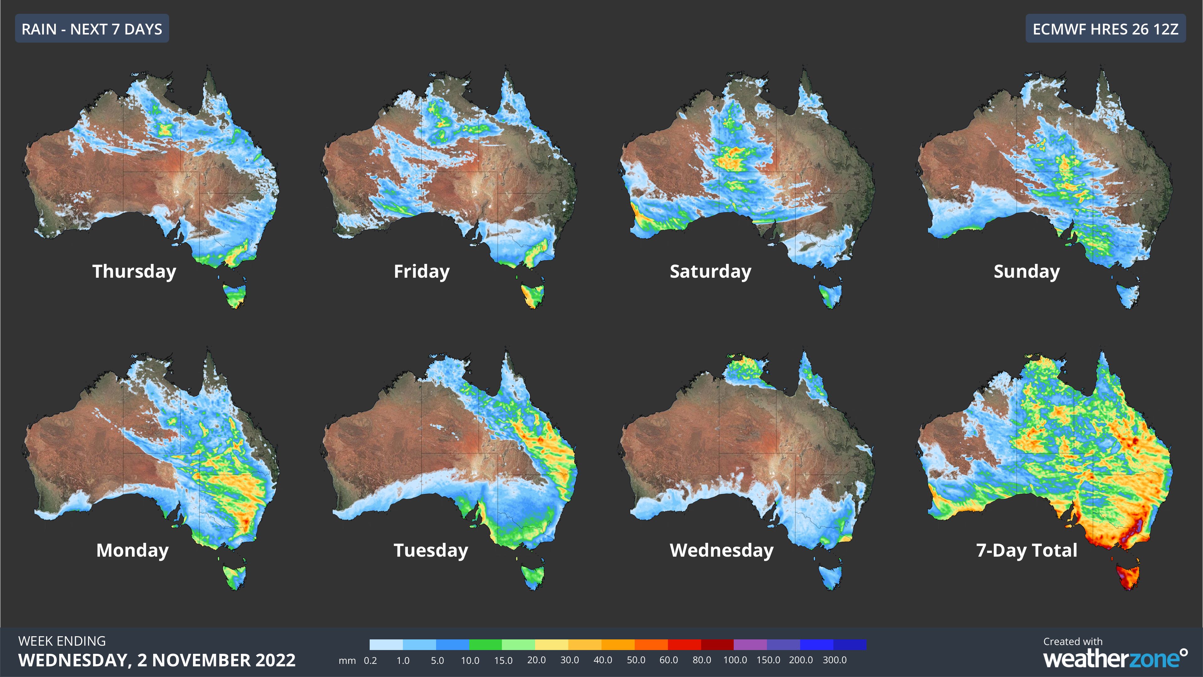
Image: Daily forecast accumulated rain during the next seven days according to the ECMWF-HRES model.
It is important to note than while rain and storms are likely to affect a broad area of the country during the coming week, there is some uncertainty regarding exactly where and how much rain will fall. The three maps below show the predicted accumulated rainfall during the next seven days from three different computer models.
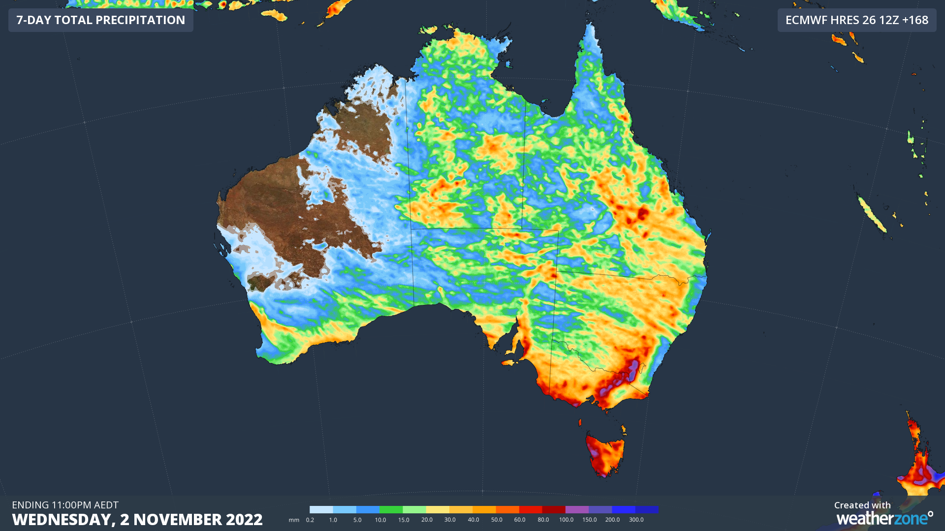
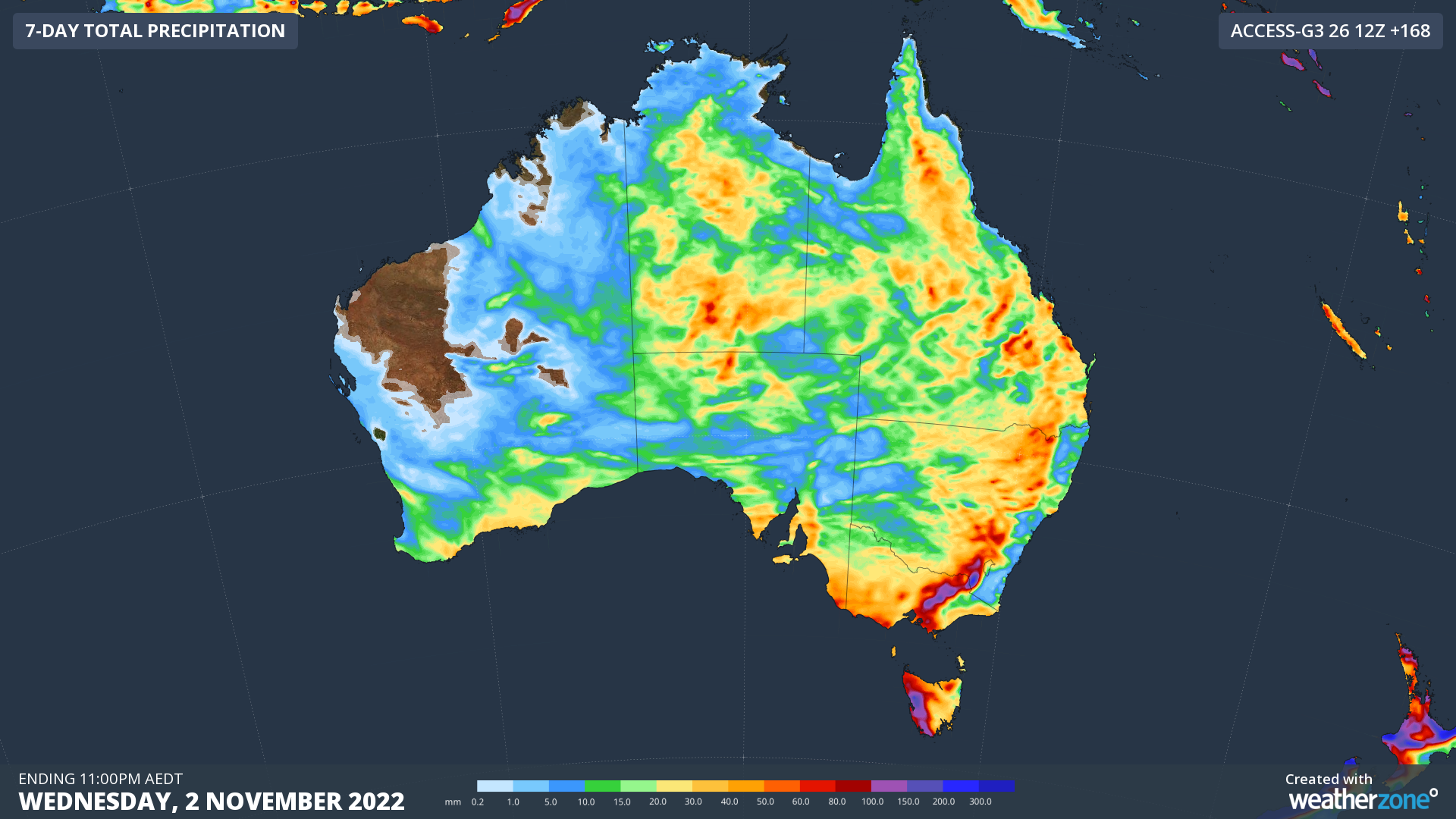
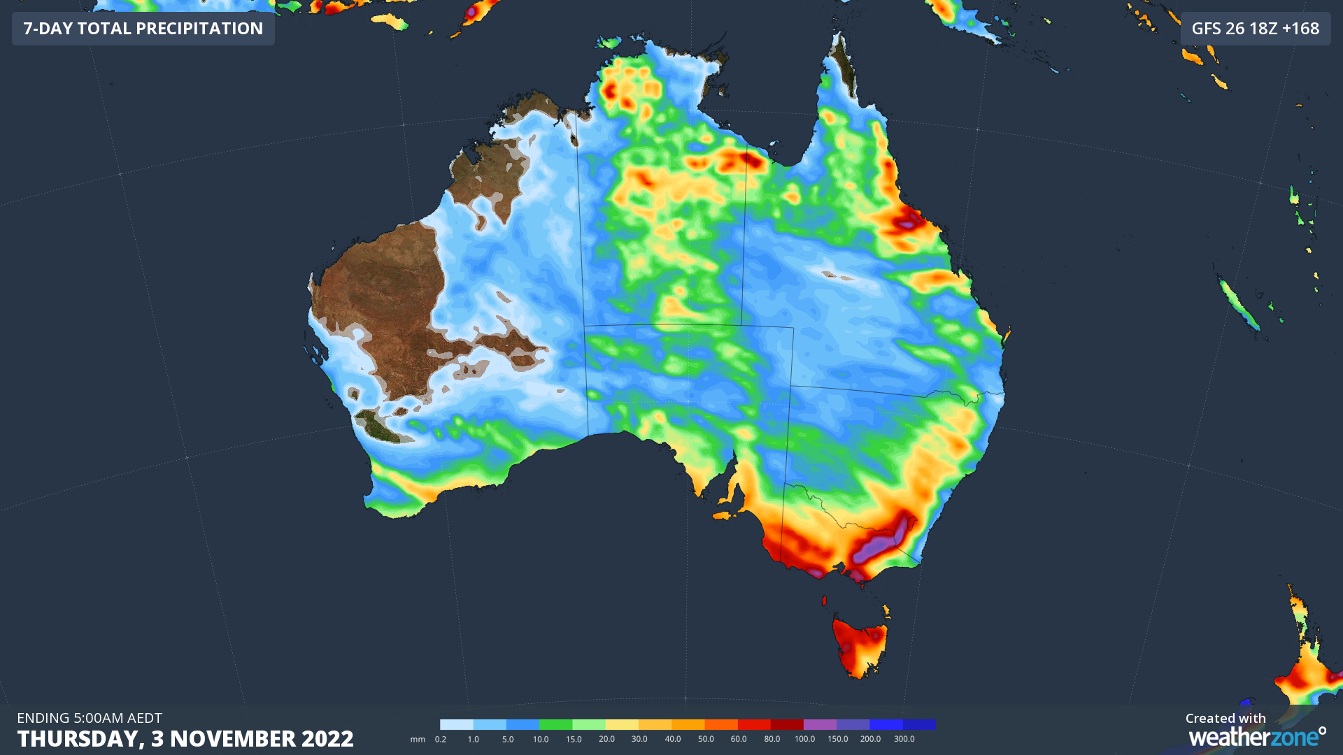
Images: Forecast accumulated rain during the seven days ending at 11pm AEDT on Wednesday, November 2 (top two maps) and 5am AEDT on Thursday, November 3 (bottom map).
Interestingly, some of the precipitation that’s about to fall over Australia will reach the ground as snow, despite being one month away from the beginning of summer.
A mass of frigid air spreading over southeastern Australia in the wake of a front should cause snow to settle in Tas, Vic and NSW between Monday and Thursday next week. Some areas could see around half a metre of fresh snow across these four days.