
Rain on the way for eastern Australia
Rain will spread over parts of Queensland and NSW during the next two days, before a Tasman Low causes a burst of strong wind and large waves along the NSW this weekend.
A low pressure trough interacting with moisture-laden air will cause rain and a few thunderstorms to spread over a broad area of eastern Australia between Thursday afternoon and Friday afternoon.
This rain will affect areas from central Queensland down to southern NSW, with widespread falls of about 5-20mm and isolated totals over 30mm likely. The heaviest rain should occur over southern inland Queensland and in northern and central NSW.
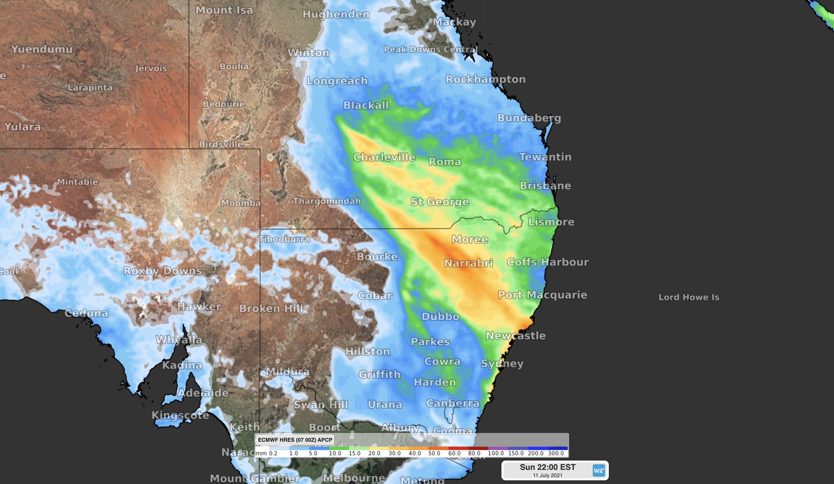
Image: Forecast accumulated rain between Thursday and Sunday, according to the ECMWF model.
Following this inland rain, the trough will move off Australia's east coast on Friday and cause a low pressure system to develop over the Tasman Sea.
As this low deepens over the Tasman, blustery winds and showers will sweep up the NSW coast on Saturday and Sunday, accompanied by a surge of large surf.
This system has the potential to cause severe weather, so be sure to check the latest warnings in your area.