
Rain arrives in Melbourne as Victoria braces for flooding
Persistent and heavy rain will soak parts of Victoria during the next 48 hours, with flash and riverine flood warnings now in force across large areas of the state.
The sequence of satellite images below shows a well-defined and near-stationary low pressure system spinning over the Great Australian Bight on Wednesday morning. To the north and east of this low, you can see a large band of cloud being dragged across southeastern Australia.
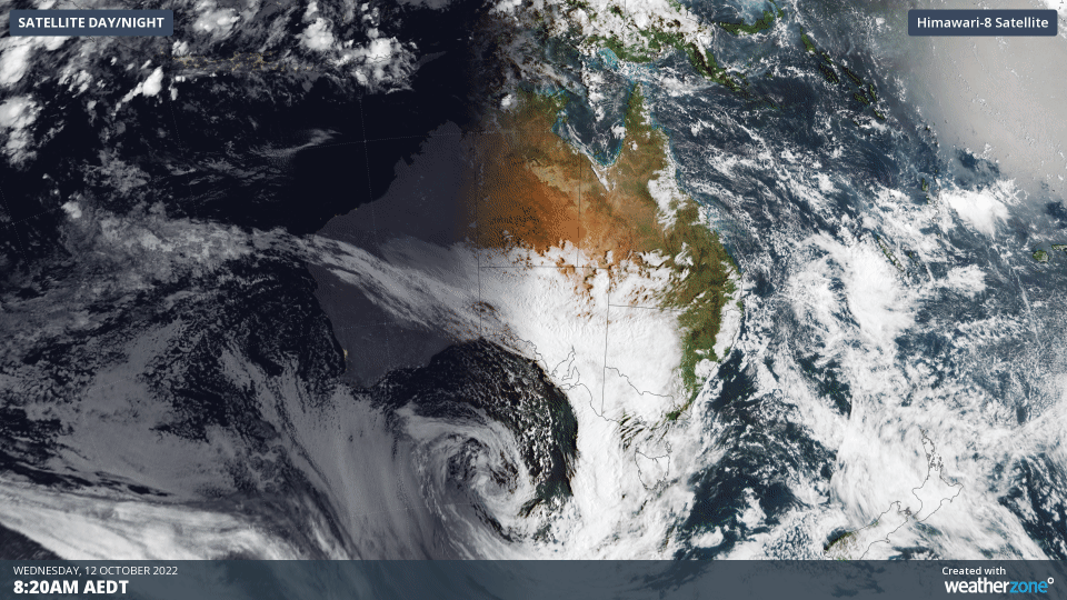
The weather pattern shown above is causing huge amounts of tropical moisture to flow over Victoria. This moisture will fuel a period of heavy rain between now and Friday morning.
Showers have already started to increase over some central and western parts of the state on Wednesday morning, with Melbourne picking up 8 mm by midday. However, this is just a taste of what’s to come over the next 24 to 48 hours.
Moisture and wind will continue to build over Victoria on Wednesday afternoon and night, with rain increasing as a cold front moves over the state’s western districts.
This cold front and abundant atmospheric moisture will spread further east on Thursday, allowing rain and wind to intensify further, especially over central, northern and northeastern parts of the state.
The heaviest rain will contract to northeast Victoria on Thursday night before clearing on Friday morning. While there will still be a few lingering showers and isolated thunderstorms over the state into Friday afternoon, the main rainband is expected to push out into the Tasman Sea before midday Friday.
This system could deliver around 100 to 200 mm of rain to parts of central and northeast Victoria, which is likely to cause flooding, especially in areas that have seen recent rainfall and have already wet catchments.
Heavy rain will also soak parts of Tasmania and southern NSW during the next 48 hours, likely causing or exacerbating existing flooding in both states.
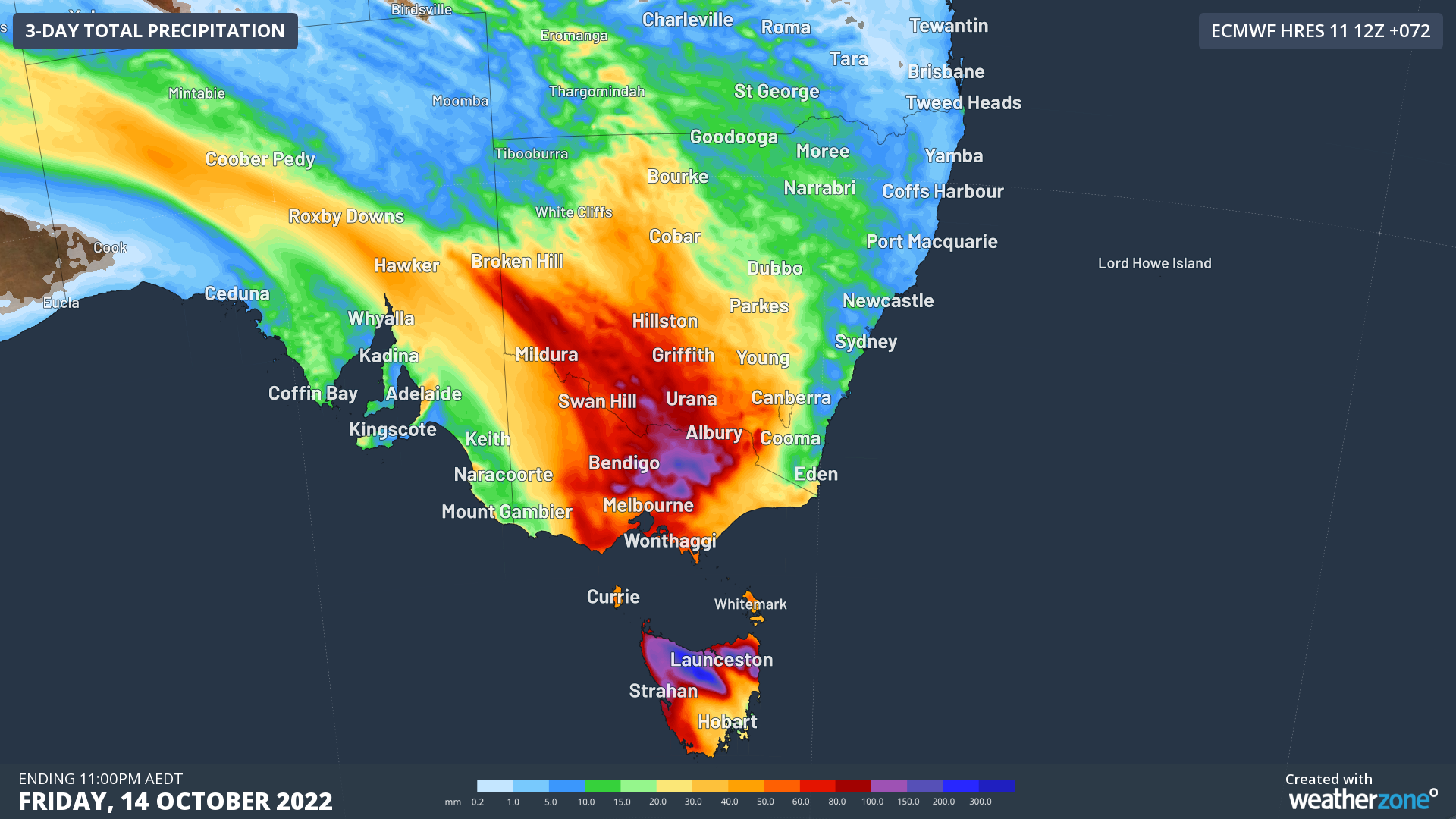
Image: Forecast accumulated rainfall between Wednesday and Friday, according to the ECMWF-HRES model.
While rain-bearing cold fronts like this are a common feature in southeastern Australia at this time of year, the slow-moving nature of this system, combined with its abundant moisture feed, will cause unusually heavy and prolonged rainfall.
As of midday on Wednesday, a severe weather warning was in place for heavy rain, flash flooding and damaging north to northeasterly winds over a large part of Victoria. A flood watch was also in effect for Northern and parts of Southern Victoria, which stated that:
- Major flooding is likely across a number of northern Victorian catchments
- Isolated major flooding is likely in the southwest
- Widespread minor to moderate flooding is expected across northern and parts of western Victoria
- Isolated minor flooding is possible in parts of Gippsland
Severe weather warnings, flood warnings and flood watches are also in place for parts of NSW and Tasmania. Check the latest warnings for the most up-to-date information on this evolving weather event.