Rain and wind spreading across Australia
A large low pressure system and several cold fronts will cause rain and blustery winds to spread across the southern half of Australia this week.
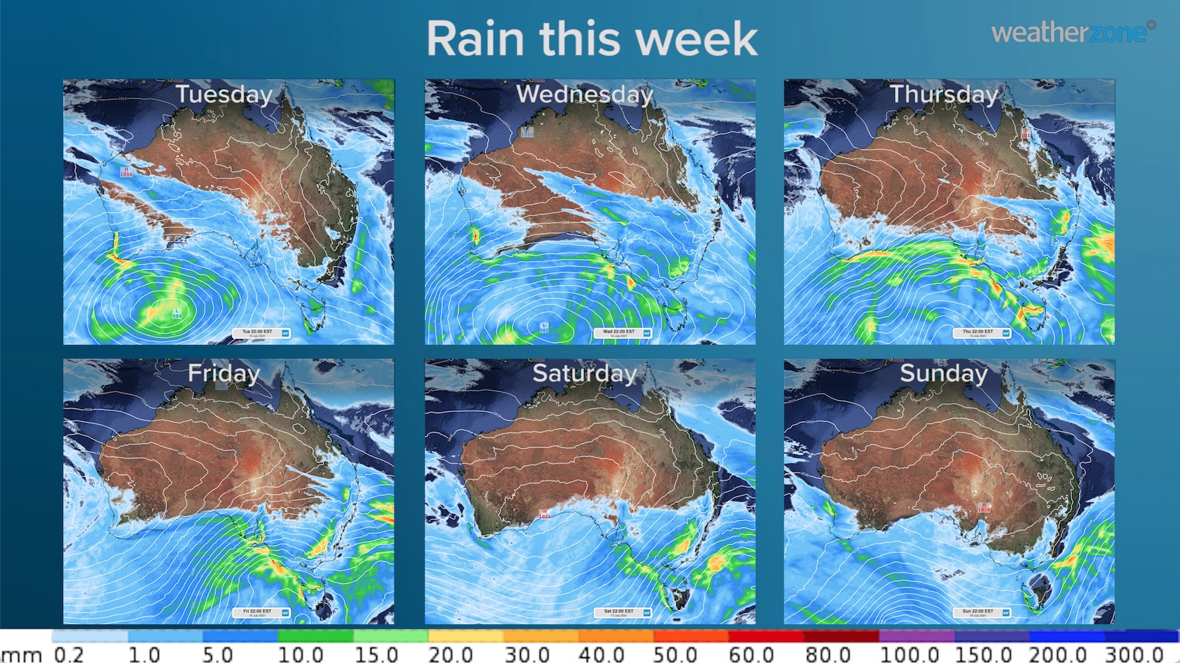
The image below shows how much rain is predicted by one computer model on each day between Tuesday and Sunday.

The images also show isobars, which are lines that connect areas of equal atmospheric pressure. These isobars show us where the low pressure system will be located at 10pm AEST each day.
But isobars also reveal where it's going to be windy. When the white isobars are packed closely together, there is a stronger pressure gradient in that area, resulting in stronger winds. As the low moves from southern WA, across the Great Australian Bight, and passes to the south of Tasmania, it's going to send a surge of moderate-to-strong winds across the southern half of the country.
The video below shows an animation of how this wind will impact each state and territory as the week unfolds.
We have already seen severe weather in WA from this system and warnings are likely to be issues in other parts of southern Australia as the week unfolds.
Be sure to check the latest forecasts and warnings in your area.