Rain and storms to impact southeastern states
The recent spring-like weather in Australia's southeastern states is set to end abruptly, as a band of fierce winds, rain and severe thunderstorms spread across the region in the coming days.
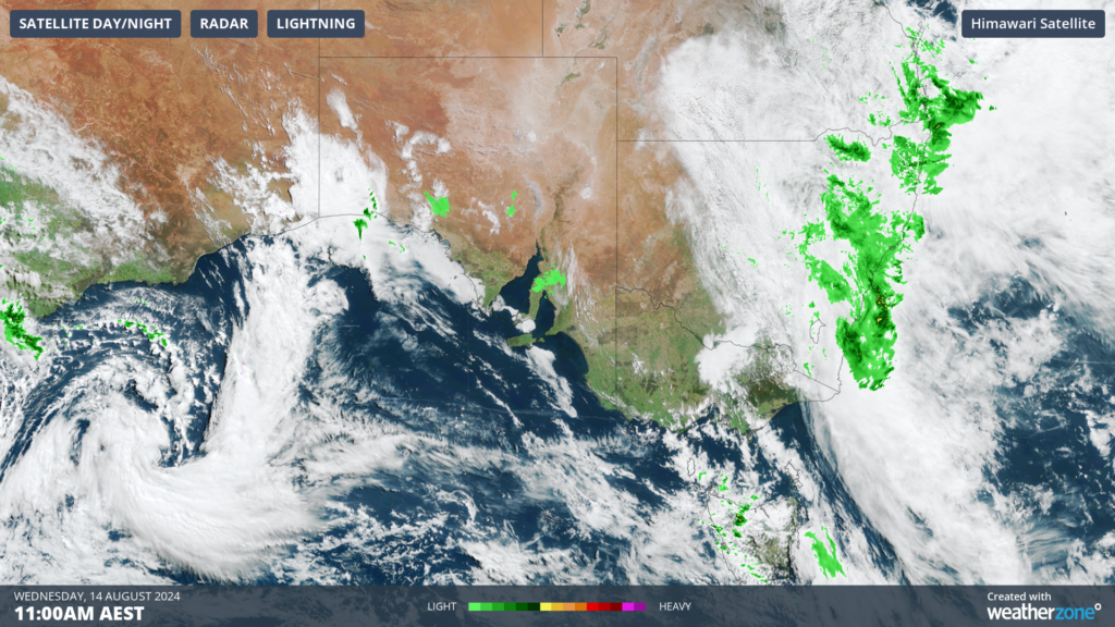
The satellite image below shows a low pressure system and associated front to the south of WA approaching SA rapidly from the west on Wednesday morning.

Image: Himawari-9 satellite image at 11am AEST on Wednesday, August 14
You can see in the image above that much of SA is experiencing a sunny day ahead of this low pressure system.
The southern states have experienced warm and mild weather since Sunday, with Adelaide set to see a run of five days over 20°C between Sunday and Thursday.
This beautiful run of weather will end abruptly Thursday night with the passage of the front, with temperatures dropping to the mid teens on Friday in Adelaide and Saturday in Melbourne.
The low will also bring the potential for rain and thunderstorms, which will begin in SA from Thursday afternoon and spread towards the southeast into Vic, NSW and the ACT on Friday and Saturday.
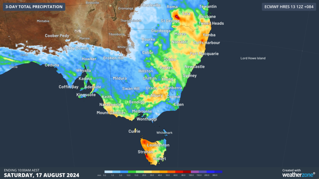
The image below shows that widespread falls of 20 to 40 mm are forecast in the next three days across southeastern SA, parts of Vic and NSW, while western Tas could see 40 to 60 mm.

Image: Accumulated rain forecast for the next 3 days leading up to 10am Saturday, August 17.
Severe thunderstorms are possible in SA from Thursday afternoon and NSW, the ACT and Vic on Friday. The most likely phenomenon is damaging winds in these storms and small hail. In NSW on Friday there is potential for a squall line to form which could generate damaging winds across parts of the state.
This system will also elevate wind power in the southeast between Thursday and Saturday.
Looking ahead, the wind, storms and rain should clear later on the weekend, before another strong cold front approaches Australia’s southeast mid next week.