
Queensland deluge rarer than one in 2000-year event
A staggering amount of rain has inundated parts of Queensland’s northeast coast over the past week, with some places picking up more than 1.7 metres of rain during what has become an historic event for the region.
A relentless feed of moisture-laden winds converging over Qld’s North Tropical Coast region has produce a prolonged period of exceptionally heavy rain over the past week. This rain was enhanced by a slow-moving low pressure system and active monsoon trough, which caused a weather pattern that drew in vast amount of tropical atmospheric moisture and focussed it over a relatively small area of northern Qld.
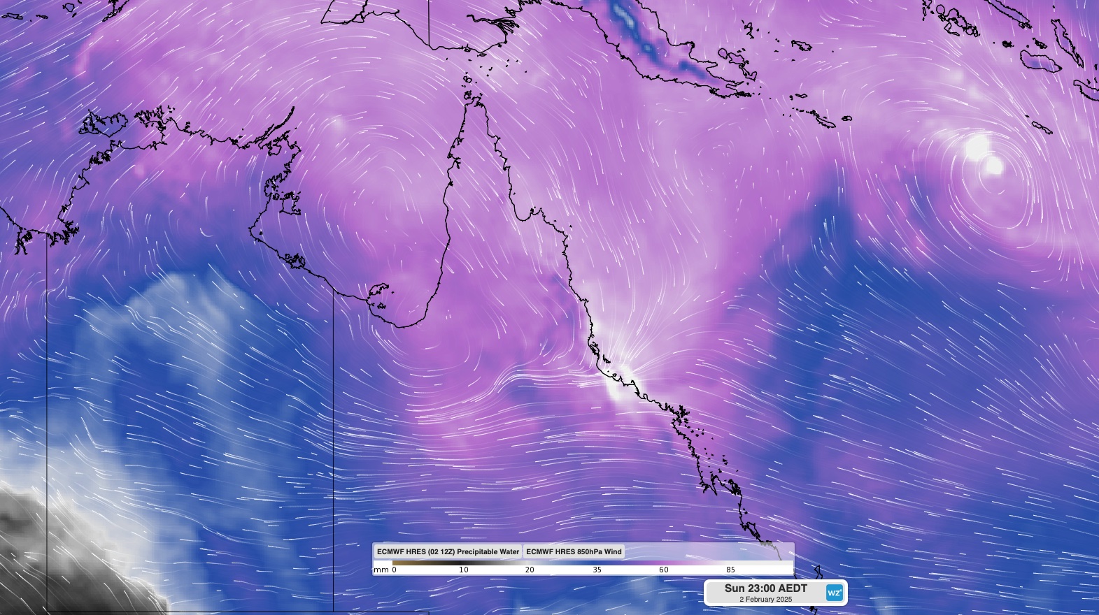
Image: Modelled precipitable water (atmospheric moisture) and 850 hPa winds, showing easterly and northerly winds converging over Qld’s northern tropical coast on Sunday night.
The torrential rain caused by this setup saw some rain gauges between Townsville and Cairns receive close to 1.5 metres of rain in the last 72 hours and almost 1.8 metres in the last eight days. For some places, this has been their wettest few days on record and has resulted in major riverine flooding.
A rain gauge at Cardwell Marine Parade collected 1000mm of rain in the 72 hours ending at 9am AEST on Monday, February 3. This was the site’s heaviest three-day rainfall on record, with data available back to 1871.
Another rain gauge located near Rollingstone, to the northwest of Townsville, received just over 1,760 mm of rain during the 8 days ending at 9am AEST on Monday. This included 1,475 mm in the last 72 hours of this period and 1,178 mm in the last 48 hours.
While Queensland’s North Tropical Coast frequently gets hit with periods of heavy rain during the wet season, the sustained intensity of this event has been both remarkable and devastating.
Based on annual exceedance probability (AEP), Rollingstone’s 48-hour and 72-hour rainfall rates were both rarer than a one in 2000-year event. Put another way, this much rain over these timeframes has less than a 0.05 % likelihood of occurring in any given year.
This immense rainfall caused destructive floods that covered roads and destroyed bridges. A section of a Bruce Highway bridge was washed away during a particularly heavy burst of rain to the north of Townsville on Sunday, cutting an important supply route for communities in the region.
Unfortunately, more rain will fall over already flooded areas of northeast Qld in the coming days under the sustained influence of the monsoon trough and associated low pressure system. Rain will also become more widespread across northern and northwestern Qld this week, along with other areas of northern Australia.
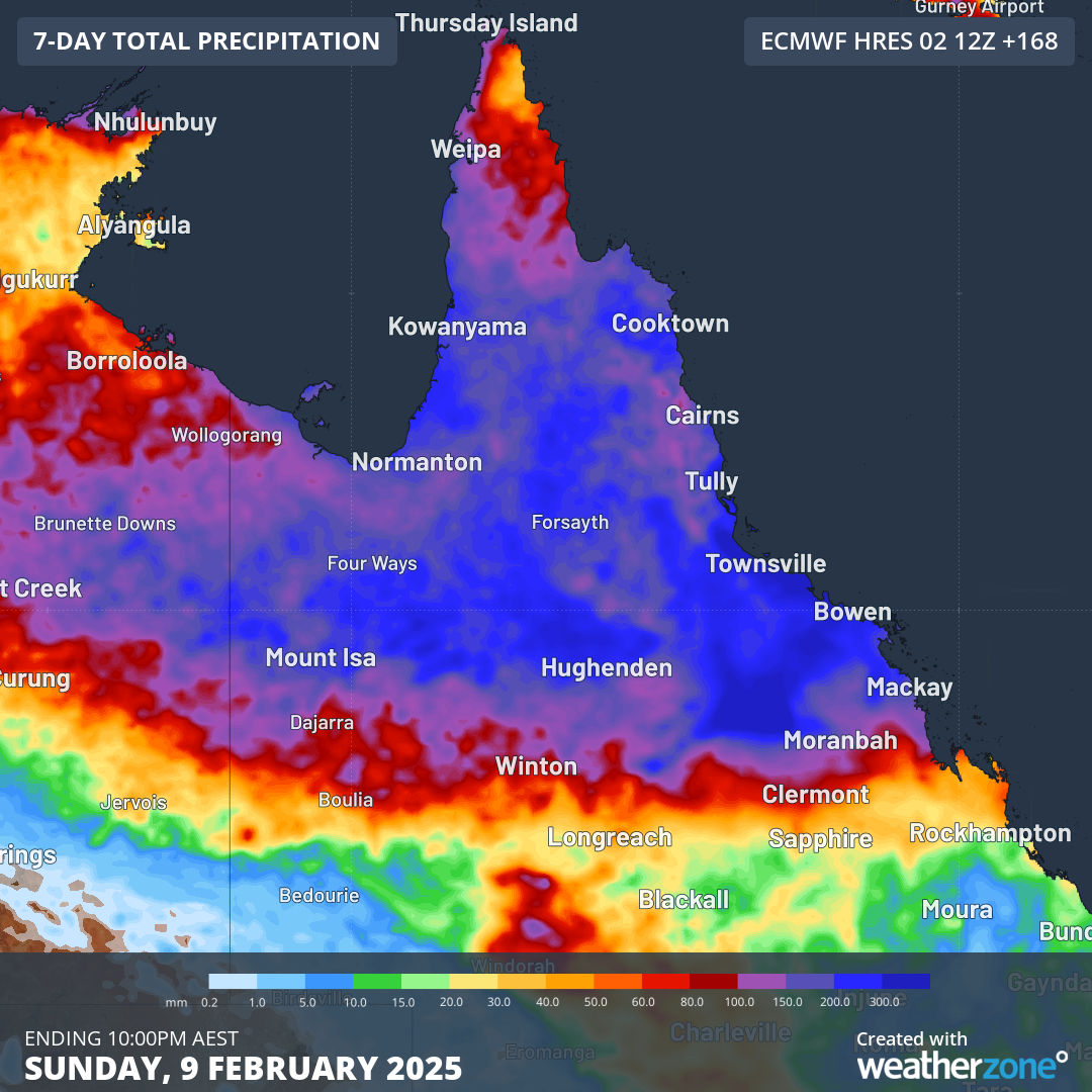
Image: Forecast accumulated rain during the seven days ending on Sunday, February 9. 2025, according to the ECMWF-HRES model.
Despite the record-breaking rainfall of the last few days, this event is not over yet. Be sure to check the latest flood watches, flood warnings and severe weather warnings for the most up-to-date information in the coming days.