
Queensland deluge continues but drier weather is on the way
Queensland’s flood-weary northeast tropical coast is copping more heavy rain today, but drier weather is finally on the horizon from the middle of this week.
Parts of northeast Qld have seen frequent bouts of heavy rain over the past two weeks as an active monsoon trough caused persistent rain and thunderstorms over the state’s northeast tropical coast.
Some of the rainfall totals that have accumulated over the past couple of weeks have been staggering. A rain gauge at Cardwell received 2.5 metres of rain during the two-week period ending on February 9.
Another gauge at Rollingstone copped 1.4 metres of rain in the three days ending at 9am on February 3. This much rain over a 72-hour period is rarer than a 1 in 10,000 year event for Rollingstone, which means it has less than a 0.01% likelihood of occurring each year.
Even the last couple of days have been remarkably wet in some areas, with another 100 to 200mm falling near and to the north of Townsville during the 24 hours to 9am on Tuesday, including:
- 202 mm at Pace Road, Rollingstone
- 143 mm at Paluma
- 107 mm at South Townsville Alert
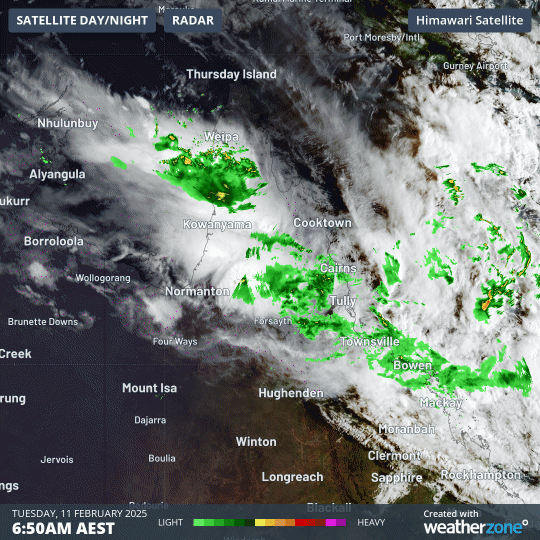
Image: Cloud and rain continuing over northern Qld on Tuesday morning.
Further heavy rain is expected to fall over parts of northern Qld on Tuesday into Wednesday morning. This new rainfall, combined with water that is still trapped in the landscape from the past couple of weeks, is likely to cause further flooding in some areas.
As of 10am AEST on Tuesday, a severe weather warning was in place for heavy rain in parts of the Herbert and Lower Burdekin, North Tropical Coast and Tablelands, Northern Goldfields and Upper Flinders and Central Coast and Whitsundays districts. This warning area includes Townsville, Rollingstone, Tully, Hamilton Island/Proserpine and Georgetown.
Numerous moderate to major flood warnings are also in place across northern Qld in response to the ongoing rainfall that has plagued the region since late last month.
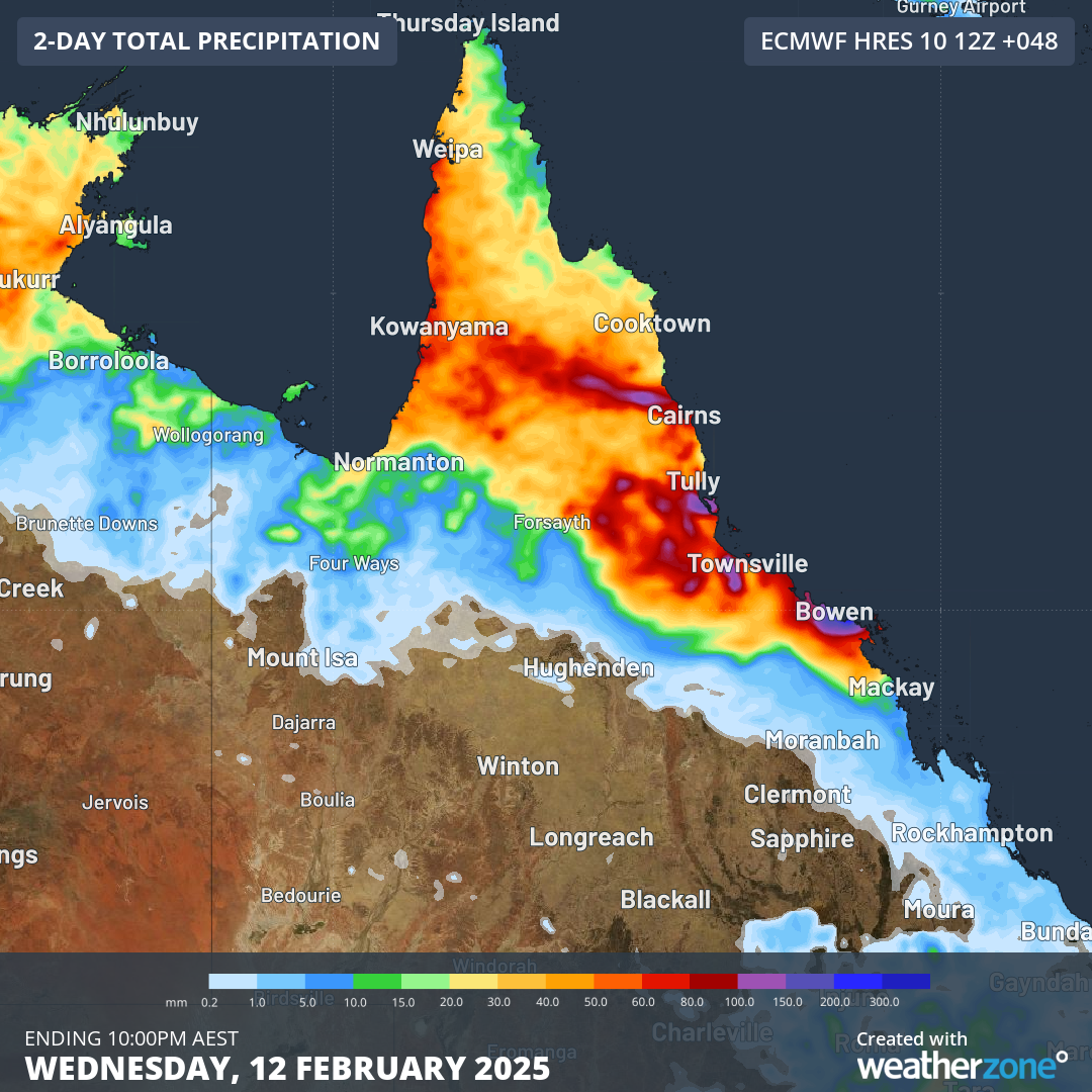
Image: Forecast accumulated rain during the 48 hours ending at 10pm AEST on Wednesday.
Fortunately, the relentless weather pattern than has caused persistent rain over northeast Qld in recent weeks is finally about to break.
Forecast models predict that the monsoon trough will retreat further north from Wednesday, allowing rain to ease substantially over the state’s sodden northeast tropical coast. While showers and thunderstorms are still likely to occur at times through the second half of this week, we won’t see the persistent and heavy monsoonal rainfall that has plagued the region in recent weeks.
Despite the easing rainfall, flooding will be ongoing during the remainder of this week and with the landscape extremely wet, it will be very sensitive to any additional rainfall. Be sure to check the latest flood warnings and road closures if you are in northern Qld this week.