
Qld warmth and a 2500km gravity wave
Queenslanders are experiencing a virtual spring in August, as parts of the east and southeast saw the warmest winter temperatures so far this season.
A high pressure system and a deep westerly airflow allowed temperatures to inch into the low 30s in some parts of the state. On Saturday:
- Brisbane got to 29.5ºC, their highest temperature since March 2024, and highest for August since 2018.
- Mackay got to 28.4ºC, their highest temperature since April 2024, and the highest for August since 2018.
- Coolangatta got to 28.4ºC, their highest temperature since April 2024, and highest for August since 2009.
- Archerfield got to 30.5ºC, their highest temperature since April 2024, and the highest for August since 2017.
But that's not the end of the excitement. After the sun rose over the sunshine state this morning, a long atmospheric gravity wave, revealed by a roll cloud spanning about 2500km from the Whitsundays to far northwest New Zealand, began propagating east in between two cloudbands.
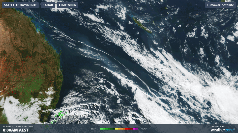
Image: Himawari satellite imagery loop in the three hours to 11am on Sunday August 18th.
This gravity wave was likely triggered by severe thunderstorm disturbances in the western cloudband (east of Lord Howe Island), before aligning with the cold front. The roll cloud formed in a small unstable layer along the cold front and gravity wave at about 2km elevation.
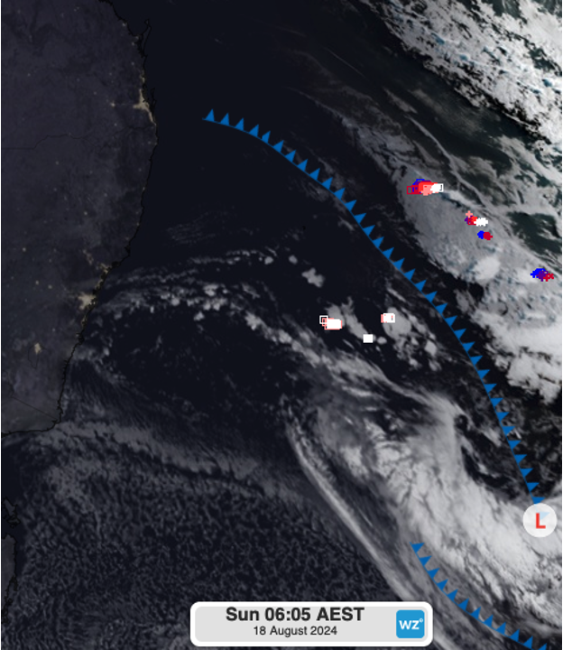
Image: Satellite imagery showing the cold front and lightning strikes behind the forming gravity wave clouds using DTN autofronts just after 6am AEST Sunday.
Looking ahead, southeast Queensland can expect a much milder run of days as a trough moves up the New South Wales coast, bringing about some showers, particularly this Tuesday.