Qld, NSW to cop a soaking
Heavy and persistent rainfall is set to impact parts of eastern Qld and northeast NSW from early to mid-next week, as moisture laden easterly winds stream onto the coast.
The moist easterly winds will extend up to around 2.5km above the surface, transporting a deep layer of moisture into NSW and Qld. Within this deep easterly flow, a low pressure trough has already in the Coral Sea and will move closer to the southeast Qld coast early next week, triggering heavy rainfall in the region.
The satellite image below shows cloud and showers moving onshore the Qld and northeast NSW coastline on Friday morning.
Image: Himawari-9 satellite image at 7am AEST on Friday, August 9.
While showers are expected in the coming days, the heaviest rain is expected between Sunday, August 11 and Thursday August 15.
Widespread falls of 60 to 80mm are forecast on and east of the Great Divide between Cairns and Port Macquarie, with the potential for 100 to 250 mm of rain to fall in this four-day period.
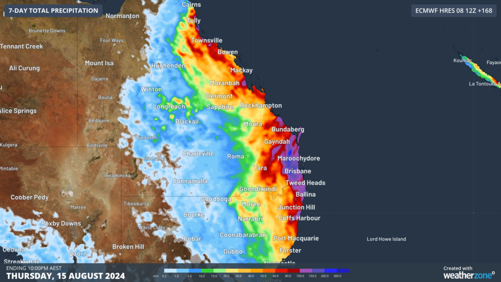
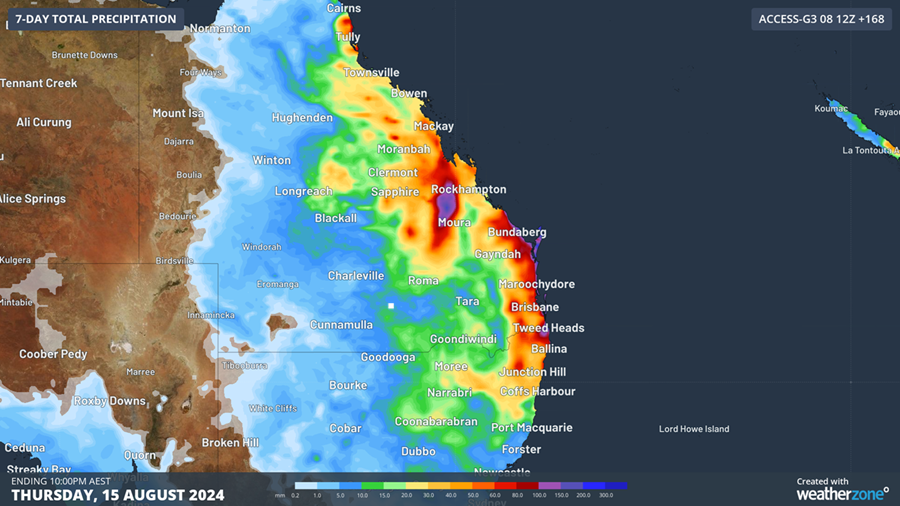
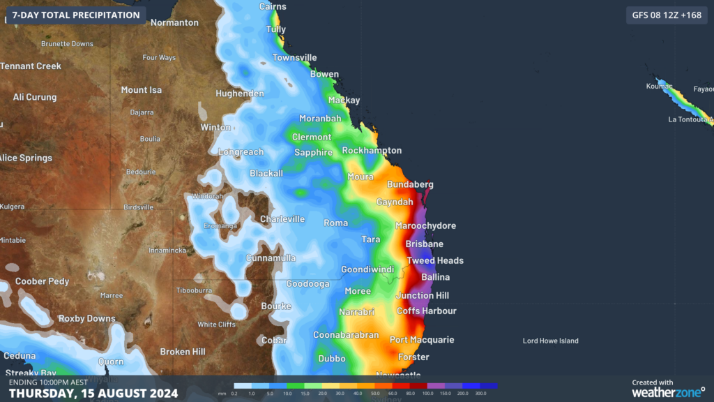
The map below shows that there is still considerable uncertainty about where and when the heaviest rain will fall along this broad area next week. Some computer models suggest parts of southeast Qld, including Brisbane and northeast NSW will be the hardest hit, while another suggests the heaviest falls will remain offshore.


Image: Accumulated rain forecast for the 7-days leading up to 10pm Thursday, August 15, According to (top to bottom) ECMWF, Access and GFS.
Daily rainfall totals could reach 80 to 100 mm early next week, bringing the potential for flooding in parts of Qld and northeast NSW.
We will be watching this system closely as it unfolds, please keep an eye out for the latest warnings.