
Pre-season storms strike QLD with heavy rain on the way
The skies sparked to life above southeast Queensland as a wave of pre-season thunderstorms swept across the region on Sunday night. Now, the focus shifts further north as clouds start to build along the state's central and northeast coasts.
A low pressure trough interacting with moisture-laden air in an unstable atmosphere produced a flurry of lightning over southeast Queensland on Sunday night.
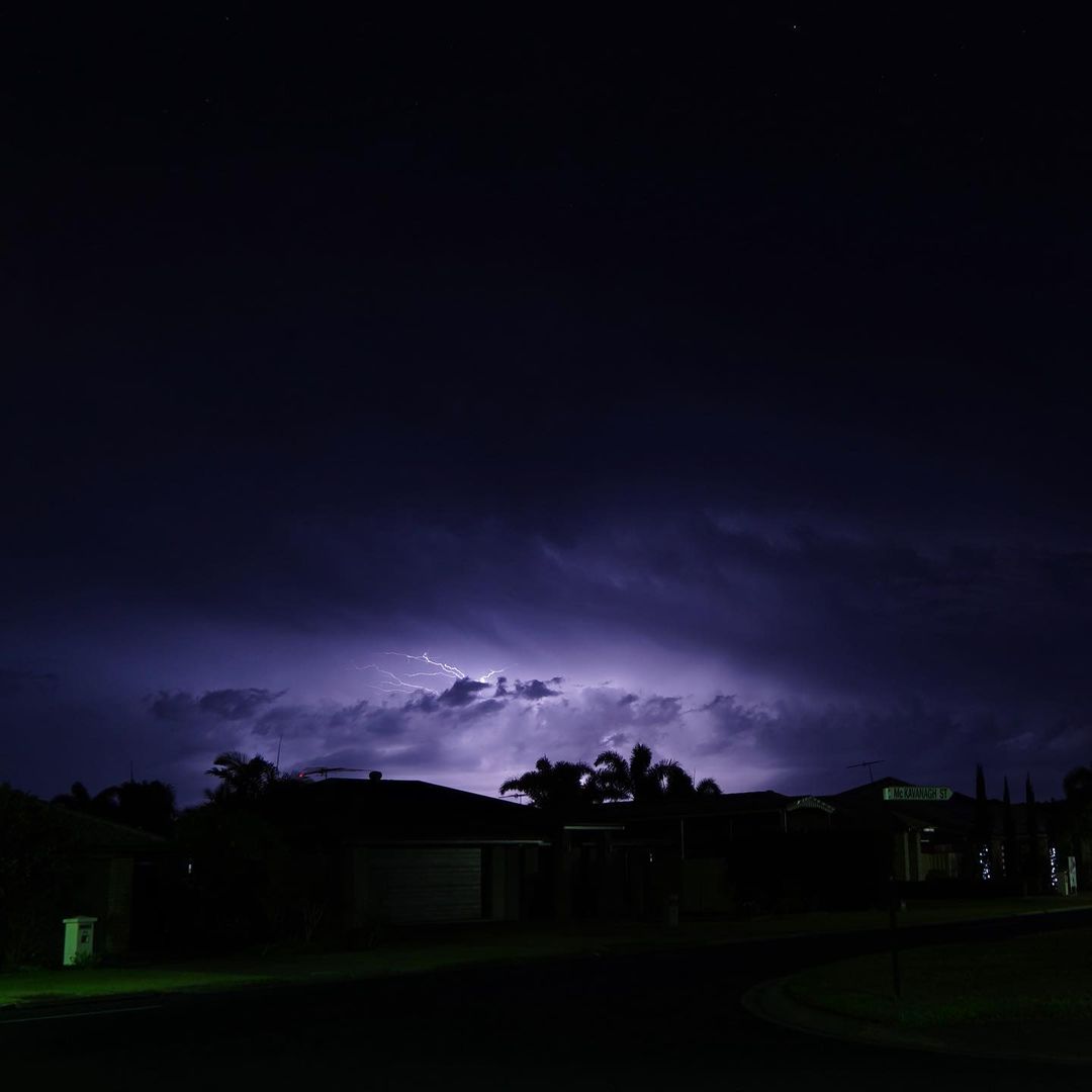
Image: Lightning near Caboolture, QLD on Sunday night. Source: @kimmy674 / Instagram
The storms rumbled to life over the Darling Downs shortly after sunset before growing and moving towards the southeast coast.
The biggest storm of the night passed to the northwest of Brisbane around 7-8pm. While it didn't deliver much rain, it produced more than 8,600 lightning pulses and nearly 400 cloud-to-ground strikes.
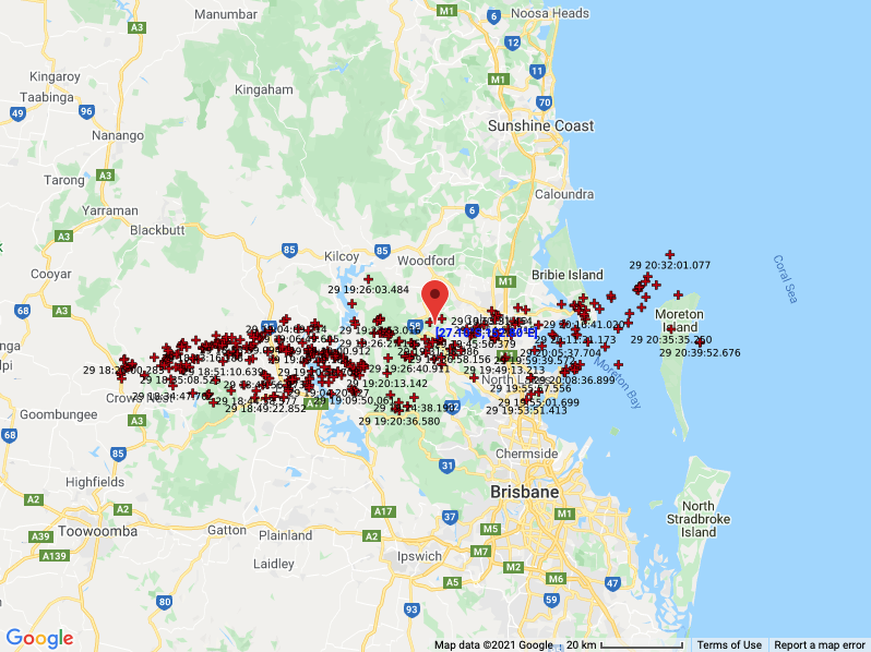
Image: Locations of the 375 cloud-to-ground lightning strikes that were detected to the north of Brisbane on Sunday night.
The night-time thunderstorms put on a spectacular show for southeast Queensland's storm enthusiasts, who are eagerly waiting for storms to become more active during spring.
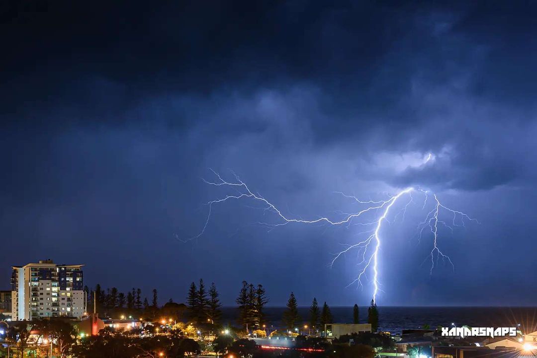
Image: Lightning over Moreton Bay, QLD. Source: @xandrsnaps / Instagram
But for now, the main focus of the weather in Queensland has shifted to the state's central and northeast coasts, where heavy rain is expected during the next 48 hours.
This rainfall is set to be triggered by a low-pressure trough over the state's central interior interacting with moist east to northeasterly winds.
Rain will begin on Monday afternoon, becoming heavier on Monday evening into Tuesday, before easing on Wednesday.
Widespread 48-hour accumulated rainfall totals of 30-40mm are a good chance along parts of the coast and ranges between about Cooktown and St Lawrence.
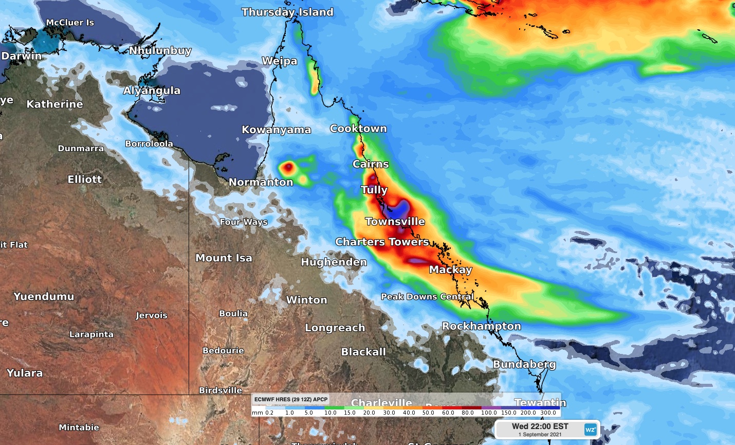
Image: Forecast accumulated rain between Monday and Wednesday according to the ECMWF-HRES model.
Some places could see heavier falls in the range of 80-120mm, which poses a risk of localised flash flooding.
Check the latest forecasts and warnings for your area if you live in central or northeast Queensland.