Potential for positive Indian Ocean Dipole

The Indian Ocean could be entering a phase that may limit rainfall in parts of central and southern Australia this winter.
Sea surface temperatures across the Indian Ocean affect rainfall patterns in Australia, particularly during the cooler months of the year.
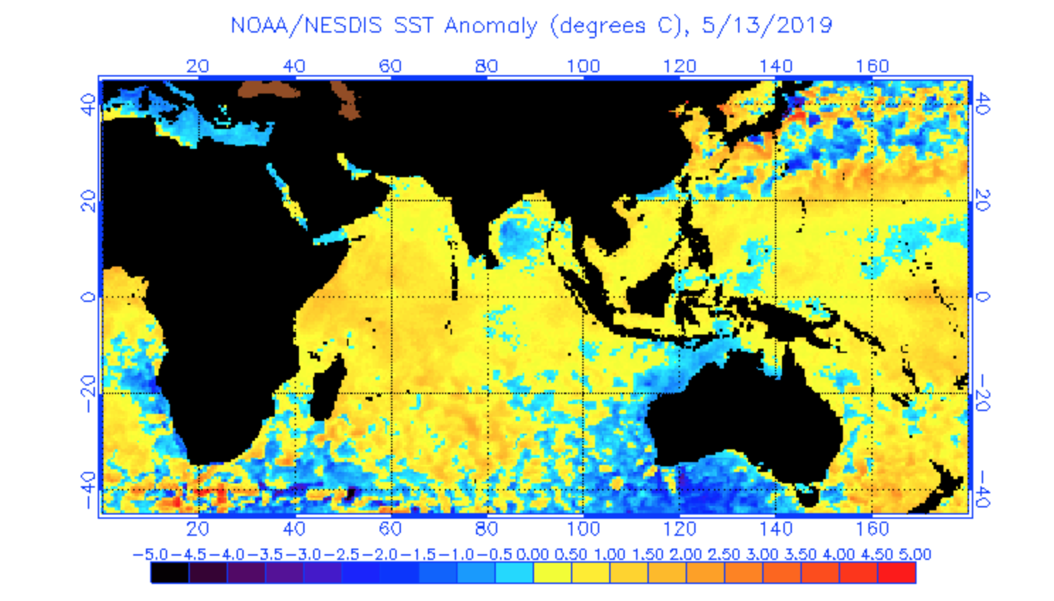
When cooler-than-usual water sits to the northwest of Australia and relatively warmer water develops near Africa's east coast, the amount of moisture being carried over Australia can be reduced. This pattern, which is called a positive Indian Ocean Dipole (IOD), often causes below-average rain across much of Australia, particularly central and southern parts of the country.
By contrast, cooler water near Africa and warmer water on our side of the Indian Ocean can enhance winter-spring rainfall in parts of Australia. As you might expect, this is called a negative Indian Ocean Dipole.
Unfortunately, all six of the international forecast models monitored by the Bureau of Meteorology predict that a positive phase IOD will develop this winter. Most of these models expect the positive IOD to persist until at least October.

Image: Sea surface temperature anomaly in the Indian Ocean this week. Credit: NOAA
This outlook increases the likelihood that already parched areas in central and southern Australia could receive below-average rain during the winter months.
However, it doesn't guarantee drier weather.
Much like El Nino and La Nina in the Pacific Ocean, the IOD is a background influence on conditions throughout the season. Individual heavy rain events can and do still occur during positive IOD events.
Climate outlooks are not the same as weather forecasts. While they can give us an indication of how the weather might behave during the months ahead, they can't tell us when, where and how much it will rain.