Potent wintry weather looms for QLD
A burst of cold and wet weather will hit Queensland early next week, with some parched parts of the state expected to pick up a month’s rain in one or two days.
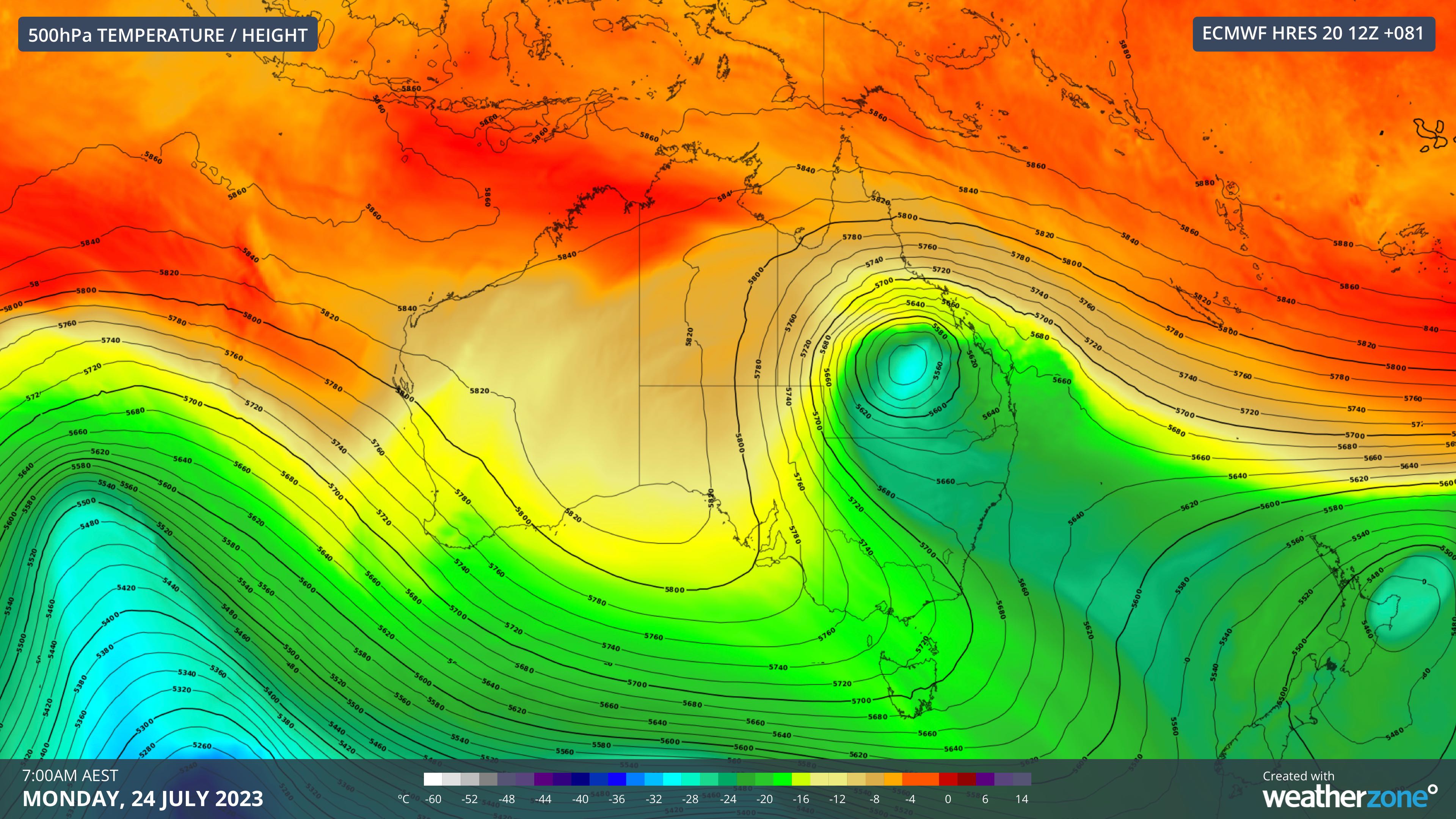
An upper-level cut-off low pressure system will carry a large pool of cold air over eastern Australia this weekend and early next week. This system will drag cold air unusually far north, producing a wintry mix of cold temperatures, thick cloud and rain in Qld.
The cut-off low will enter southern Qld on Sunday before tracking over the state between Sunday and Tuesday.

Image: 500 hPa temperature and height, showing the cut-off upper-level low over central western Qld on Monday morning.
This path is expected to cause showers to develop over southern and eastern Qld on Sunday, followed by heavier rain in parts of central and southeast Qld on Monday. Rain should continue over central eastern Qld on Tuesday and possibly into Wednesday as well.
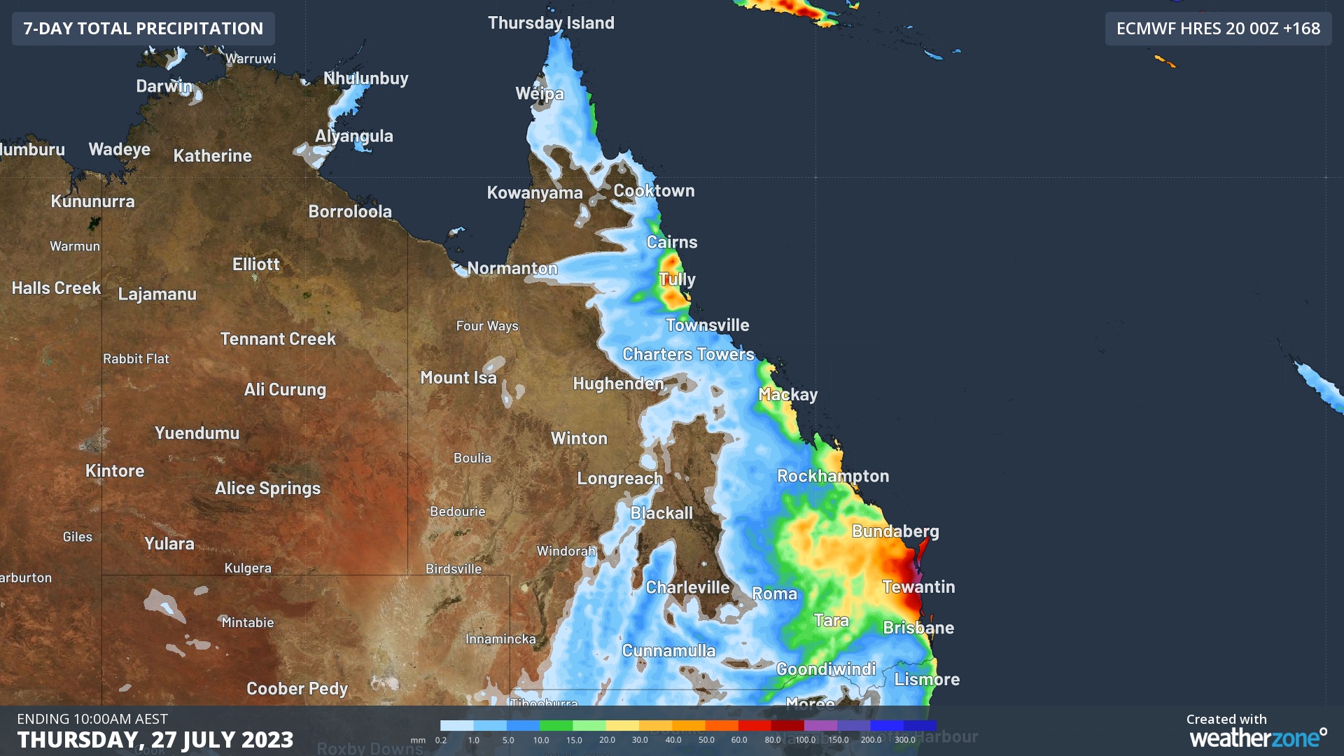
While there is some uncertainty about where and how much rain will fall from this system, some models suggest that 30-50 mm could fall over parts of the central and southeast Qld early next week. Higher accumulated totals are possible is isolated areas near the coast.
The map below shows how much rain one computer model is predicting during the 7 days ending on Thursday, July 27, although most of this rain would fall between Monday and Wednesday.

Image: Forecast accumulated rain during the 7 days ending at 10pm AEST on Thursday, July 27, 2023.
Some areas that have the potential to collect 30 to 50 mm would be receiving a full July’s rainfall in one or two days. These falls would be welcome for the region, with large areas of the state receiving well below average rain in the last couple of months.
.png)
Image: Rainfall deciles for the two-month period from the start of May to the end of June. Source: BoM
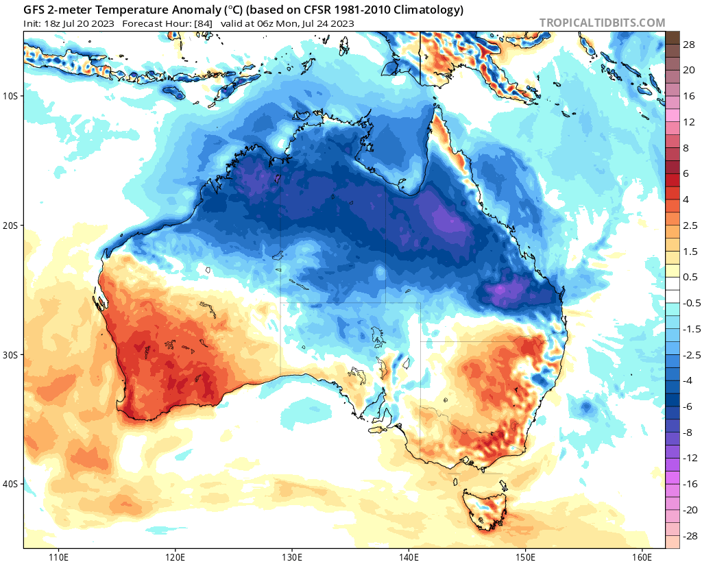
The impending rain and cloud will also cause below average temperatures over a large area of Qld, with day and night time temperatures possibly dropping 4 to 6ºC below average early next week.

Image: Forecast surface air temperature anomalies on Monday afternoon. Source: tropicaltidbits.com
While there are no severe weather warnings currently in place for this system, be sure to check the latest forecasts and warnings in the coming days.