
Pilbrrra shivering through record-cold May day
A huge mass of thick cloud will cause an exceptionally cold day in northwestern Australia on Tuesday, with some places expected to see their coldest May day on record.
The satellite image below says it all. Cloud, and lots of it, are currently shielding the northern half of WA from the sun.
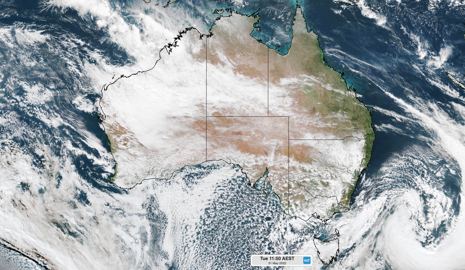
Image: Visible true-colour satellite image captured at 11:50am AEST on Tuesday, May 31, 2022.
This shield of cloud is severely limiting solar heating at the surface, which will cause maximum temperatures rarely seen in the Australian tropics. Forecast models suggest that daytime temperatures on Tuesday could be 15ºC below average for this time of year in parts of the Pilbara and Gascoyne.
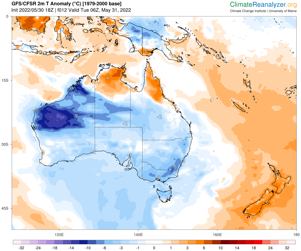
Image: Forecast temperature anomalies on Tuesday afternoon, calculated by comparing predicted surface air temperature from the GFS model with average temperature observed over the 20-year period from 1979 to 2000. Source: ClimateReanalyzer.org
The town of Newman, located about 360 km south-southwest of Port Hedland, is only forecast to reach 12ºC on Tuesday. This is 15ºC below average and could challenge the lowest May maximum temperature on record at Newman, which was 11.7ºC in 1969.
Nearby the mining town of Paraburdoo is forecast to reach 15ºC on Tuesday, 8ºC below average and just shy of its lowest May maximum temperature record of 15.7ºC from 1995.
While the thick clouds are not reaching Perth today, the city has still had its fair share of shiver-inducing temperatures this week. The city’s minimum temperature of 5.7ºC on Tuesday morning was its third straight morning below 6ºC.