Pilbara cops a month's worth of rain in a day
A northwest cloudband and thunderstorms soaked the Pilbara on Wednesday, delivering five times the June average rain in a day at one town.
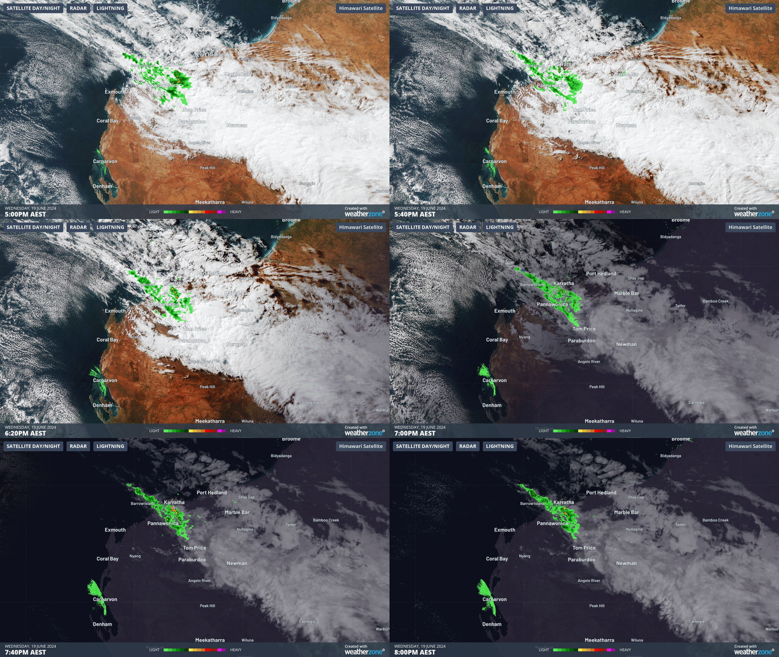
The images below show thick cloud, rain and thunderstorms streaming into the Pilbara region from the Indian Ocean on Wednesday afternoon.

Image: Himawari-9 satellite images for the three hours leading up to 6pm AWST on Wednesday, June 19.
The highest falls recorded in the 24 hours leading up to 9am on Thursday, June 20 were:
- Karijini North recorded nearly six times their June average (only five years of data), with 63.6mm falling in the gauge
- Flat Rocks observed 55mm
- Upper Portland recorded 50mm
- Mount Florence saw 38mm, nearly two times the June average
- Coolawanyah observed 37mm
- Solomon Airport received nearly four times their monthly average, with 31.6mm
Much of this rain fell into one catchment, the Fortescue River Catchment, but the river remained below flood levels.
The northwest cloud band has moved eastward and weakened on Thursday, with rain and thunderstorms clearing the region. While the rain has cleared, strong and gusty southeasterly winds should continue over the Pilbara and Kimberley regions on Thursday and Friday.
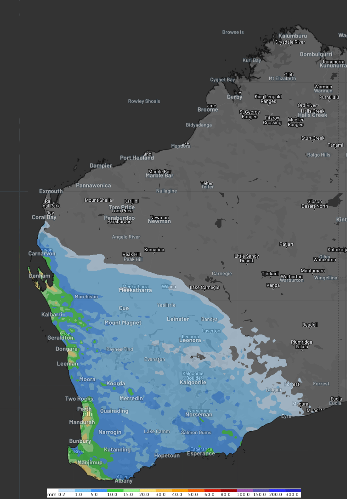
Looking ahead, a strong cold front will sweep across the southwest of the state on the weekend bringing rainfall to the southern half of WA. 
Image: 24-hour accumulated rainfall to 11pm AWST Saturday, June 22, according to ECMWF
You can see in the image above that the models suggest this rain will miss the Pilbara and Kimberley on the weekend, although it may be more cloudy than normal.