
Perth's coldest weekend in 8 months awaits
A cold front will bring a burst of cool, wet and windy weather to southwestern Australia later this week, putting Perth on track to have its coldest weekend in about eight months.
May is typically the time of year when cold fronts start to become more active over southwestern Australia due to the seasonal northward shift of the subtropical ridge in the Southern Hemisphere.
This increased frontal activity is why Perth’s average rainfall in May is close to double that of April, and mean maximum temperatures drop by about 4°C between the two months.
This May’s first cold front will reach the southwest corner of WA late on Friday and reach Perth in the early hours of Saturday morning, before pushing further north and east into the weekend.
The passage of the front will produce blustery winds, showers, thunderstorms and a noticeable drop in temperature across the southwest of WA on Friday into Saturday.
Perth’s maximum temperature on Thursday is predicted to reach about 31°C in a warm air mass ahead of the approaching front. This will be Perth’s first May day over 30°C since 2018. By contrast, the city is only forecast to reach 21-22°C on Saturday and Sunday, which would make it Perth’s coldest weekend since September.
Showers accompanying the frontal system should deliver about 5 to 25mm of rain over western and southwestern districts of WA, with the heaviest rain expected to occur from the southwest coast up to just north of Perth.
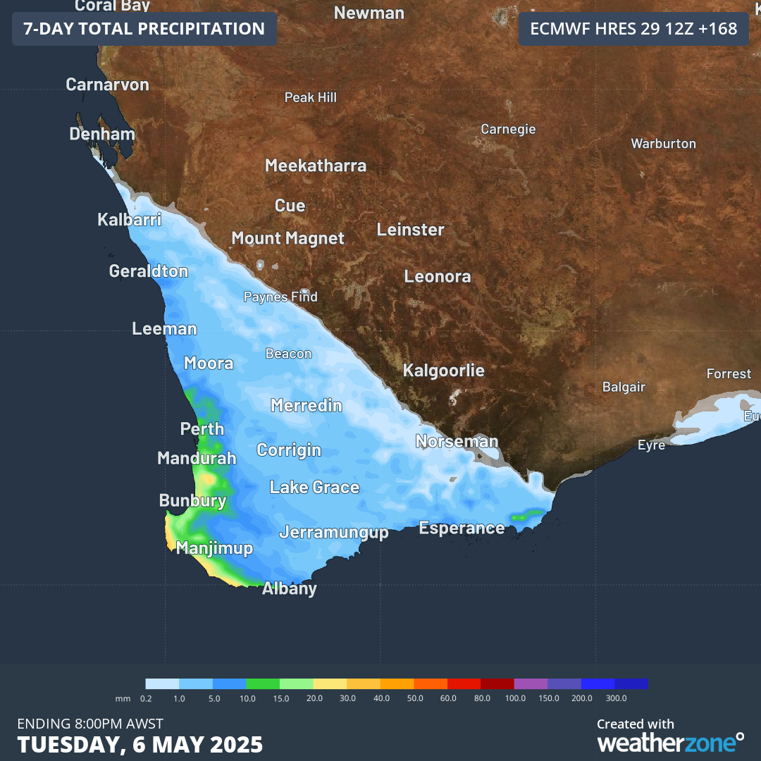
Image: Forecast accumulated rain over the next seven days, showing how much rain this week’s front is expected to deliver.
Fresh to strong winds will also blow across the southern half of WA on Friday and Saturday. While these won’t be anywhere near as strong as a typical mid-winter cold front, damaging wind gusts are possible in exposed areas along state’s southwest coast.
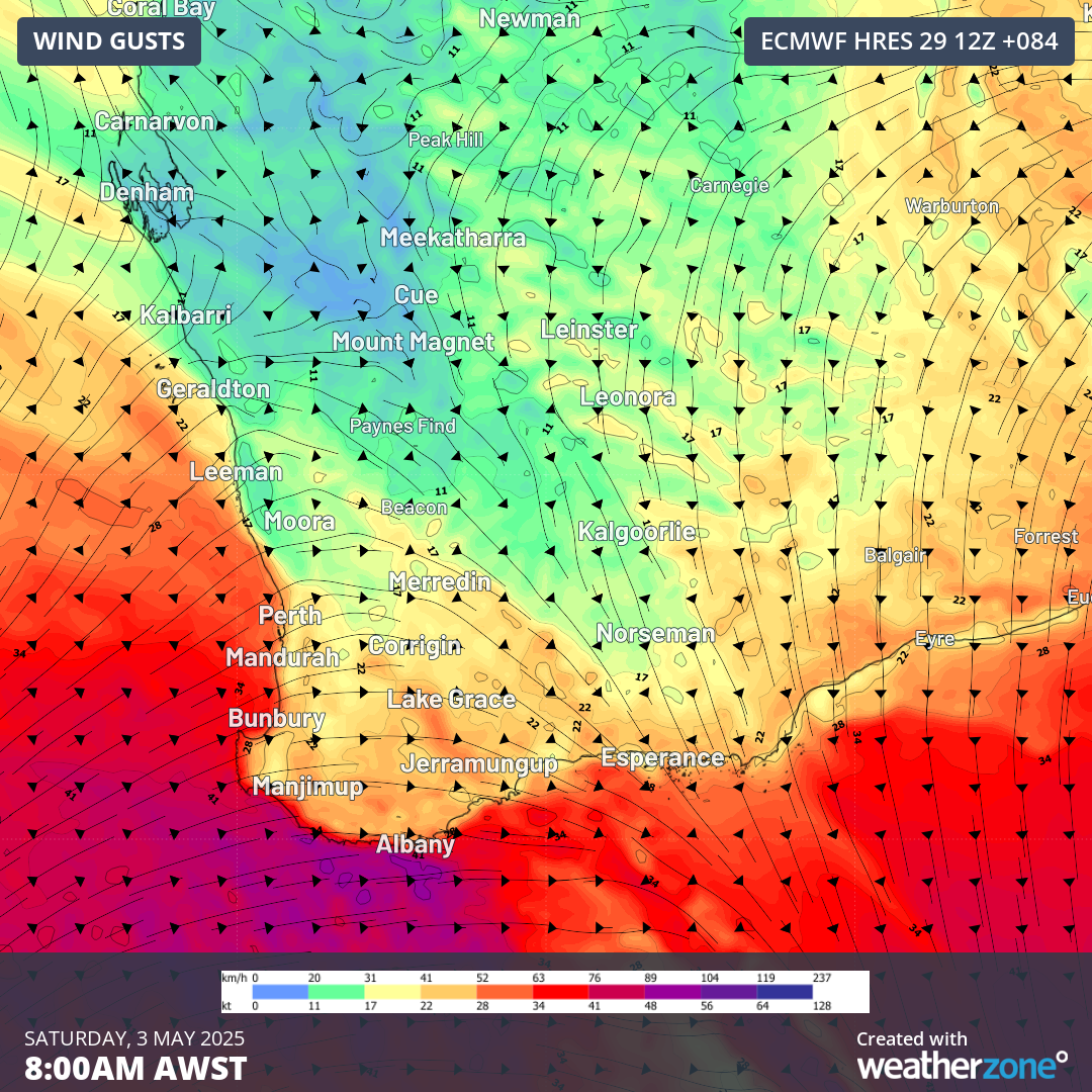
Image: Forecast wind gusts on Saturday morning.
Severe weather warnings may be issued in the coming days as this cold front approaches and crosses southwestern Australia. Check the latest forecasts and warnings for the most up-to-date information in your area.