
Perth facing hottest late-March spell on record
Perth is set for a potentially record-breaking hot spell as a heatwave bakes western and southern WA this week, while its run of warm overnight temperatures could threaten some records too.
While no individual records are likely to be broken this week (Perth has reached as hot as 42.2°C in March), the city will experience a sequence of scorching days for this time of year.
- From this Monday through to Thursday, Perth is forecast to hit 38°C, 37°C, 37°C and 37°C (the average March maximum is 29.6°C).
- Perth hasn’t seen such a hot four-day run in the second half of March since 1985.
- If the mercury exceeds 37.2°C on all four days, it will be Perth’s hottest sequence of late-March days on record.
- Uncomfortable minimums in the low-to-mid-20s are forecast all week (Perth’s average March minimum is 16.9°C).
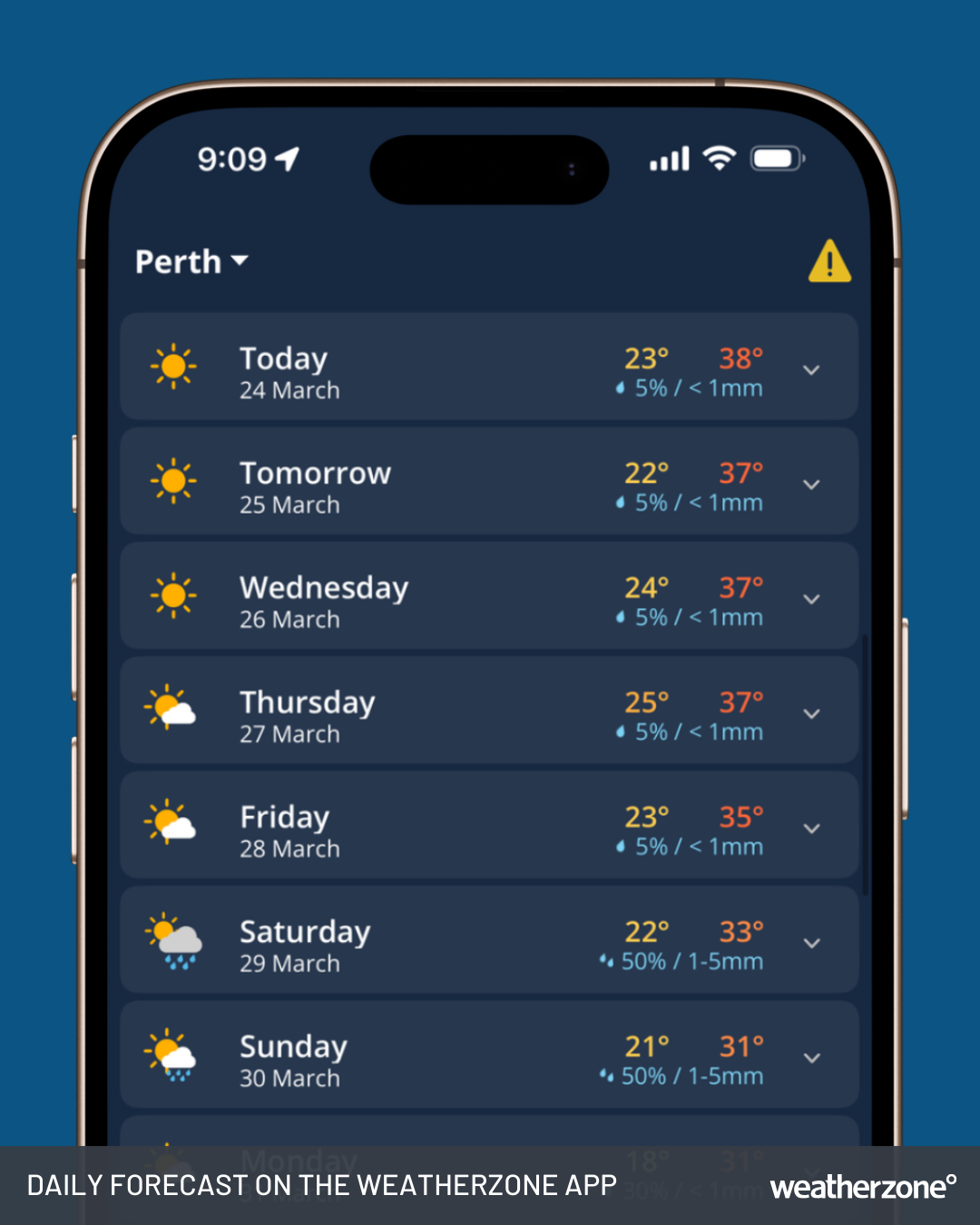
Image: Daily Forecast on the Weatherzone app for Perth, WA.
What's causing the late March heat?
At this time of year – just as during midsummer – Perth's hottest prolonged periods of weather tend to be caused by a near-stationary blocking high pressure system centred over southern Australia or the Great Australian Bight.
A potential tropical cyclone to the north of WA is also playing its part. (The cyclone is currently rated a slightly better than 50% chance of forming by this Thursday from the low on the chart below which is closest to the WA coastline).
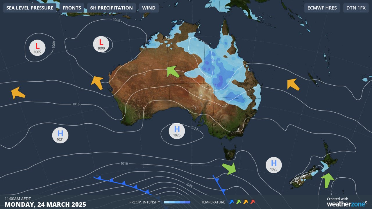
Image: Synoptic chart for Monday, March 24, 2025, showing winds circulating anti-clockwise around the blocking high, funnelling hot easterlies from Australia’s interior towards Perth and much of the WA coast.
While it may seem unusual to have a tropical cyclone and a prolonged heatwave occurring around WA at the same time, tropical cyclones off Australia's northwest shelf are known to promote the weather patterns that cause heatwaves in Australia by enhancing "subsidence warming".
In simple terms, tropical cyclones are intense areas of upward moving air. What goes up has to come down, and the air that is forced upwards in tropical cyclones often descends in the mid-latitudes (such as southern WA), warming as it does so and enhancing heat in these regions.
READ MORE: HOW TROPICAL CYCLONES CAN CREATE HEATWAVES IN AUSTRALIA
Meanwhile, temperatures had already soared to 37.5°C in the city at midday (AWT) and beyond 38°C in some Perth suburbs.
The current heatwave is affecting a lengthy stretch of the WA coastline (and nearby inland areas) from Exmouth in the Pilbara forecast district, south to Cape Leeuwin, and east about as far as Esperance. We'll keep you updated on this event the Weatherzone news feed as the week progresses.