
Parched national capital about to get wet
Canberra is set to see its first significant rainfall in several months, with both Wednesday and Thursday looking likely to deliver a much-needed drop.
- From 9 am Wednesday to 9 am Thursday, rainfall totals of between 10mm and 20mm are likely
- From 9 am Thursday through to 9 am Friday, further falls of around 5mm are possible.
Anything over 10mm on either day (or both) would be very welcome in the national capital. Not since June 8 has Canberra had a day when rainfall totals (in millimetres) reached double-digits.
As Canberra's rainfall graph for the last 12 month shows, the city saw below-average rainfall in all three months in the 2024 winter.
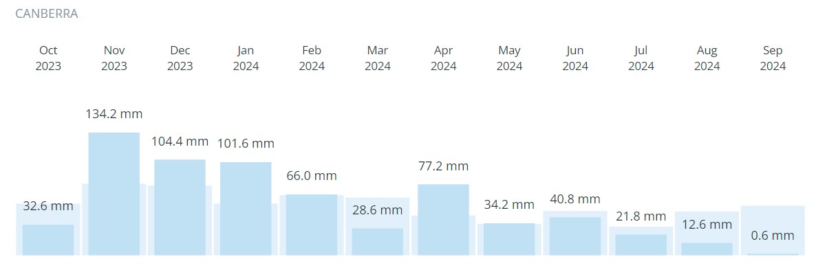
Canberra temperatures were also well above average for much of winter, especially in August, when max temps were 3.7 degrees above the long-term average in what was Australia's warmest winter month on record by a huge margin.
Despite the unseasonable warmth and meagre rainfall in recent times, Canberra's water storage (updated today, September 24) is still a tick over 95%. So shortages heading into summer are not looming at this stage.
But the parks and gardens of the so-called "Bush Capital" are desperate for a drink after a September in which there has been just one damp day. That was September 15 and it wasn’t very wet with just 0.6 mm of rain recorded.
When will the rain arrive?
At this stage, the period between about 2 pm Wednesday and 2 pm Thursday looks like the wettest 24-hour slot as an upper-level cut-off low pressure system drifts across NSW.
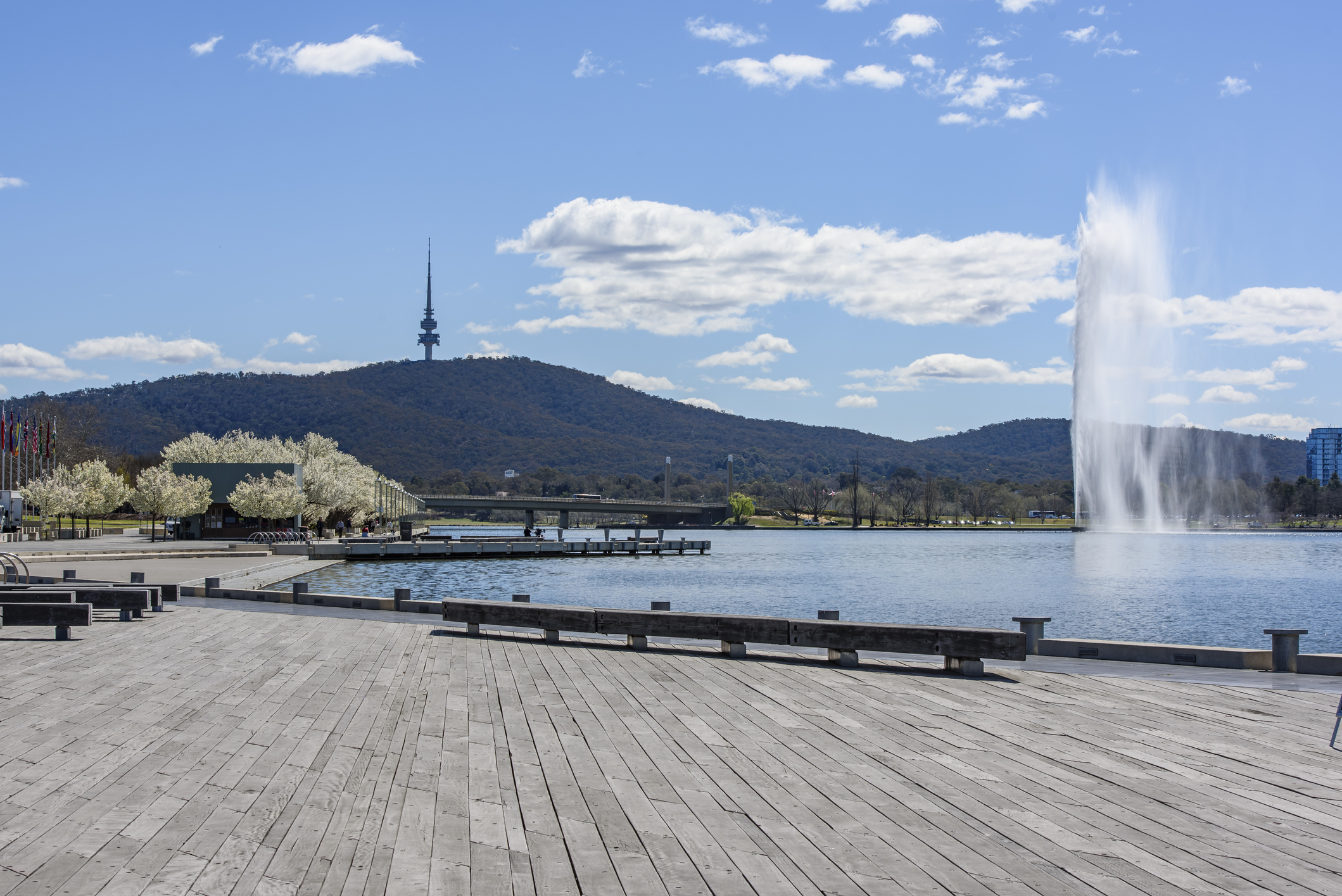
Image: The clouds are about to do their best impression of the fountain. Source: iStock.
This system will also deliver widespread rain to many spots beyond Canberra that need a good spring soaking, and indeed the combination of tropical moisture feeding into the upper-level trough has already delivered the heaviest September rainfall on record at Yulara, near Uluru.
Another feature of the system affecting Canberra this week is cold air associated with a cold front which is currently lurking in the Great Australian Bight. By Thursday, snow is likely on the mountains around Canberra down to as low as 1000 metres (and possibly lower due to the 'melting effect').