
Oh, what a morning in the mountains
After heavy snow fell on Monday with over 25 centimetres reported at some resorts, the cold front has done the polite thing and quickly moved out to sea, allowing the Australian Alps to bathe in glorious winter sunshine for a day or two.
This was the scene at dawn on Tuesday at Victoria's highest ski resort Mt Hotham. The resort only has a couple of lifts open for now, but will likely add a few to that tally in time for the Victorian public school holidays at the end of this week.
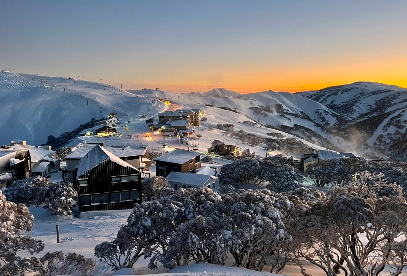
Image: Mt Hotham, with its village perched near the top of the mountain rather than down in the valley, is looking peachy this Tuesday. Source: Chris Hocking.
Take a look at these pics from New South Wales. The first is from the Quad Express at Perisher, and the second shows the line of the still-closed Link T-Bar at nearby Smiggin Holes, which is yet to open for 2023.
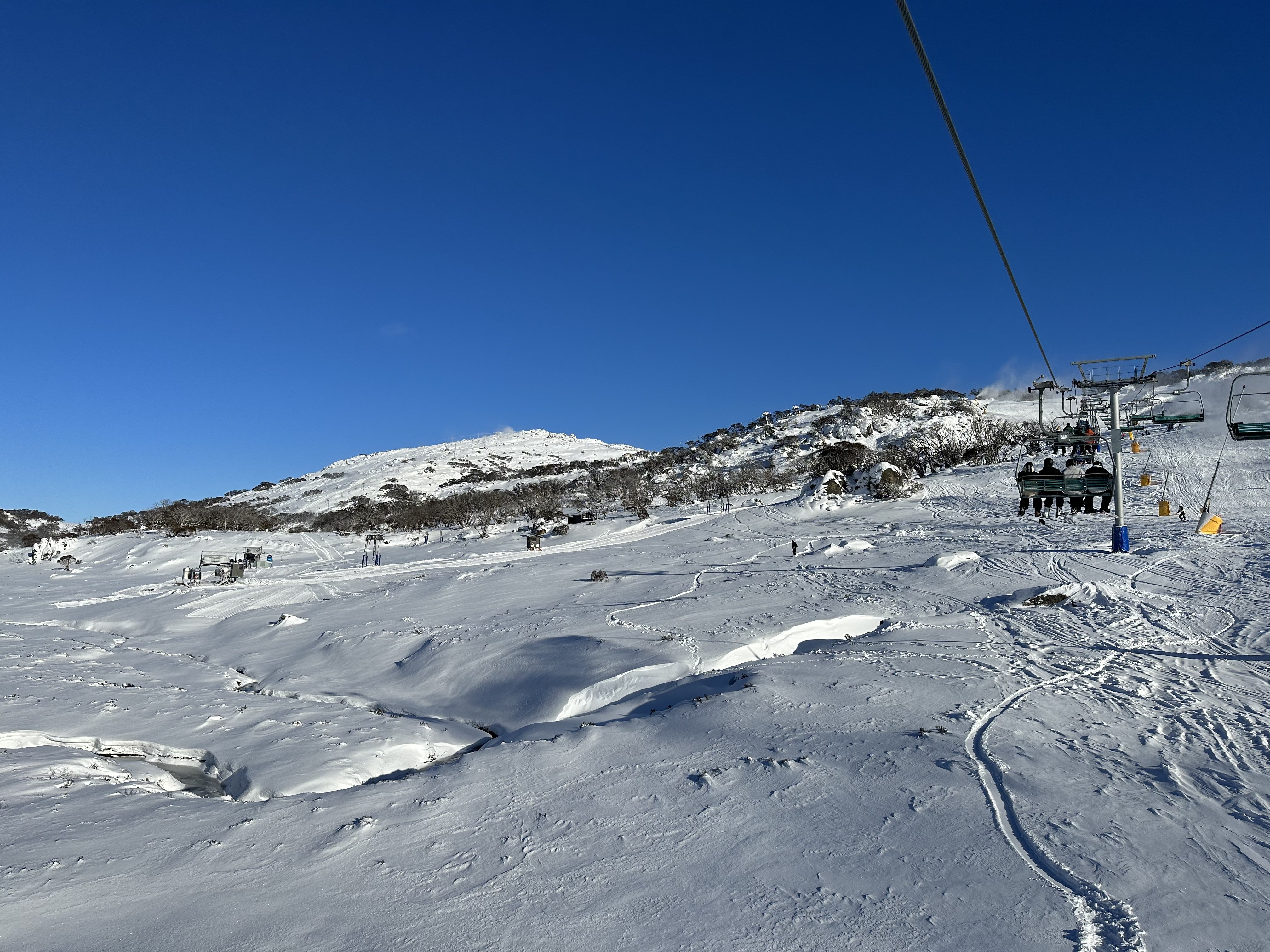
Image: Nice to get there before the school hol crowds. Source: Jasper Schwarz.
Look a little closer at that second image and you'll see it shows a phenomenon called "Alpenglow", which we actually wrote about last year on Weatherzone.
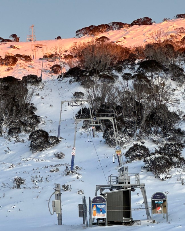
Image: Yellow snow bad, pink snow good! Source: Jasper Schwarz.
As we explained back in that story:
- At sunrise and sunset, the sun is low in the sky near the horizon. That means the sunlight travels through more of the atmosphere than when the sun is directly overhead.
- Because blue light gets scattered more quickly by the atmosphere, it is deflected away before we see it when the sun is low (and travels through more of the atmosphere). That leaves more of the red wave length.
So when the morning sun strikes a nice white snowy surface on a clear day, hey presto, for a few minutes there you've got yourself one glorious pink Alpenglow.
Is there more snow on the horizon?
Yes. As mentioned, today and most of Wednesday should be fine across our mainland alpine country, before a series of troughs and cold fronts start crossing the region on Thursday.
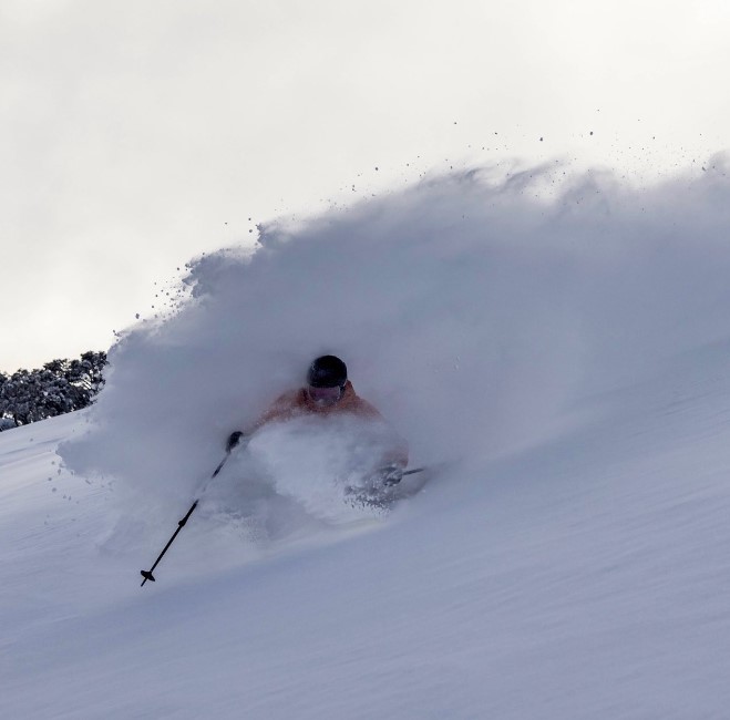
Image: Japan-like scenes in the so-called "side country" just outside the ski area boundary at Mt Hotham on Monday. Source: Chris Hocking.
Light to moderate snowfalls are then in the forecast each day for at least a week or so. And while the snow level won't be as low as Monday's cold blast that brought snow to sub-alpine places like Victoria's Macedon Ranges and the NSW Central Tablelands, it should still be cold enough for snow at the upper elevations of most ski resorts.
As ever, please check our snow page for the latest forecasts and much more.