
Numerous tropical cyclones threaten the South Pacific
Several tropical systems will affect the Coral Sea and South Pacific Ocean over the coming week, possibly impacting Fiji, Tonga, and–later–Australia's East Coast.
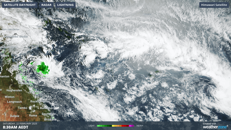 Image: Satellite loop over the Coral Sea and South Pacific Ocean on Saturday, February 22, showing the South Pacific Convergence Zone and numerous tropical lows over the region.
The South Pacific Convergence Zone (SPCZ) is a region of increased cloudiness and precipitation with enhanced wind convergence extending over the western Pacific Ocean. The SPCZ is most often located over very warm waters from the Western Pacific Warm Pool, helping fuel the intensification of tropical systems over the region. A number of these tropical lows are expected over the Coral Sea and South Pacific Ocean this week.
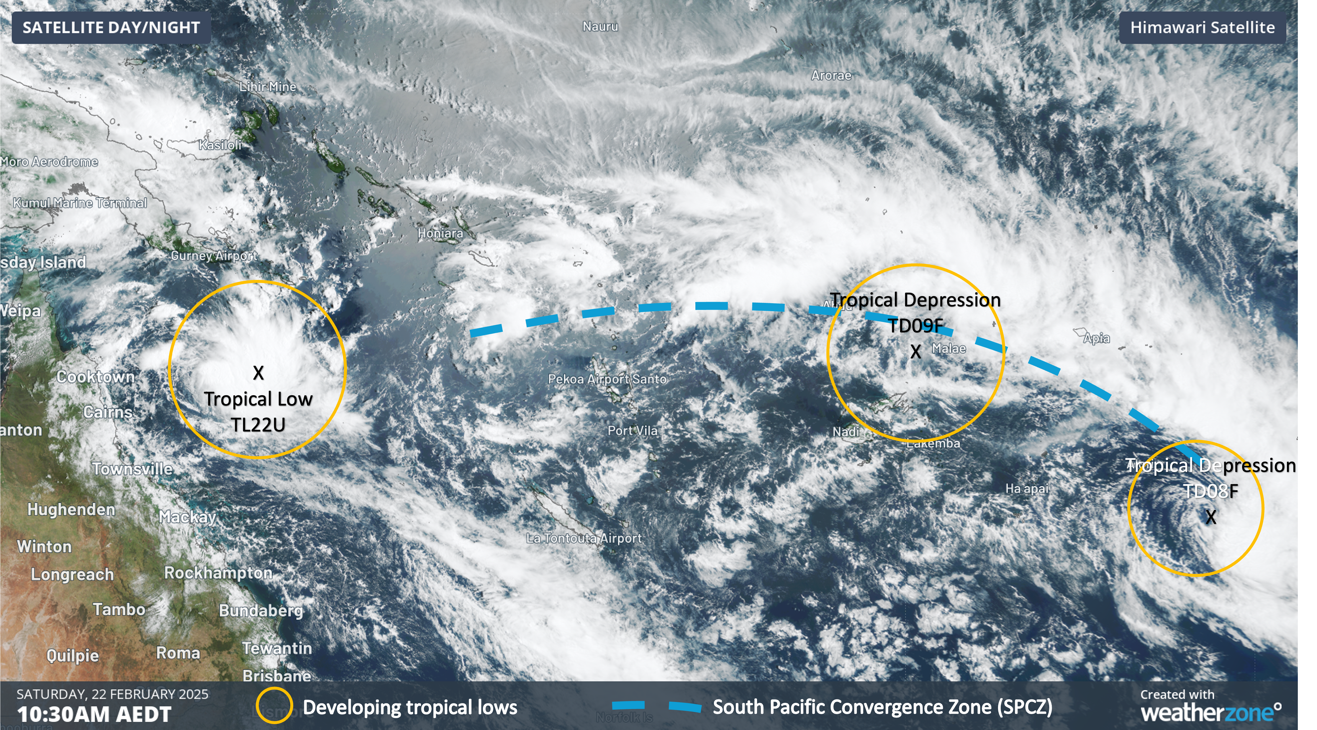 Image: Annotated satellite image on Saturday, February 22, showing the South Pacific Convergence Zone (SPCZ) and three tropical systems of interest over the Coral Sea and Pacific Ocean.
Tropical Depression TD08F is located in the far east of Fiji's area of responsibility, near Niue. This system is unlikely to directly affect any South Pacific nations in the vicinity. High levels of moisture trapped in the SPCZ are bringing heavy and intense rain to Samoa over the weekend, and to Niue over 24 to 36 hours on Saturday and possibly early Sunday (Niue is east of the date line).
Tropical Depression TD09F is located northeast of Fiji, near the island of Futuna, one of the Wallis and Futuna Island collectivity. This depression is expected to intensify in the coming days, with a high chance of being a tropical cyclone next week. The next tropical cyclone to be named by the Fiji Meteorological Service will be called Tropical Cyclone Rae.
TD09F could come close to western parts of the Fijian island group later on Sunday and on Monday, with a small chance of it impacting Fiji's main islands of Viti Levu and Vanua Levu, bringing the risk of heavy rainfall and strong winds. Tonga is more at risk of seeing strong and damaging winds and period of intense rainfall between late Monday and early Wednesday, with the system gaining strength and potentially coming close to the Pacific nation.
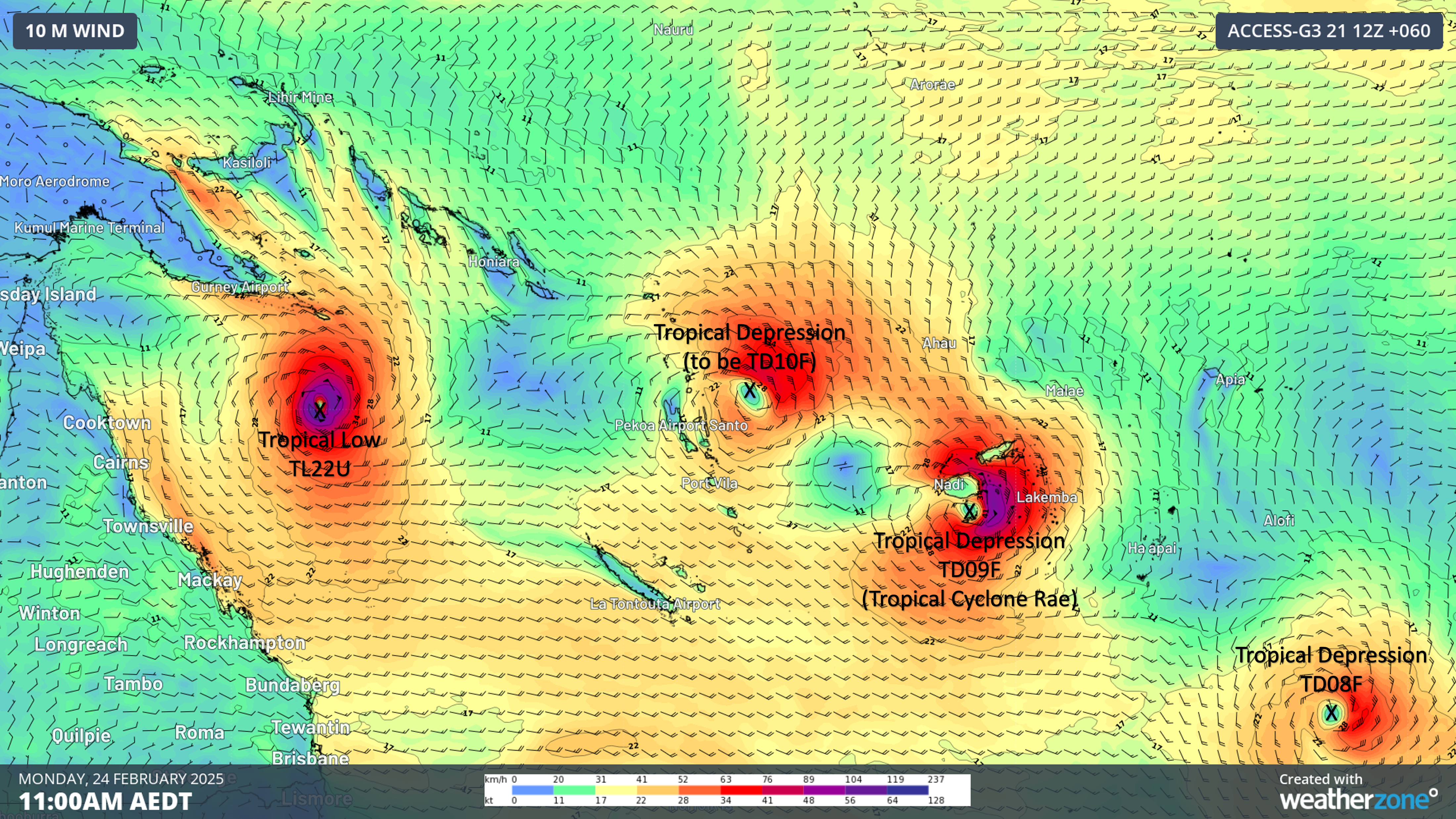 Image: Modelled winds across the Coral Sea and western South Pacific on Monday, February 24, showing a number of tropical systems across the region.
Another tropical depression (to be named TD10F) could form either on Sunday or Monday to the north or east of Vanuatu. This depression will be slow to intensify early next week, and most likely will be between Vanuatu and Fiji, avoiding most populated islands. It should intensify through the mid week period, becoming Tropical Cyclone Seru (if Rae forms before it). By late week, and into next weekend, this system should be weakening again, but may interact with the SPCZ, bringing heavy rainfall to Fiji and Tonga.
Closer to Australia, Tropical Low 22U is forming well east of Cooktown, over the Coral Sea. By late Sunday or Monday, there is a high chance that this system will be Tropical Cyclone Alfred or Bianca dependent on if a system to the northwest of Australia, in the Indian Ocean, is named first. While it will remain far out at sea for most of next week, there are indications this system could come closer to Queensland's coast around late next week. Uncertainty is however very high looking this far ahead, with lots likely to change regarding the intensity, positioning and timing of this system later in the week. For people living in eastern Queensland, please refer to the latest advisories for the most up to date information.
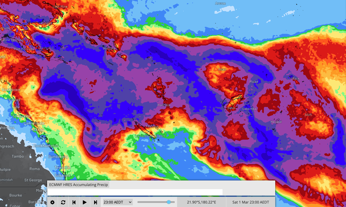 Image: Forecast rainfall accumulations across the Coral Sea and western Pacific Ocean over the next week.