NSW recovering from drought with Sydney storages nearly full
This winter and this year have been a remarkable contrast to 2019 in terms of rainfall in NSW. Large areas of the state are recovering from drought and water storages in Sydney have hit their highest level in several years.
While there is still a long way to go to properly break the drought in many areas of NSW, there have been promising signs of drought recovery across the state since the start of 2020.
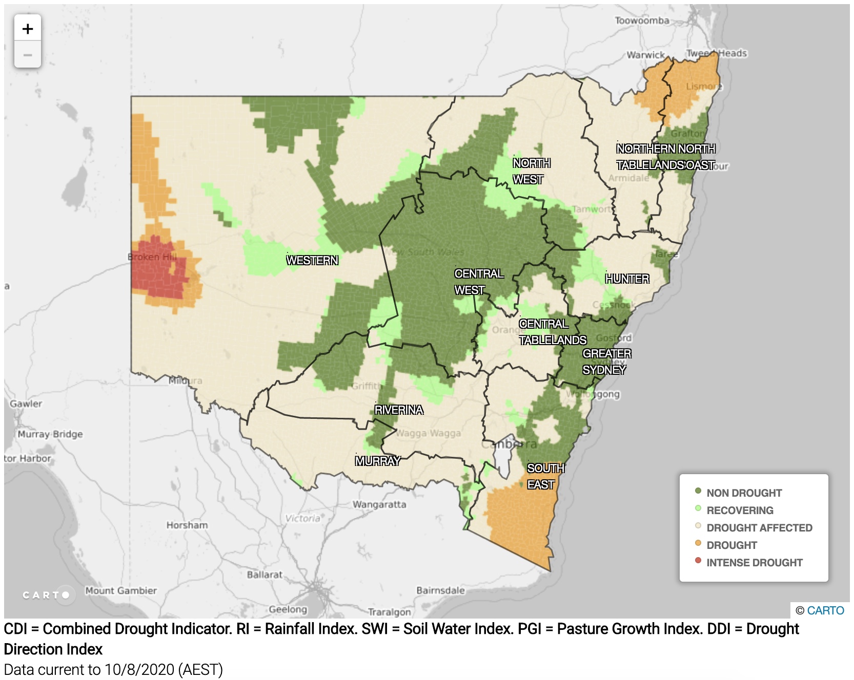
According to the NSW Department of Primary Industries (DPI), 100 percent of the state was in one of three drought categories at the end of January this year. By the beginning of winter, this number had only dropped slightly to 90.8 percent.
Fortunately, useful rain this winter has built on falls from earlier in the year to pull more areas out of drought. By the end of June, 86.9 percent of NSW was in one of three drought categories and at the end of July, this figure dipped to 78.5 percent. Preliminary figures from the opening ten days of this month suggest that the total area of NSW still in a drought category has dropped to around 63 percent.

Image: Drought map from the NSW Department of Primary Industries, as of 10 August 2020.
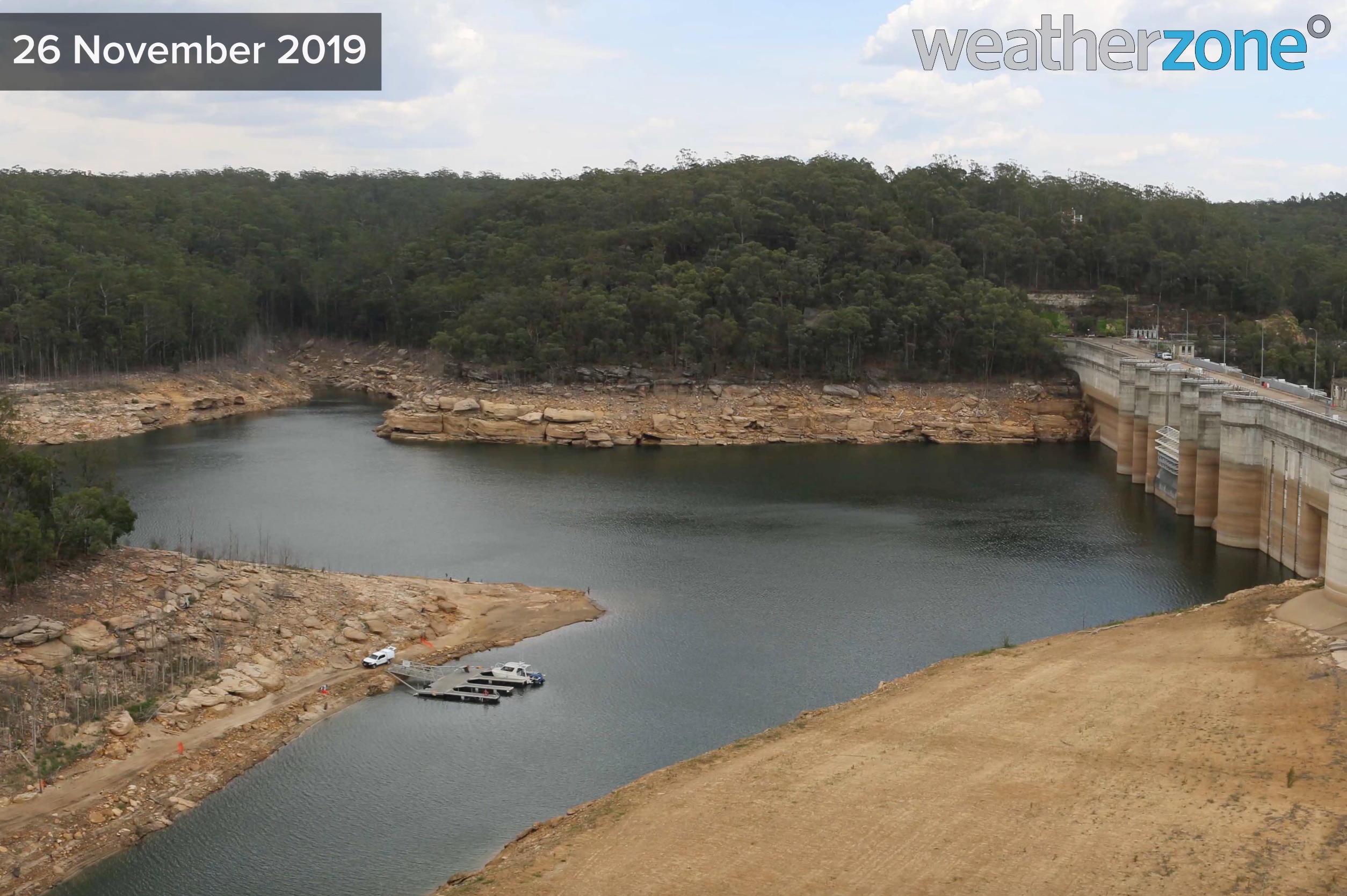
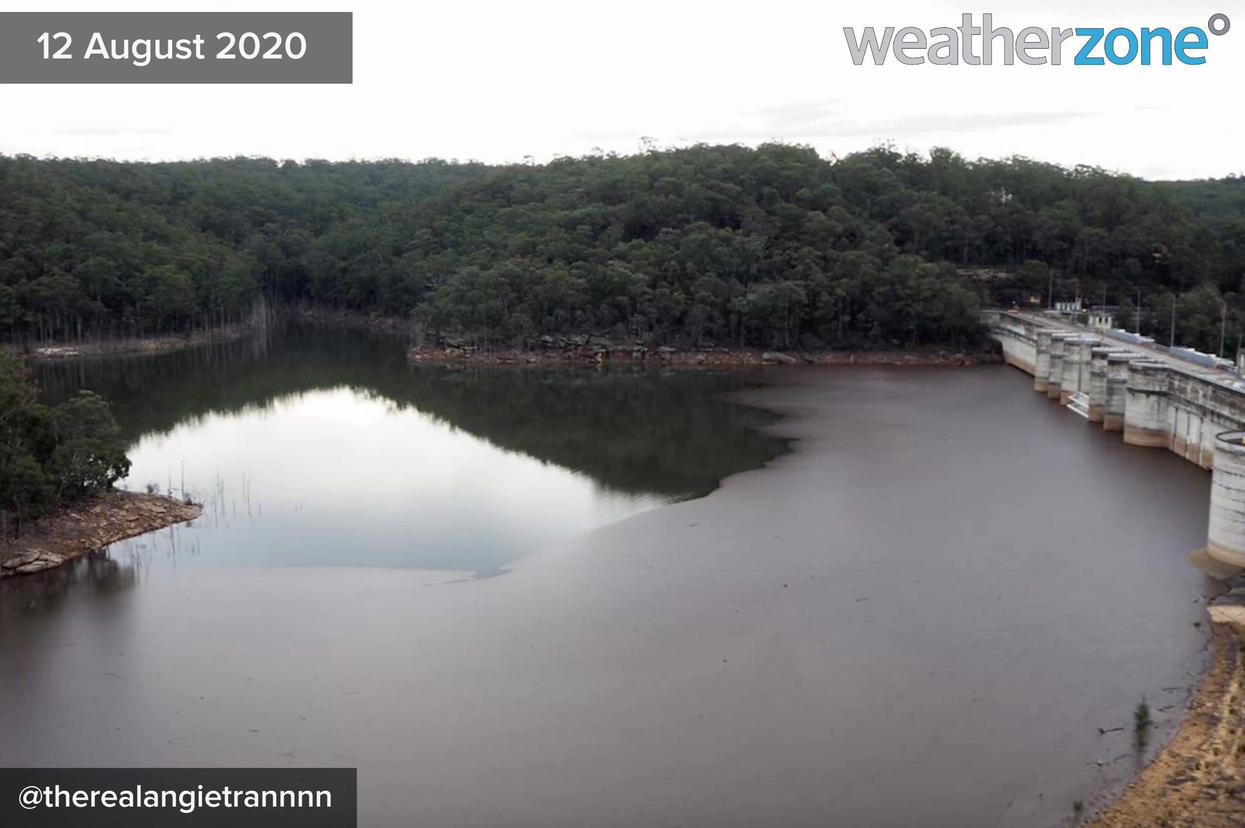
Sydney's water storages have been the vanguard of the NSW trend, with most dams that supply the city currently sitting around 90-100 percent full. Sydney's overall water storage level reached 96.5 percent of capacity in the middle of this week, its highest level in at least three years.


Impressively, Sydney has almost received a year's worth of rain during the first seven-and-a-half months of this year. As of 9am on Wednesday, the city's running annual total for 2020 was 1134.6mm, which is only 78.8mm below the long-term average for the entire year. It's also Sydney's wettest year-to-date since 1998, in stark contrast to 2019, which only saw 851.8mm falling during the entire year.
Looking ahead, another round of rain and thunderstorms will sweep across NSW towards the end of this week. While falls will be under 30mm for most of the state, this system will deliver more water into numerous catchments across the state.
A number of seasonal forecast models also suggest that La Niña could develop in the Pacific Ocean later this year. If this happens, it would raise the likelihood of above-average rain during the remaining months of 2020 for much of NSW and eastern Australia.
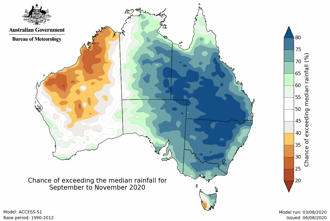
In response to this, the Bureau of Meteorology's latest seasonal outlook predicts above-average rain across the eastern half of the Australian mainland between September and November.

Image: The Bureau of Meteorology's three-month rainfall outlook for the period from September to November.
This year has already been a stark contrast to 2019 for rainfall in NSW and this trend looks set to continue in the months ahead. While this is good news for some, it could be a double-edged sword; continuing the recovery from drought and elevating the risk of flooding at the same time.