NSW from space: what a difference a year makes
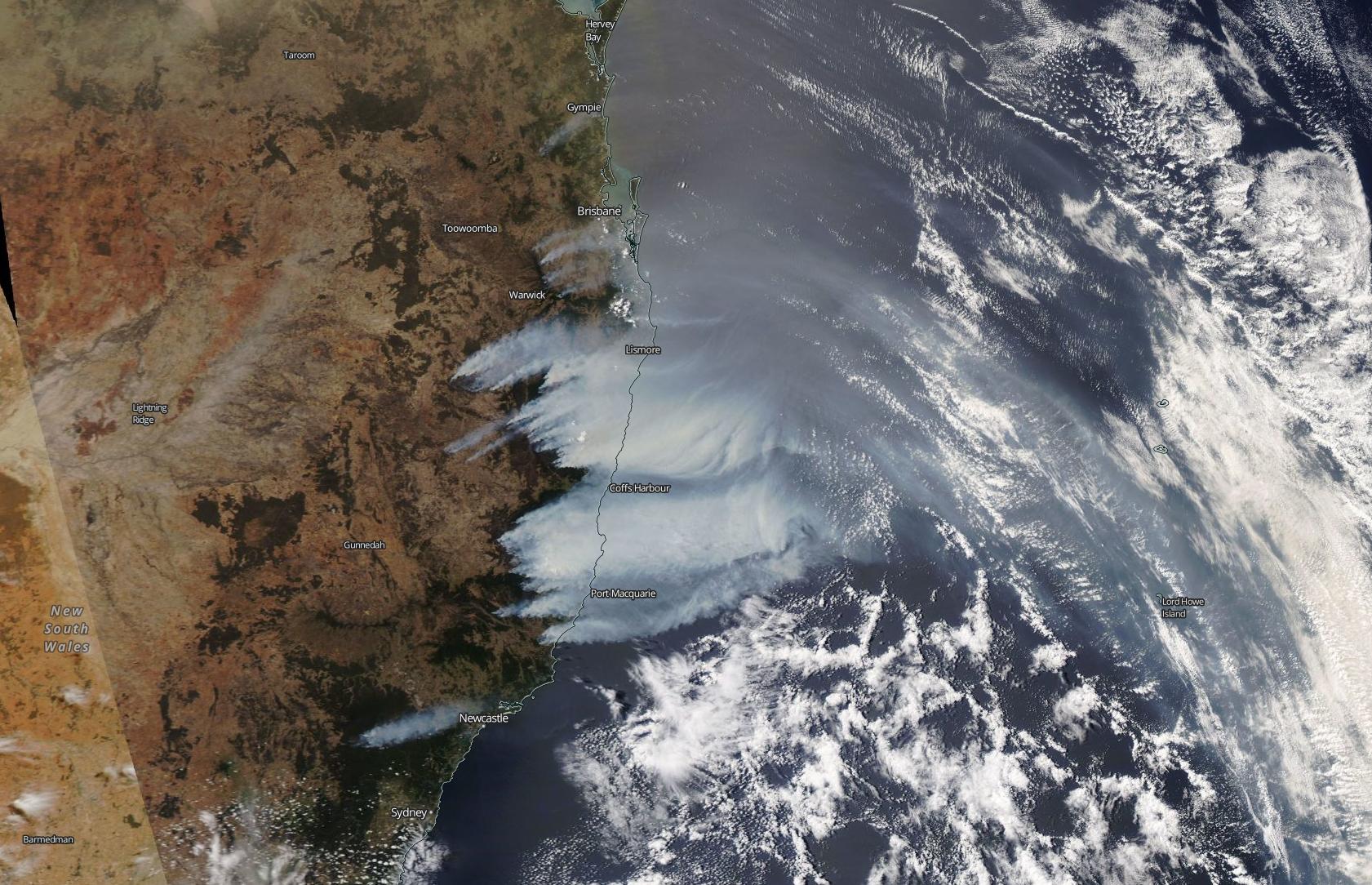
On this day last year, eastern Australia was ablaze as a river of smoke drifted across the Tasman Sea towards New Zealand.
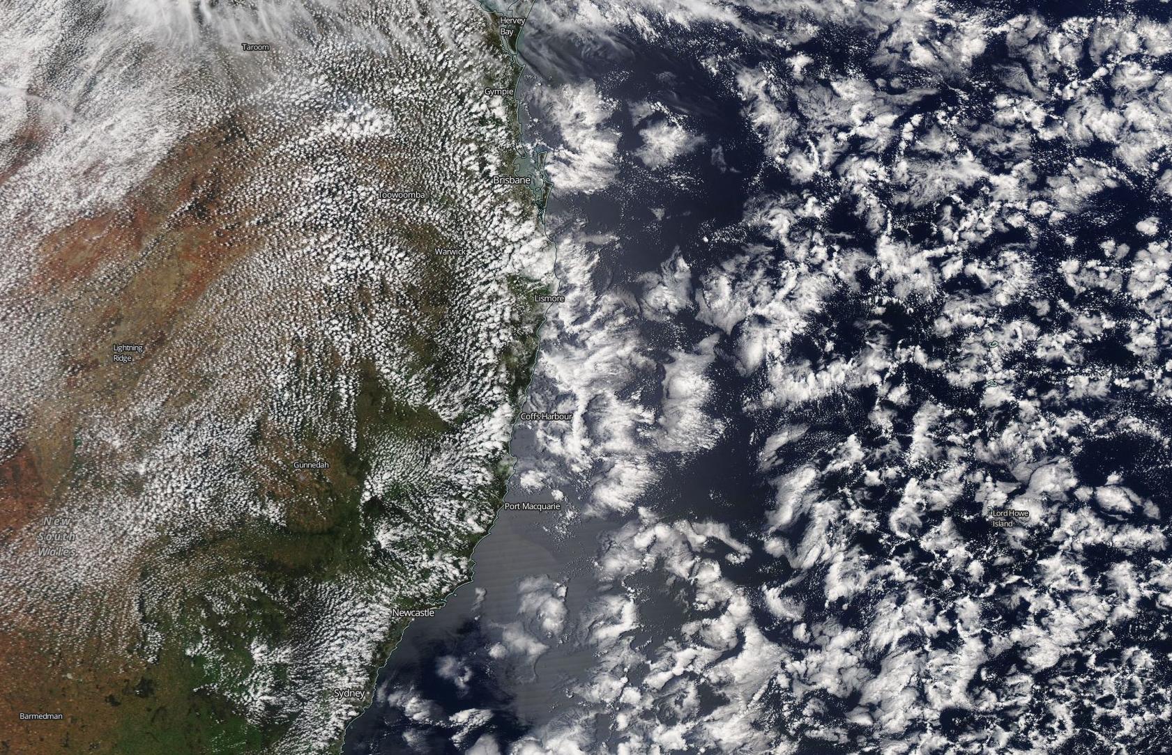
Things couldn't look more different exactly one year later.
On November 9 in 2019, over 80 fires were burning across NSW and more than 40 of these were uncontained. Devastatingly, over 100 homes had been destroyed by these fires the previous day. To make matters worse, the state's Rural Fire Service (RFS) was warning of catastrophic fire danger ratings in and around Sydney later that week.
The scale of last year's fires in eastern Australia on November 9 was captured in spectacular detail from space.
High resolution visible satellite images from NASA's Aqua satellite show thick smoke billowing across the Tasman Sea from multiple fires burning in NSW.

Image: Visible satellite image taken on November 9, 2019 by NASA's Aqua satellite. Source: NASA Worldview
An image taken by the same satellite on the same date this year reveals just how different conditions are 12 months down the track.

Image: Visible satellite image taken on November 9, 2020 by NASA's Aqua satellite. Source: NASA Worldview
According to the RFS website, there were only eight bush or grass fires burning in NSW on Monday morning, along with a few planned hazard reduction burns. As of midday, none of these were out of control.
This year's slower start to the bushfire season in eastern Australia can largely be put down to wetter weather in the preceding months.
Large areas of NSW are currently running above their long-term averages for year-to-date rainfall. In 2019, most of NSW received less than 60 percent of the usual annual rainfall, making it the state’s dreist (and hottest) year on record.
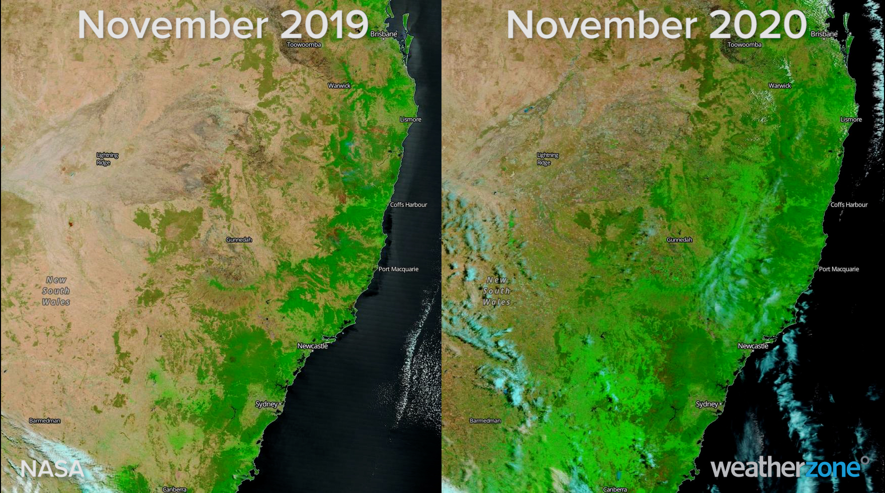
NASA's satellite imagery also shows us how much this abrupt turnaround in rainfall has transformed the landscape in NSW.
Enhanced infrared satellite images from NASA's Terra satellite shows that the ground is covered in far more live green vegetation today than it was a year ago. These living plants are harder to burn, which makes fires harder to start and helps suppress the spread of fires if they manage to get going.

Image: Enhanced infrared satellite images showing the extent of living vegetation (green) in November 2019 and November 2020. Source: NASA Worldview
But while the 'vegetation boom' of 2020 should help make this fire season less severe than the last, it will bring a new set of challenges.
An abundance of pastoral growth over inland districts of eastern Australia this year will boost fuel loads for grass fires as we head into the warmer summer months.
Even though this is likely to be a less active fire season, fires will still happen. Visit the Fires Near Me website and mobile app for up-to-date information on bush and grass fires in the coming months.