
NSW from fires to floods in two years
The last two years have been transformative for NSW, with dirt and fire replaced by green vegetation and flooding.
The two images below were captured by NASA’s polar orbiting satellites on November 15, two years apart.
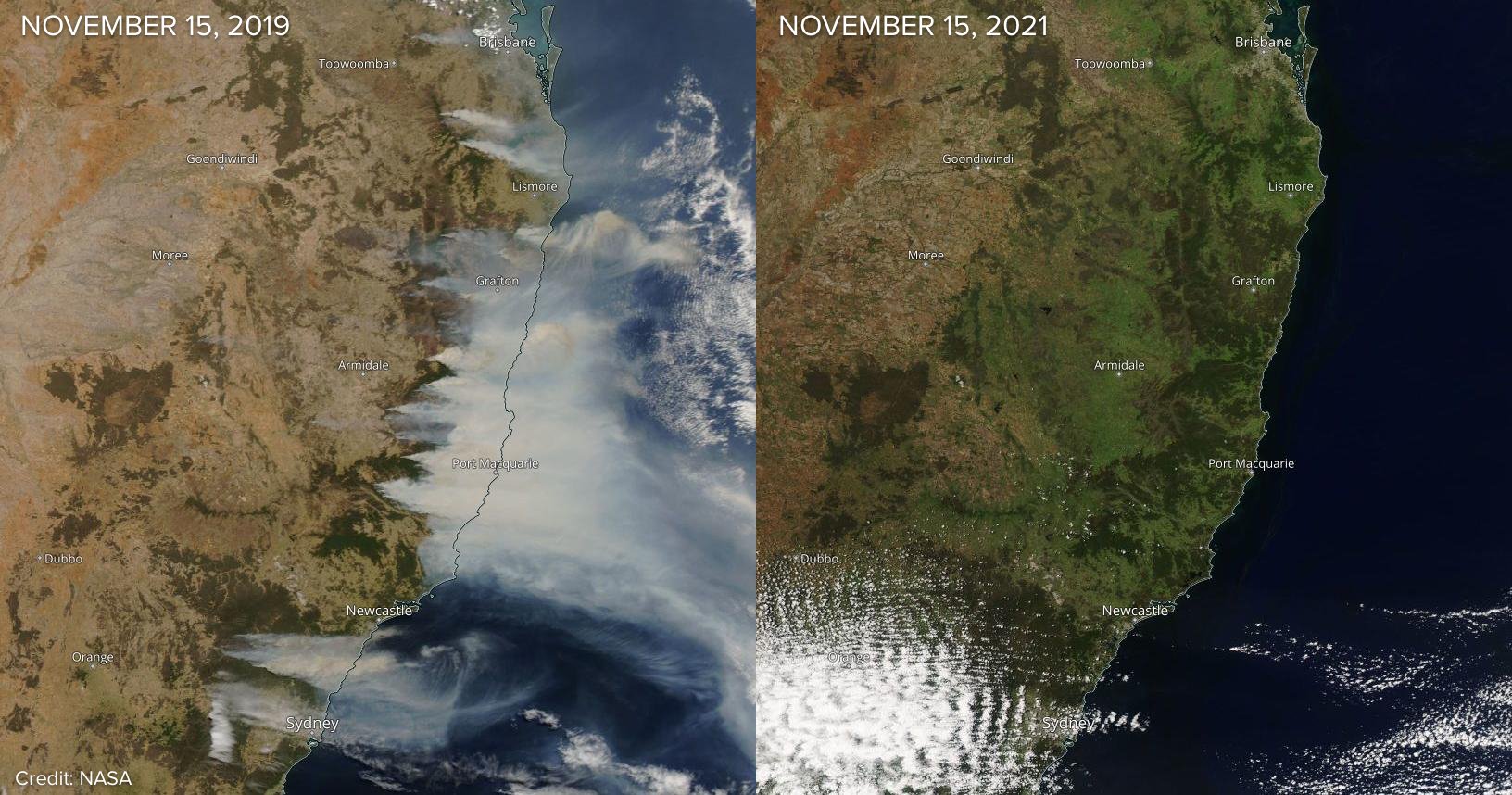
Image: Visible satellite images captured on November 15th in 2019 (left) and 2021 (right). Source: NASA
The first image shows huge columns of smoke billowing out of fires across eastern NSW and southeast QLD. These fires were occurring at the end of Australia hottest and driest year on record, and towards the end of a multi-year drought.
Fast forward to November 15 in 2021 and the landscape is noticeably greener following two years of nourishing rainfall. This rain has been underpinned by a La Niña last summer and another La Niña-like pattern in the Pacific Ocean this spring.
The rain in NSW over the last two springs and summers was also enhanced, indirectly, by an unusually strong polar vortex during the last two winters. While it seems far-fetched, a strong Southern Hemisphere polar vortex in winter can trigger a predominantly positive Southern Annular Mode in spring and summer, which typically boosts warm-season rainfall over Australia’s eastern states.
The maps below show the stark contrast in rainfall between the two-year period ending in October 2021 and the same period ending in October 2019.
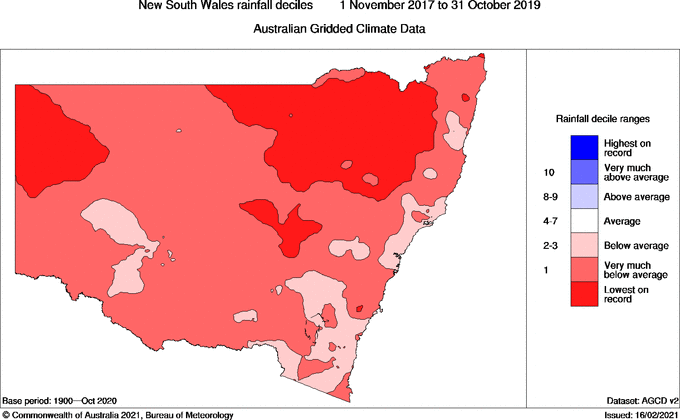
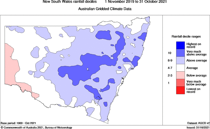
Images: Observed rainfall deciles during the 24-month period ending in October 2019 (top) and October 2021 (bottom). Source: Bureau of Meteorology.
But while rain returning to the landscape has been good news in most cases, some rivers have been inundated and are currently flooding.
A major flood warning is in place for the Lachlan River today, where major flooding is expected to reach the town of Forbes overnight tonight into Wednesday.
Check the latest flood warnings here.