
North Kimberley bracing for Tropical Cyclone Anika
Two tropical cyclones have formed in Australia’s area of responsibility during the last 24 hours and one of them could make landfall over the Kimberley coast this weekend.
Tropical Cyclone Vernon formed near the Cocos Keeling Islands on Friday and quickly gained strength as it tracked towards the west over open water in the Indian Ocean.
At 8am AWST on Saturday, Vernon was a powerful category four tropical cyclone located about 710 km west-southwest of the Cocos Keeling Islands. Fortunately, this system will continue to move west in the coming days, without affecting Australia’s mainland or remote territories.
However, another tropical cyclone spinning over the Timor Sea does pose a threat to Australia’s coastline.
Tropical Cyclone Anika formed on Friday night and by 12:30pm ACST on Saturday, it was located about 175 km northeast of Kalumburu, WA.
This category one tropical cyclone is expected to move south and approach the North Kimberley coast in the next 24 hours.
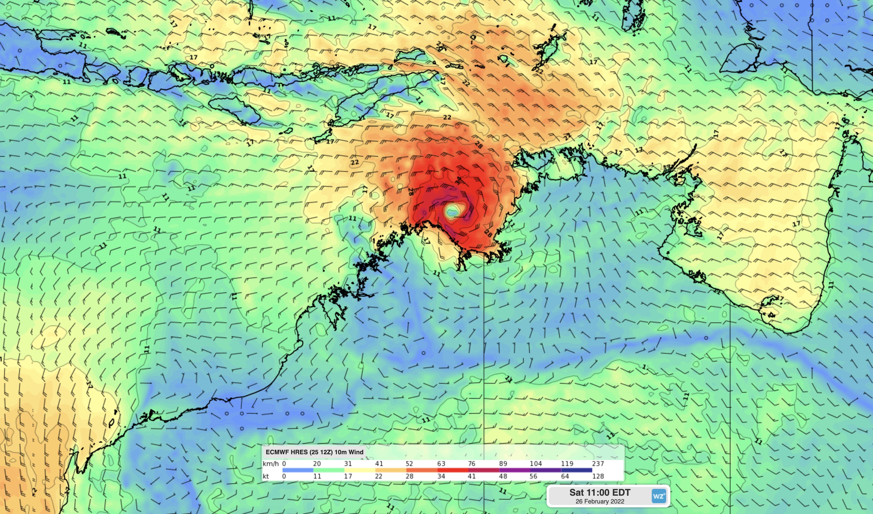
Image: ECMWF modelled wind speed and direction at 11am AEDT on Saturday.
At this stage, Anika should cross the Kimberley coast as a category two tropical cyclone on Sunday, most likely somewhere between Kalumburu and Wadeye. However, there is still some uncertainty regarding its future strength and movement, so communities and industries in northern WA should closely monitor the latest tropical cyclone advisories.
Heavy rain, flooding and damaging-to-destructive winds are possible as Tropical Cyclone Anika approaches the coast and makes landfall. After crossing the coast, heavy rain should spread further west and south as Anika moves over the Northern Kimberley while weakening.
Looking further ahead, the remnants of Cyclone Anika may move back off the Kimberley coast at some stage early next week. If it does move back out over open water, the system could reintensify and a second landfall over the west Kimberly or Pilbara coasts becomes a possibility mid-to-late next week.
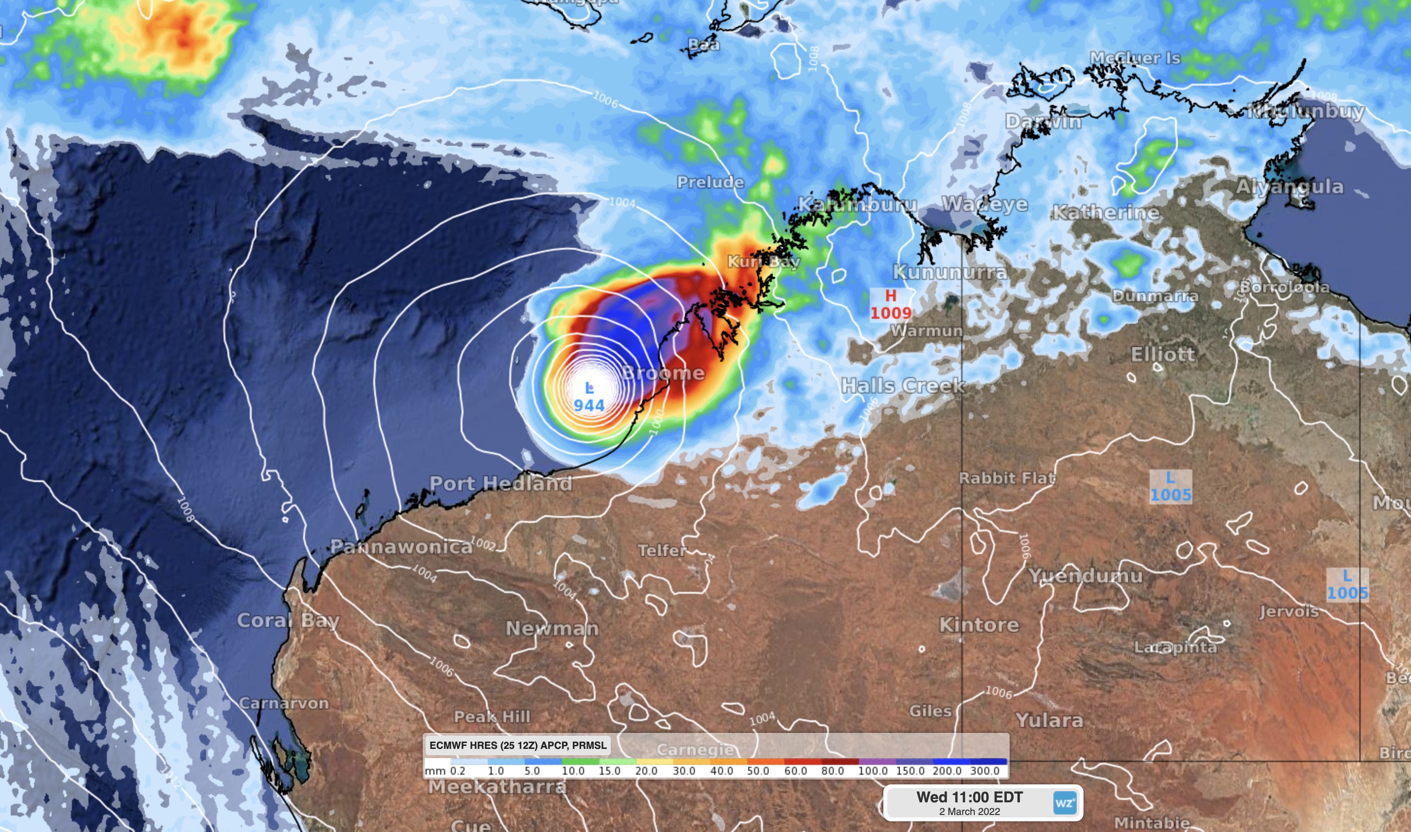
Image: Forecast mean sea level pressure and accumulated 24-hour rainfall on Wednesday morning, March 2nd, according to the ECMWF-HRES model.
Check the latest tropical cyclone advisories for the most up-to-date information on Tropical Cyclone Anika.