
No significant rain relief for parched SA
There's no shortage of images showing how desperately dry southern and eastern parts of South Australia have been lately.
For example, here’s a picture of a rural landscape near Laura, about 200km north of Adelaide, taken on February 20. Not a drop of rain has been recorded since there since a meagre 1mm in mid-January this year.
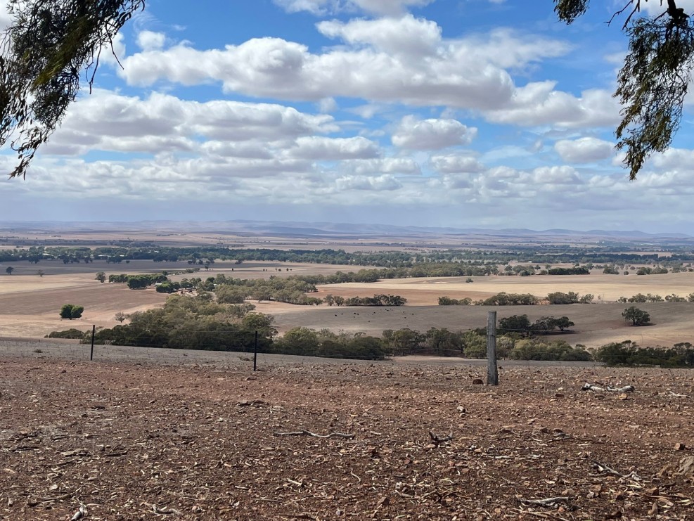
Image: The landscape at Laura near Port Pirie in South Australia's Mid North forecast district. Source: Gillian Fennell.
While the close-up view of the desiccated landscape paints a bleak picture, the countryside looks no less parched when viewed from space.
This is the satellite view of southeastern SA and western and central Vic, taken on Thursday afternoon.
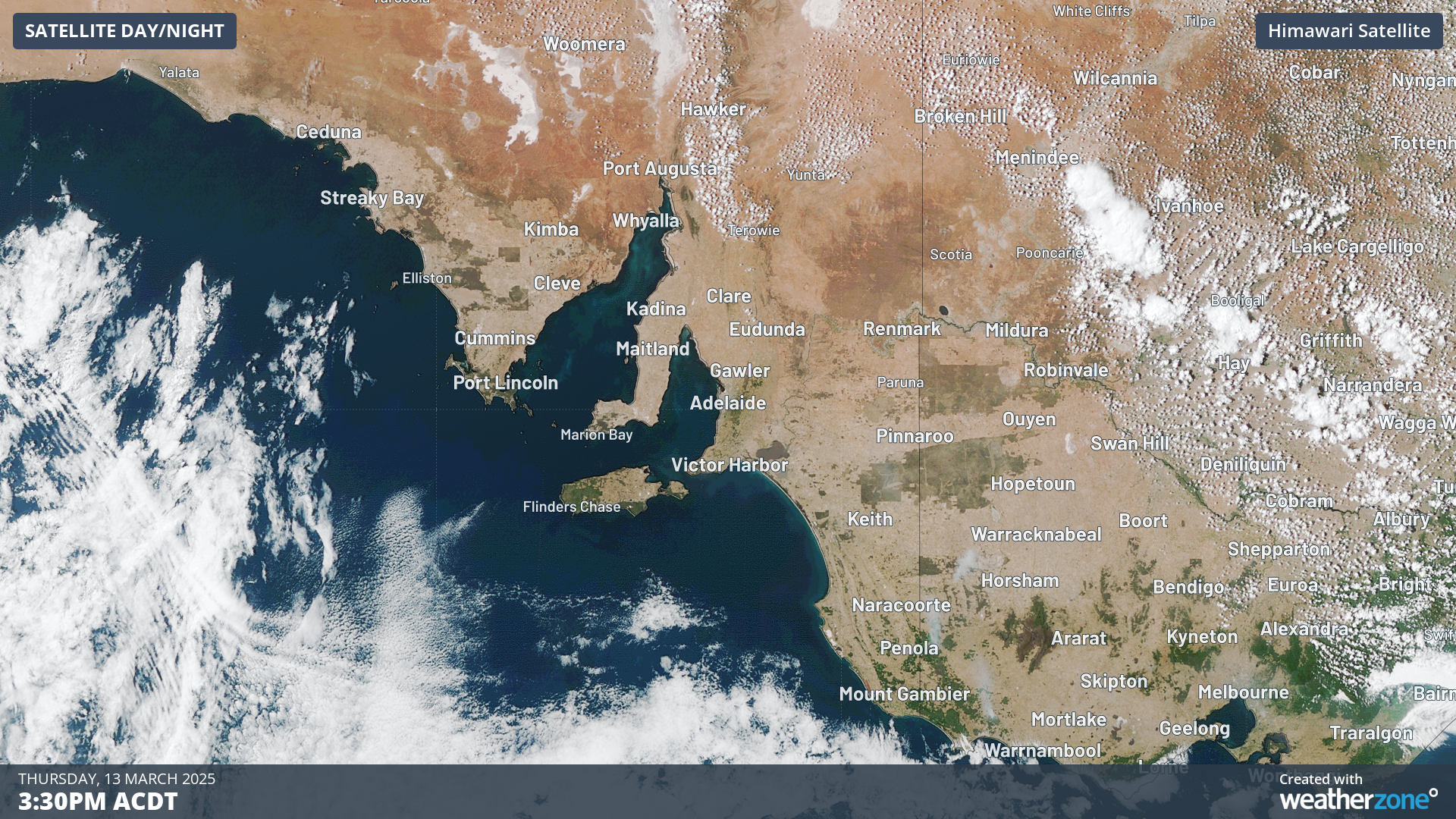
Image: So brown it’s almost grey. The patches of green are forested land.
To date in 2025 (as of Friday, March 14), Adelaide, has had just 23.5mm of rain. While summer and early autumn are traditionally a dry time in Australia’s driest capital city, this is still only a third of the average annual rainfall to this point of the year.
Indeed, Adelaide just had its driest summer in 33 years, yet its rainfall deficiency stretches much further back. For example, in 2024:
- Just 346.6mm of rain fell, which was just under two-thirds of the annual average of 526mm.
- Only one month in 2024 (June) saw above-average rainfall, and not by much. Every other month was much drier than usual.
And this is not just about Adelaide. As you can see on the chart below, virtually the whole of SA has had below-average rainfall to start the year, while some areas were very much below average.
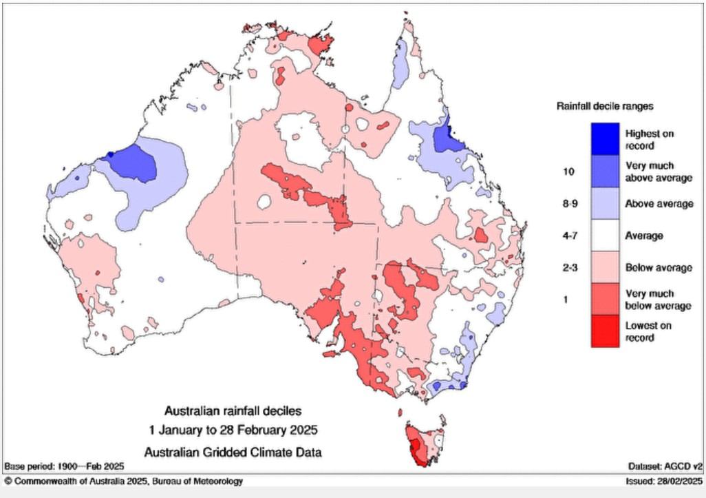
Image: Two-monthly rainfall deciles for Australia for Jan and Feb 2025.
The chart also shows that parts of western Tasmania saw the lowest rainfall on record. It’s no coincidence that numerous serious bushfires occurred in that area in February, sone of which burned temperate rainforest which hadn’t seen a fire in recent memory.
The situation in Tasmania and western Victoria (where there have also been severe bushfires in recent months) illustrates that the current prolonged dry spell is far from just a South Australian story. But SA is definitely the state with the largest area affected.
Meanwhile the ABC reported this week that most of the Fleurieu Peninsula and Adelaide Hills – two areas which are among the wettest parts of SA – have gone more than 100 days without a daily rain event that delivered a fall of 10mm or more.
And in its most recent drought statement, the BoM reported that for southern Australia (encompassing parts of WA, SA, Vic and Tas) "The rainfall deficiency period starting in April 2023 reflects the impacts of climate change."
Will there be any reprieve with the rain due this weekend?
Unfortunately for South Australians, the heaviest rain associated with a cold front due this weekend will fall in Tasmania and southern Victoria.
Adelaide could see up to 5mm on Sunday while places in SA's far southeast like Mount Gambier and Coonawarra could see up to 15mm, but that’s about the best that locals can hope for before another dry week sets in.