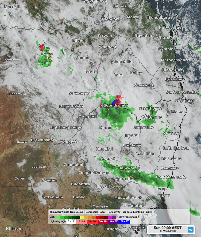
Night of heavy rain and storms for northeast NSW and southeast Queensland
A broad and slow moving low pressure trough has made for a wet and stormy night across parts of northeastern New South Wales and southeast Queensland.
The heaviest falls mostly occurred between the late afternoon on Saturday and Sunday morning, with rainfall and thunderstorms continuing this morning for the region. In the 24 hours to 9am, rainfall records included:
- 82.6mm at Miles, Qld, it’s wettest March day on record (24 years of record) with nearly all of it falling within 5 hours yesterday.
- 66mm at Tamworth Airport, NSW, nearly 50mm of which fell in the 4 hours to 8:30am, making it their wettest March day in 10 years.
- 59mm at Samuel Hill, Qld, with 55mm falling in 2 and a half hours yesterday afternoon.
- 56mm at Gunnedah Airport, NSW, with 43mm falling in the 3 hours to 9am, making it the wettest March day in 4 years.
- Giddi Giddi South, Qld, recorded 52mm in the hour to 7am with 39mm at nearby Goondiwindi.
- 46mm at Glen Innes Airport, NSW, 48mm at Moree, NSW and 42mm at Inverell, NSW.
Over a quarter of a million lightning strikes have also been recorded over southeast Queensland over the course of Saturday and Sunday morning.

Himawari-9 Visible True Colour Satellite Imagery showing thick cloud over the northeast of NSW and southeast Queensland, along with radar rainfall signals and lightning detected at 9am this morning, including a severe thunderstorm near Goondiwindi on the NSW-Qld border.
Further rainfall and thunderstorms are expected today as the trough gradually shifts eastwards over the region. Keep track of the latest warnings for severe thunderstorms in your region at: https://www.weatherzone.com.au/warnings