New York City's first ever Flash Flood Emergency warning
The remnants of Hurricane Ida have just inundated New York City, prompting the city's first ever Flash Flood Warning from the National Weather Service.
Hurricane Ida slammed into Louisiana on Sunday as a powerful category four hurricane, producing a huge storm surge, relentless rain and destructive winds.
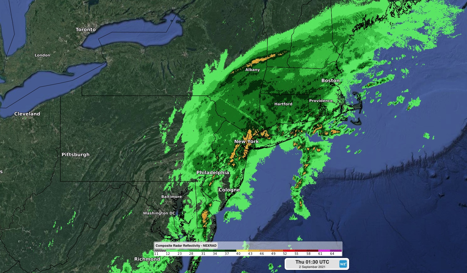
After traversing the Eastern U.S. over the last three days, the remnants of Ida are now bringing torrential rain to New York, causing flash flooding on Wednesday night.

Image: Rain over New York and surrounding states on Wednesday night, caused by the remnants of Hurricane Ida.
The deluge prompted the National Weather Service's New York office to issue New York City's first ever Flash Flood Emergency Warning on Wednesday night.
Flash Flood Emergency including New York NY, Brooklyn NY, Queens NY until 11:30 PM EDT pic.twitter.com/Phpg3otRnk
— NWS New York NY (@NWSNewYorkNY) September 2, 2021
According to the NWS, this rare warning is reserved for "exceeding rare situations when a severe threat to human life and catastrophic damage from a flash flood is happening or will happen soon."
Rain rates were so intense on Wednedsay night that cars were sent floating down streets and waterfalls poured into subways.
Getting a bit of rain in New York City tonight…@Gothamist @nytimes @NYDailyNews pic.twitter.com/JaC9XA6XC7
— Alex Etling (@AlexEtling) September 2, 2021
A rain gauge at Central Park received an astonishing 80 mm (3.15 inches) of rain in one hour, which appears to be the highest hourly rain rate on record for the site. The same site collected 132mm (5.2 inches) in three hours, which is statistically a one-in-500 year rain event at Central Park.
The 3.15" in one hour at New York Central Park has a 200-year recurrence interval. The three-hour total of 5.20" has a 500-year recurrence interval. (Note: this replaces an earlier [deleted] tweet with incorrect values.) pic.twitter.com/YF1sXwnsf2
— Brian Brettschneider (@Climatologist49) September 2, 2021