New data points towards re-emerging La Nina
New observations from the tropical Pacific Ocean suggest a La Niña pattern is gaining strength as we enter the final weeks of the Southern Hemisphere's winter.
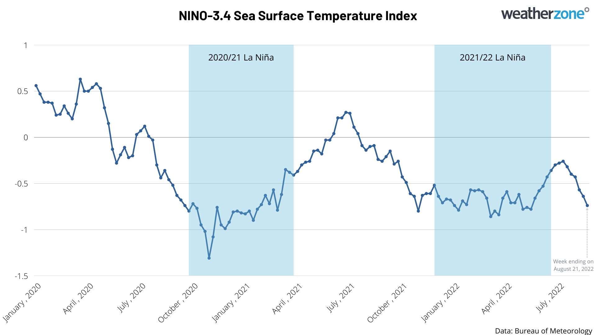
The Niño-3.4 index measures the sea surface temperature anomaly inside a defined area of the central equatorial Pacific Ocean. According to the Bureau of Meteorology, sustained Niño-3.4 values of around -0.8ºC or less are typical during La Niña events.
This week, the Niño-3.4 index reached -0.74ºC after cooling progressively during the last six weeks. This is the lowest value in three months and, for the first time since the end of the last La Niña back in June, is near the threshold used by the BoM to classify La Niña.

Image: Weekly Niño-3.4 temperature anomaly since January 2020, showing the past two La Niña episodes (blue shading) and the re-emerging La Niña signal in the past month or so.
In addition to the cooling sea surface temperatures in the Niño-3.4 region, atmospheric indices such as the Southern Oscillation Index (SOI) are also near or exceeding La Niña thresholds.
Based on this latest data, there is an increasing likelihood that the Bureau of Meteorology will declare La Niña in the coming weeks. If it doesn, this would make it the third La Niña season in a row, a rare feat that has only happened a few times in historical records.
La Niña typically causes above average rain, cooler-than-average days and abnormally warm nights over large areas of northern and eastern Australia.